Hill forts · West Midlands
The Bridestones
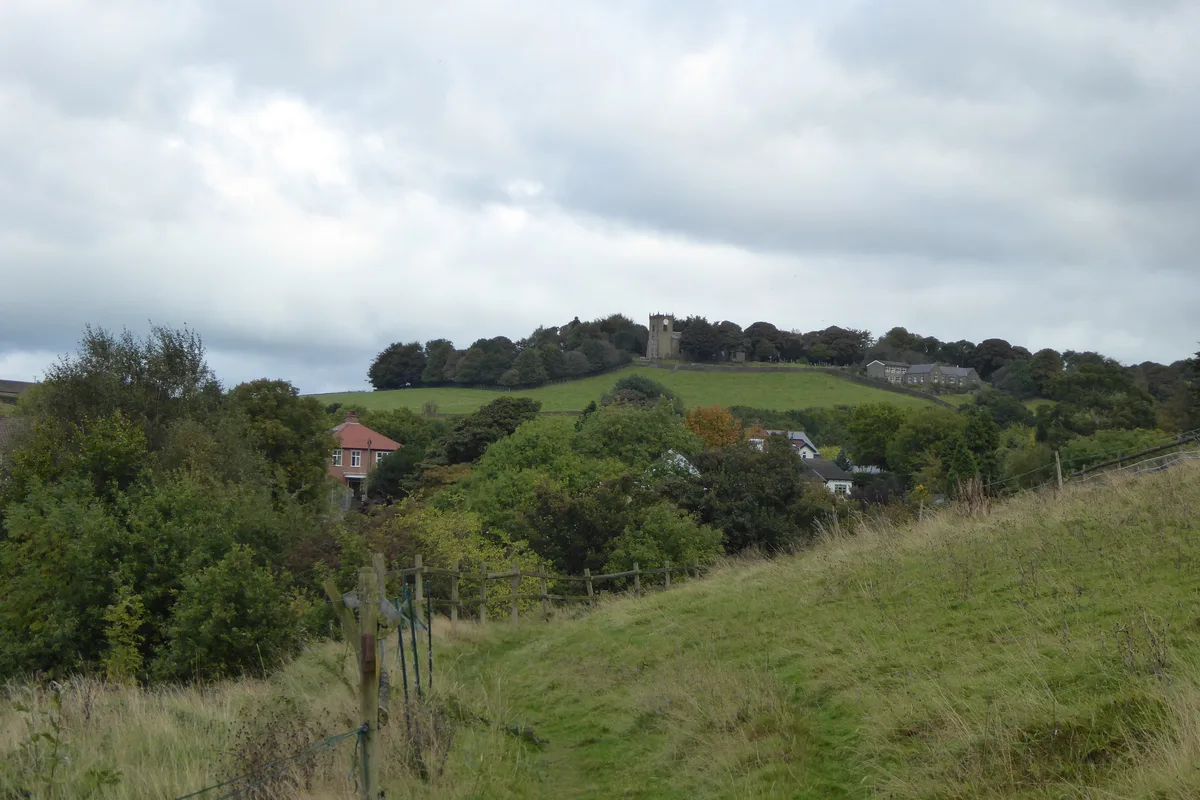
The Bridestones — burial chamber in Cheshire, England, UK.

Wikimedia Commons contributors — see linked file page for photographer and licence licence
Plan your visit
- Typical visit
- 1 h–2 h
- Nearest railway station
- Congleton · 3.4 km
- Free entry
- Dog-friendly
About
The Bridestones is a hill fort in the United Kingdom. Heritage designation: scheduled monument. Wikidata describes it as: "burial chamber in Cheshire, England, UK". Coordinates: 53.1568°, -2.1420°.
Photo gallery
From the Wikipedia article
The Bridestones is a chambered cairn, near Congleton, Cheshire, England, that was constructed in the Neolithic period about 3500–2400 BC. It was described in 1764 as being 120 yards (110 m) long and 12 yards (11 m) wide, containing three separate compartments, of which only one remains today. The remaining compartment is 6 metres (20 ft) long by 2.7 metres (8.9 ft) wide, and consists of vertical stone slabs, divided by a now-broken cross slab. The cairn originally had a stone circle surrounding it, with four portal stones; two of these portal stones still remain. The site is protected as a scheduled ancient monument.
Excerpt from Wikipedia under CC BY-SA 4.0. See the source article linked in Sources below.
- Coordinates
- 53.1568, -2.1420
- District
- Cheshire East
- Parish
- Congleton
- Postcode
- CW12 3QJ
- Parliamentary constituency
- Congleton
- Nearest railway station
- Congleton — 3.4 km
Sources
- wikidata: Q7720047 (CC0)
- wikipedia: The Bridestones (CC BY-SA 4.0)
- commons: Bridestones 1.jpg (CC BY-SA 4.0)
Other places nearby
Loading nearby places…
Nearby
 📷 3
📷 3Archaeological sites · West Midlands
Bridestones Burial Chamber
Bridestones Burial Chamber — a archaeological in england-west-midlands, United Kingdom.
 📷 3
📷 3Natural landmarks · West Midlands
Timbersbrook Picnic Area
Timbersbrook Picnic Area — a other in england-west-midlands, United Kingdom.
 📷 3
📷 3Viewpoints · West Midlands
The Cloud
The Cloud is a viewpoint in the United Kingdom.
 📷 3
📷 3Historic bridges · West Midlands
Macclesfield Canal Bridge
Macclesfield Canal Bridge is a historic bridge in the United Kingdom.
 📷 3
📷 3Historic bridges · West Midlands
Hug Bridge
Hug Bridge — Grade II listed building-listed bridge in england-west-midlands, United Kingdom.
 📷 3
📷 3Forests & woodlands · West Midlands
Dane-in-Shaw Pasture
Dane-in-Shaw Pasture is a forest or woodland in the United Kingdom.
More places in this region
 Flagship📷 3
Hill forts · West Midlands
Mellor hill fort
Mellor hill fort — prehistoric site in North West England.
 📷 3
📷 3Hill forts · West Midlands
Ariconium
Ariconium — Ariconium was a road station of Roman Britain mentioned in Iter XIII of the Iter Britanniarum of the Antonine Itineraries. It was located at Bury Hill.
 📷 3
📷 3Hill forts · West Midlands
Ascot d'Oilly Castle
Ascot d'Oilly Castle — castle in Oxfordshire, England, UK.
 📷 3
📷 3Hill forts · West Midlands
Aves ditch
Aves ditch — archaeological site in Oxfordshire.
Frequently asked questions
- Where is The Bridestones?
- The Bridestones is in the West Midlands, United Kingdom (postcode CW12 3QJ), in the parish of Congleton.
- Is The Bridestones a listed building?
- The Bridestones is officially recognised as scheduled monument listed.
- Is The Bridestones free to visit?
- Yes, The Bridestones is free to enter.
- How do I get to The Bridestones?
- The nearest railway station is Congleton, about 3.4 km away. Drivers can navigate to postcode CW12 3QJ.