Hill forts · West Midlands
Manduessedum
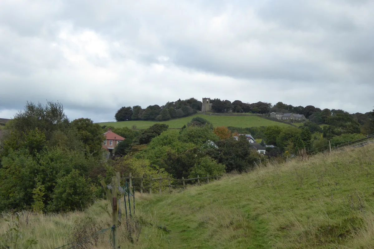
Manduessedum — archaeological site in Warwickshire, West Midlands, England, UK.

Wikimedia Commons contributors — see linked file page for photographer and licence licence
Plan your visit
- Typical visit
- 1 h–2 h
- Nearest railway station
- Atherstone · 2.0 km
- Free entry
- Dog-friendly
About
Manduessedum is a hill fort in the United Kingdom. Wikidata describes it as: "archaeological site in Warwickshire, West Midlands, England, UK". Coordinates: 52.5670°, -1.5290°.
Photo gallery
From the Wikipedia article
Manduessedum or Manduesedum was a Roman fort and later a civilian small town in the Roman Province of Britannia. It was located on and immediately to the east of the site of the modern village of Mancetter, located in the English county of Warwickshire, close to the modern town of Atherstone. The name is of Romano-Celtic origin, and is likely derived from the Gaulish essedum, meaning 'chariot', whilst the first element mandu was common in Gaulish place names, but its meaning is obscure. The fort was founded in around AD 50 on the Watling Street Roman road, guarding the point where the road crossed the River Anker. The final battle of the rebel queen of the Britons Boudica at the Battle of Watling Street in AD 60/61 may have taken place near Manduessedum. The British forces were defeated by the Roman general Suetonius Paullinus. The fort appears to have been fairly short lived, as there is little sign of military occupation at the site after AD 70. Manduessedum later developed into an important civilian settlement, and was the centre of an extensive pottery making industry which primarily produced Mortaria (mixing bowls). The remains of up to 70 pottery kilns dating from the Roman period have been found in the area, as well as the remains of a Roman villa. The area has been listed as a scheduled monument.
Excerpt from Wikipedia under CC BY-SA 4.0. See the source article linked in Sources below.
- Coordinates
- 52.5670, -1.5290
- County
- Warwickshire
- District
- North Warwickshire
- Parish
- Mancetter
- Postcode
- CV9 1NJ
- Parliamentary constituency
- North Warwickshire and Bedworth
- Nearest railway station
- Atherstone — 2 km
Sources
- wikidata: Q366185 (CC0)
- wikipedia: Manduessedum (CC BY-SA 4.0)
- commons: Watling Street route.jpg (CC BY-SA 4.0)
Other places nearby
Loading nearby places…
Nearby
 📷 3
📷 3Archaeological sites · West Midlands
Mancetter Roman Fort
Mancetter Roman Fort — a archaeological in england-west-midlands, United Kingdom.
B&Bs · West Midlands
The Old House
The Old House — a bed-and-breakfast in england west midlands.
 📷 3
📷 3Historic churches · West Midlands
Church of St Peter
Church of St Peter — church in Witherley, Leicestershire, England, UK.
 📷 3
📷 3Historic bridges · West Midlands
Bridge 37 Rawnhill Bridge At Sp 3120 9692 Coventry Canal
Bridge 37 Rawnhill Bridge At Sp 3120 9692 Coventry Canal — Grade II listed building-listed bridge in england-west-midlands, United Kingdom.
 📷 3
📷 3Historic pubs · West Midlands
Blue Lion
Blue Lion — Historic pub — listed building or notable heritage status.
 📷 3
📷 3Archaeological sites · West Midlands
Manduvessedum Roman Station
Manduvessedum Roman Station — a archaeological in england-west-midlands, United Kingdom.
More places in this region
 Flagship📷 3
Hill forts · West Midlands
Mellor hill fort
Mellor hill fort — prehistoric site in North West England.
 📷 3
📷 3Hill forts · West Midlands
Ariconium
Ariconium — Ariconium was a road station of Roman Britain mentioned in Iter XIII of the Iter Britanniarum of the Antonine Itineraries. It was located at Bury Hill.
 📷 3
📷 3Hill forts · West Midlands
Ascot d'Oilly Castle
Ascot d'Oilly Castle — castle in Oxfordshire, England, UK.
 📷 3
📷 3Hill forts · West Midlands
Aves ditch
Aves ditch — archaeological site in Oxfordshire.
Frequently asked questions
- Where is Manduessedum?
- Manduessedum is in Warwickshire, the West Midlands, United Kingdom (postcode CV9 1NJ), in the parish of Mancetter.
- Is Manduessedum free to visit?
- Yes, Manduessedum is free to enter.
- How do I get to Manduessedum?
- The nearest railway station is Atherstone, about 2.0 km away. Drivers can navigate to postcode CV9 1NJ.