Forests & woodlands · West Midlands
Dane-in-Shaw Pasture
Dane-in-Shaw Pasture is a forest or woodland in the United Kingdom.

Wikimedia Commons contributors — see linked file page for photographer and licence licence
Plan your visit
- Typical visit
- 1 h–3 h
- Nearest railway station
- Congleton · 0.6 km
- Free entry
- Family-friendly
- Dog-friendly
About
Dane-in-Shaw Pasture is a named forest, woodland or nature reserve in the United Kingdom. Coordinates: 53.1601°, -2.1840°. This entry is part of The Great Britain Guide, a free, ad-free, open-data tourist directory.
Photo gallery
Protected designations
- Site of Special Scientific Interest: Dane-in-Shaw Pasture SSSI
Designations sourced from Natural England open data under OGL v3.
From the Wikipedia article
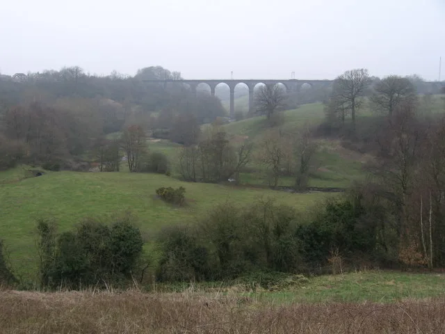
Dane-in-Shaw Pasture is a Site of Special Scientific Interest (SSSI) in Cheshire, England. It is located on the eastern edge of the town of Congleton. The southern boundary of this protected area is near Macclesfield Canal. The northern boundary of this protected area is near the Stafford to Manchester Railway line. A stream called Dane-in-Shaw Brook flows through this protected area. This area of pasture is protected because of the diversity of plant species present. Dane-in-Shaw Pasture SSSI can be accessed using the Biddulph Valley Way. This pasture has been publicised within the Coronation Meadows Project.
Excerpt from Wikipedia under CC BY-SA 4.0. See the source article linked in Sources below.
- Coordinates
- 53.1601, -2.1840
- District
- Cheshire East
- Parish
- Congleton
- Postcode
- CW12 3TY
- Parliamentary constituency
- Congleton
- Nearest railway station
- Congleton — 0.6 km
Sources
- osm: w659158288 (ODbL)
- wikipedia: Dane-In-Shaw Pasture (CC BY-SA 4.0)
- commons: Congleton - railway viaduct - geograph.org.uk - 1227491.jpg (CC BY-SA 4.0)
Other places nearby
Loading nearby places…
Nearby
 📷 3
📷 3Wildlife reserves · West Midlands
Q123010010
Q123010010 is a wildlife reserve in the United Kingdom.
 📷 3
📷 3Historic bridges · West Midlands
Macclesfield Canal Bridge
Macclesfield Canal Bridge is a historic bridge in the United Kingdom.
 📷 3
📷 3Historic bridges · West Midlands
Macclesfield Canal Morley Drive, Bridge Number 74
Macclesfield Canal Morley Drive, Bridge Number 74 — Grade II listed building-listed bridge in england-west-midlands, United Kingdom.
 📷 3
📷 3Historic bridges · West Midlands
Macclesfield Canal Morris Bridge, Bridge Number 76
Macclesfield Canal Morris Bridge, Bridge Number 76 — Grade II listed building-listed bridge in england-west-midlands, United Kingdom.
 📷 3
📷 3Historic bridges · West Midlands
Macclesfield Canal Lambert's Lane Bridge Number 77
Macclesfield Canal Lambert's Lane Bridge Number 77 — Grade II listed building-listed bridge in england-west-midlands, United Kingdom.
 📷 3
📷 3Natural landmarks · West Midlands
Timbersbrook Picnic Area
Timbersbrook Picnic Area — a other in england-west-midlands, United Kingdom.
More forests in this region
 📷 3
📷 3Forests & woodlands · West Midlands
Abington Meadows Nature Reserve
Abington Meadows Nature Reserve is a forest or woodland in the United Kingdom.
_(geograph_2935627).jpg?width=1200) 📷 3
📷 3Forests & woodlands · West Midlands
Adderbury Lakes
Adderbury Lakes is a forest or woodland in the United Kingdom.
 📷 3
📷 3Forests & woodlands · West Midlands
Alcott Wood
Alcott Wood is a forest or woodland in the United Kingdom.
 📷 3
📷 3Forests & woodlands · West Midlands
Alvecote Meadows Nature Reserve
Alvecote Meadows Nature Reserve is a forest or woodland in the United Kingdom.
Frequently asked questions
- Where is Dane-in-Shaw Pasture?
- Dane-in-Shaw Pasture is in the West Midlands, United Kingdom (postcode CW12 3TY), in the parish of Congleton.
- Is Dane-in-Shaw Pasture a protected site?
- Yes — Dane-in-Shaw Pasture is part of the Dane-in-Shaw Pasture SSSI Site of Special Scientific Interest.
- Is Dane-in-Shaw Pasture free to visit?
- Yes, Dane-in-Shaw Pasture is free to enter.
- How do I get to Dane-in-Shaw Pasture?
- The nearest railway station is Congleton, about 0.6 km away. Drivers can navigate to postcode CW12 3TY.