Castles · West Midlands
Marple, Greater Manchester
Marple is a town in the Metropolitan Borough of Stockport, Greater Manchester, England. It is on the River Goyt, 9 miles (14 km) south-east of Manchester, 9 miles (14 km) north of Macclesfield and 4 m

Gerald England — CC BY-SA 2.0 via Wikimedia Commons licence
Plan your visit
- Typical visit
- 1.5 h–3 h
- Family-friendly
- Limited wheelchair access
About
Marple is a town in the Metropolitan Borough of Stockport, Greater Manchester, England. It is on the River Goyt, 9 miles (14 km) south-east of Manchester, 9 miles (14 km) north of Macclesfield and 4 miles (6 km) south-east of Stockport. At the 2021 census, the built up area had a population of 12,970. It lies within the historic county boundaries of Cheshire (although its district Marple Bridge was historically partially in Derbyshire), and became part of Greater Manchester in 1974. The town lies along the Peak Forest Canal, which contains the Marple Lock Flight and Marple Aqueduct. The Roman Lakes, to the south-east of the town centre, attracts anglers and walkers. The town is served by two railway stations: Marple and Rose Hill Marple, providing access to the rail network in Greater Manchester, a direct line to Sheffield and beyond. It is also close to the Middlewood Way, a shared use path following the former Macclesfield, Bollington and Marple Railway line south from Rose Hill to Macclesfield.
Photo gallery
From the Wikipedia article
Marple is a town in the Metropolitan Borough of Stockport, Greater Manchester, England. It is on the River Goyt, 9 miles (14 km) south-east of Manchester, 9 miles (14 km) north of Macclesfield and 4 miles (6 km) south-east of Stockport. At the 2021 census, the built up area had a population of 12,970. It lies within the historic county boundaries of Cheshire (although its district Marple Bridge was historically partially in Derbyshire), and became part of Greater Manchester in 1974. The town lies along the Peak Forest Canal, which contains the Marple Lock Flight and Marple Aqueduct. The Roman Lakes, to the south-east of the town centre, attracts anglers and walkers. The town is served by two railway stations: Marple and Rose Hill Marple, providing access to the rail network in Greater Manchester, a direct line to Sheffield and beyond. It is also close to the Middlewood Way, a shared use path following the former Macclesfield, Bollington and Marple Railway line south from Rose Hill to Macclesfield.
Excerpt from Wikipedia under CC BY-SA 4.0. See the source article linked in Sources below.
Background
History
Scientists estimate that the earliest residents of the area settled several millennia ago. The population of the village began to rise, with the construction of terraces to house mill workers and the formation of a village centre filled with private businesses. Samuel Oldknow also played a large role in the development of the town in addition to his mills; there is still a street named Oldknow Road in Marple today. He built workers' cottages and churches, introduced aspen trees to the area, and assisted in the constructions of the Macclesfield and Peak Forest Canals. Marple Aqueduct, which opened in 1800, carries the Peak Forest Canals over the River Goyt, was designed by Benjamin Outram, a…
Sourced from Wikipedia under CC BY-SA 4.0.
- Coordinates
- 53.3970, -2.0610
- District
- Stockport
- Parish
- Stockport, unparished area
- Postcode
- SK6 6BA
- Parliamentary constituency
- Hazel Grove
Sources
- wikipedia: Marple, Greater Manchester (CC BY-SA 4.0)
Other places nearby
Loading nearby places…
Nearby
📷 3Memorials & monuments · West Midlands
Marple War Memorial
Marple War Memorial — Grade II listed building-listed memorial in england-west-midlands, United Kingdom.
 📷 3
📷 3Historic bridges · West Midlands
Posset Bridge (Number 18) on Peak Forest Canal
Posset Bridge (Number 18) on Peak Forest Canal — Grade II listed building-listed bridge in england-west-midlands, United Kingdom.
Cinemas · West Midlands
Regent
Regent — a cinema in england west midlands.
 📷 3
📷 3Theatres · West Midlands
Carver Theatre
Carver Theatre is a theatre in the United Kingdom.
 📷 3
📷 3Historic bridges · West Midlands
Bridge Number 1 (Junction Bridge) on Macclesfield Canal
Bridge Number 1 (Junction Bridge) on Macclesfield Canal — Grade II listed building-listed bridge in england-west-midlands, United Kingdom.
 📷 3
📷 3Historic churches · West Midlands
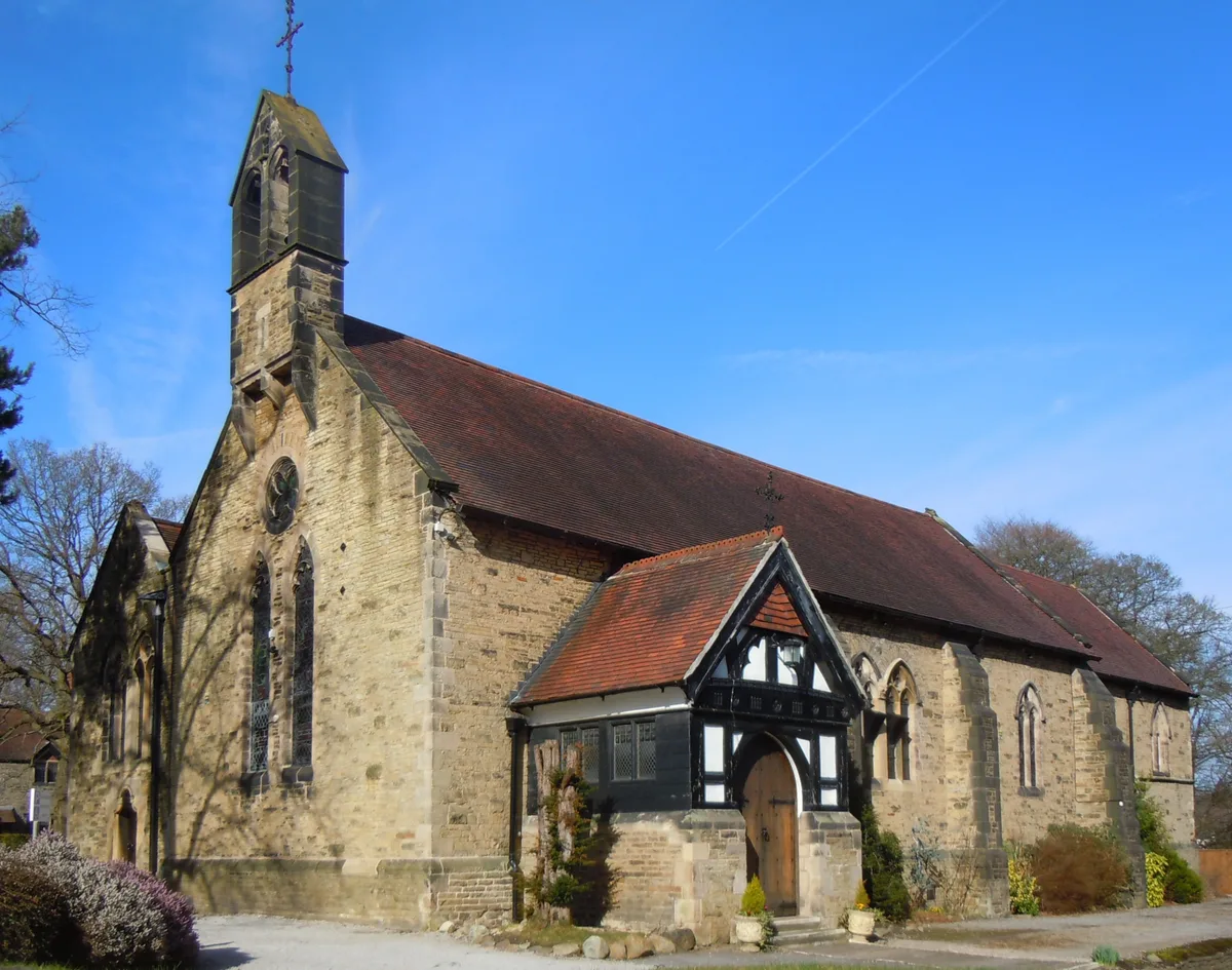
Church of St Martin, Marple
Church of St Martin, Marple — Grade II* listed church in Marple, Stockport, UK.
More castles in this region
 📷 3
📷 3Castles · West Midlands
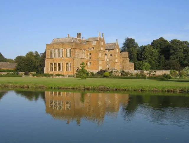
Broughton Castle
Broughton Castle — medieval manor house in Oxfordshire, England, UK.
 📷 3
📷 3Castles · West Midlands
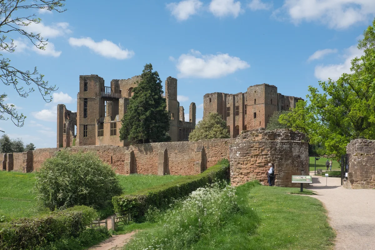
Kenilworth Castle
Kenilworth Castle — castle ruin in the town of Kenilworth, Warwickshire, England, UK.
 📷 3
📷 3Castles · West Midlands
Allesley Castle
Allesley Castle — motte-and-bailey castle in Coventry, West Midlands, England, UK.
 📷 3
📷 3Castles · West Midlands
Ardley Castle
Ardley Castle is a castle in the United Kingdom.
Frequently asked questions
- Where is Marple, Greater Manchester?
- Marple, Greater Manchester is in the West Midlands, United Kingdom (postcode SK6 6BA), in the parish of Stockport, unparished area.
- Does Marple, Greater Manchester charge admission?
- Marple, Greater Manchester typically charges admission. Check the official site for current ticket prices and opening hours.
- How do I get to Marple, Greater Manchester?
- Drivers can navigate to postcode SK6 6BA. It sits within the Hazel Grove parliamentary constituency.