Castles · West Midlands
Audenshaw
Audenshaw is a town in Tameside, Greater Manchester, England, 4.9 miles (7.9 km) east of Manchester. Historically part of Lancashire, in 2011 it had a population of 11,419. The name derives from Aldwi

John Topping — CC BY-SA 2.0 via Wikimedia Commons licence
Plan your visit
- Typical visit
- 1.5 h–3 h
- Family-friendly
- Limited wheelchair access
About
Audenshaw is a town in Tameside, Greater Manchester, England, 4.9 miles (7.9 km) east of Manchester. Historically part of Lancashire, in 2011 it had a population of 11,419. The name derives from Aldwin, a Saxon personal name, and the Old English suffix shagh meaning "Woodland". Nico Ditch, an early-medieval linear earthwork possibly built as a defensive barrier against Vikings, runs through the area. Medieval Audenshaw was a division of the township of Ashton in the county of Lancashire. Audenshaw expanded as a centre for textile manufacture during the Industrial Revolution and the Victorian era with inhabitants employed in hat-making, cotton-spinning, calico-printing, and silk-weaving. In 1974, Audenshaw Urban District became part of the Metropolitan Borough of Tameside.
Photo gallery
From the Wikipedia article
Audenshaw is a town in Tameside, Greater Manchester, England, 4.9 miles (7.9 km) east of Manchester. Historically part of Lancashire, in 2011 it had a population of 11,419. The name derives from Aldwin, a Saxon personal name, and the Old English suffix shagh meaning "Woodland". Nico Ditch, an early-medieval linear earthwork possibly built as a defensive barrier against Vikings, runs through the area. Medieval Audenshaw was a division of the township of Ashton in the county of Lancashire. Audenshaw expanded as a centre for textile manufacture during the Industrial Revolution and the Victorian era with inhabitants employed in hat-making, cotton-spinning, calico-printing, and silk-weaving. In 1974, Audenshaw Urban District became part of the Metropolitan Borough of Tameside.
Excerpt from Wikipedia under CC BY-SA 4.0. See the source article linked in Sources below.
Background
History
The name Audenshaw is a corruption of its earlier name Aldwinshagh which derives from Aldwin, a Saxon personal name, combined with the Old English suffix shagh meaning "Woodland". Nico Ditch, a medieval linear earthwork, runs through the area. Stretching 6 mi from Ashton Moss in the east to just east of Stretford in the west, the origin of the ditch is unclear. According to legend, it was completed in a single night by the inhabitants of Manchester, as a protection against Viking invaders in 869–870, and that it was the site of a bloody battle between Saxons and Danes and that Gorton and Reddish got their name from the battle, "Gore Town" and "Red-Ditch". Despite the legend, the U-shape of…
Sourced from Wikipedia under CC BY-SA 4.0.
- Coordinates
- 53.4730, -2.1220
- District
- Tameside
- Parish
- Tameside, unparished area
- Postcode
- M34 5NW
- Parliamentary constituency
- Ashton-under-Lyne
Sources
- wikipedia: Audenshaw (CC BY-SA 4.0)
Other places nearby
Loading nearby places…
Nearby
 📷 3
📷 3Theatres · North West England
Odeon Guide Bridge
Odeon Guide Bridge in England North West, United Kingdom.
 📷 5
📷 5Theatres · West Midlands
Stamford Cinema
Stamford Cinema — a cinema heritage in england-west-midlands, United Kingdom.
 📷 3
📷 3Memorials & monuments · West Midlands
Audenshaw War Memorial
Audenshaw War Memorial — Grade II listed building-listed memorial in england-west-midlands, United Kingdom.
 📷 5
📷 5Parks · West Midlands
Egerton Park Arts College
Egerton Park Arts College — a school heritage in england-west-midlands, United Kingdom.
 📷 3
📷 3Memorials & monuments · West Midlands
Dukinfield Hall War Memorial
Dukinfield Hall War Memorial — Grade II listed building-listed memorial in england-west-midlands, United Kingdom.
 📷 3
📷 3Chapels · West Midlands
Old Hall Chapel
Old Hall Chapel — chapel in Dukinfield, Greater Manchester, England, UK.
More castles in this region
 📷 3
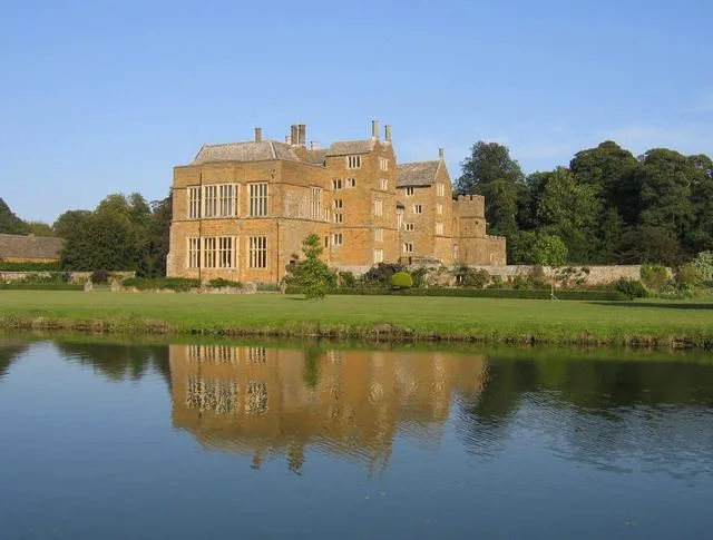
📷 3Castles · West Midlands
Broughton Castle
Broughton Castle — medieval manor house in Oxfordshire, England, UK.
 📷 3
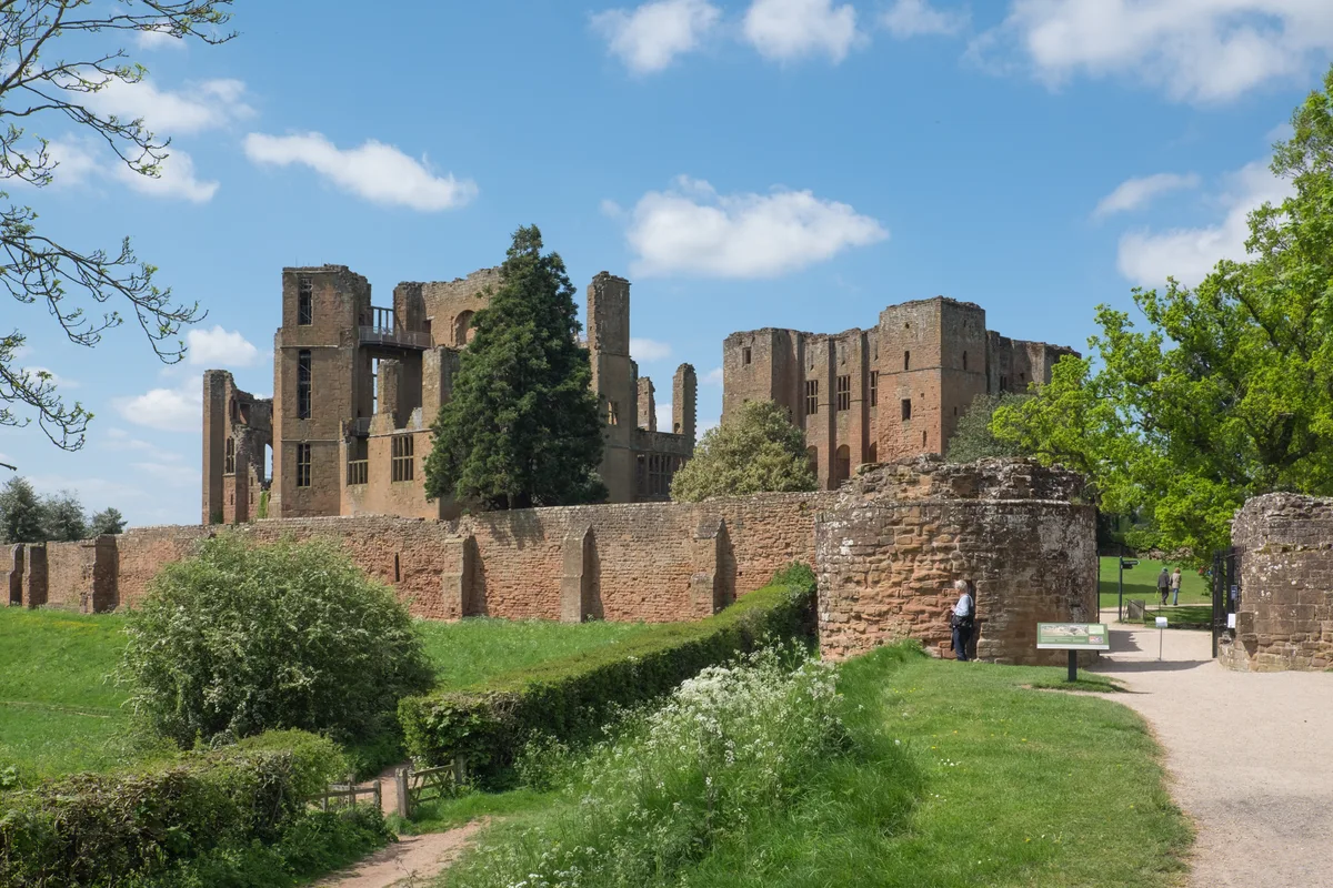
📷 3Castles · West Midlands
Kenilworth Castle
Kenilworth Castle — castle ruin in the town of Kenilworth, Warwickshire, England, UK.
 📷 3
📷 3Castles · West Midlands
Allesley Castle
Allesley Castle — motte-and-bailey castle in Coventry, West Midlands, England, UK.
 📷 3
📷 3Castles · West Midlands
Ardley Castle
Ardley Castle is a castle in the United Kingdom.
Frequently asked questions
- Where is Audenshaw?
- Audenshaw is in the West Midlands, United Kingdom (postcode M34 5NW), in the parish of Tameside, unparished area.
- Does Audenshaw charge admission?
- Audenshaw typically charges admission. Check the official site for current ticket prices and opening hours.
- How do I get to Audenshaw?
- Drivers can navigate to postcode M34 5NW. It sits within the Ashton-under-Lyne parliamentary constituency.