Natural landmarks · North West England
Slight Side
Slight Side — mountain in United Kingdom.

Wikimedia Commons contributors — see linked file page for photographer and licence licence
Plan your visit
- Typical visit
- 1 h–2 h
- Nearest railway station
- Dalegarth · 5.5 km
- Free entry
- Dog-friendly
About
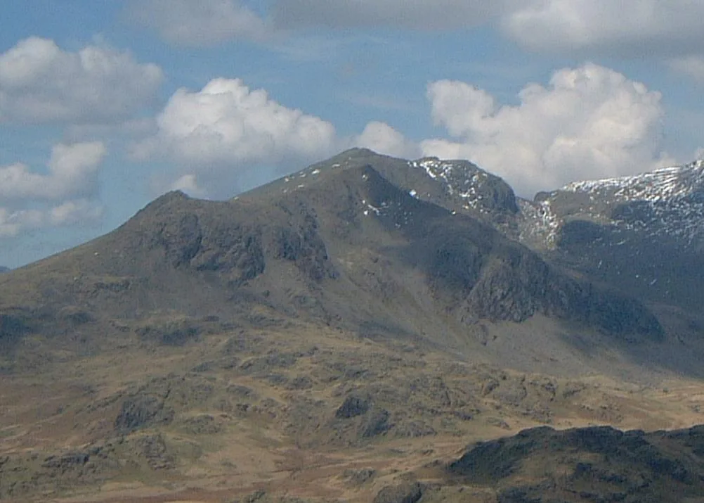
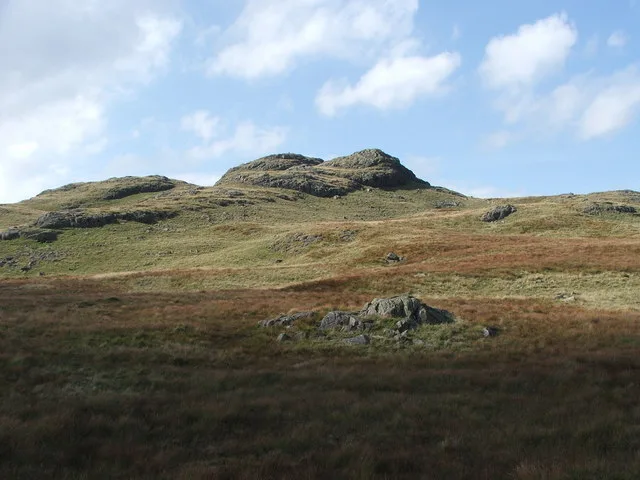
Slight Side is a named natural landmark in the United Kingdom. Wikidata describes it as: "mountain in United Kingdom". Coordinates: 54.4342°, -3.2210°.
Photo gallery
Protected designations
- Site of Special Scientific Interest: Scafell Pikes SSSI
Designations sourced from Natural England open data under OGL v3.
From the Wikipedia article
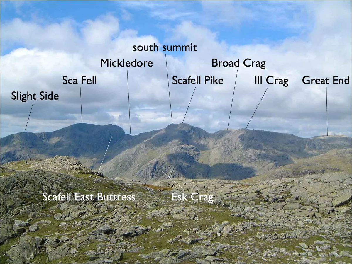
Slight Side is a fell in the English Lake District it stands 25 kilometres (16 miles) east southeast of the town of Whitehaven and reaches a height of 762 metres (2,499 ft). Slight Side lies at the south western edge of the Scafell Massif, a four-kilometre-long (2+1⁄2-mile) crescent of high ground which includes the highest ground in England. The fells names derives from the Old Norse language and means "The mountain shieling with the level pastures", it is a combination of the Norse words "sletta" and "saetr". With a shieling meaning a shepherds hut or a mountain pasture used in the summer.
Excerpt from Wikipedia under CC BY-SA 4.0. See the source article linked in Sources below.
- Coordinates
- 54.4342, -3.2210
- Address
- Cumbria, England
- Nearest railway station
- Dalegarth — 5.5 km
Sources
- wikidata: Q7540465 (CC0)
- wikipedia: Slight Side (CC BY-SA 4.0)
- commons: Slight Side and Scafell.JPG (CC BY-SA 4.0)
Other places nearby
Loading nearby places…
Nearby
 📷 3
📷 3Mountains & hills · North West England
Slight Side
Slight Side — Named summit at 762 m.
 📷 5
📷 5Mountains & hills · North West England
Sca Fell
Sca Fell — Named summit at 963.9 m.
 📷 3
📷 3Mountains & hills · North West England
Great How
Great How — Named summit at 522 m.
 📷 5
📷 5Natural landmarks · North West England
Sca Fell
Sca Fell is a natural landmark in the United Kingdom.
Climbing & bouldering crags · North West England
East Buttress
East Buttress — a climbing crag in england north west.
Climbing & bouldering crags · North West England
Deep Gill Buttress
Deep Gill Buttress — a climbing crag in england north west.
More natural landmarks in this region
 ★ Iconic📷 4
Natural landmarks · North West England
Coniston Water
Lake District lake — Swallows and Amazons setting and Donald Campbell water-speed history.
 📷 3
📷 3Natural landmarks · North West England
Elter Water
Elter Water — lake in the United Kingdom.
 📷 3
📷 3Natural landmarks · North West England
Esthwaite Water
Esthwaite Water — lake in the United Kingdom.
 Flagship📷 5
Natural landmarks · North West England
Semerwater
Semerwater — lake in North Yorkshire, England, UK.
Frequently asked questions
- Where is Slight Side?
- Slight Side is in North-West England, United Kingdom.
- Is Slight Side a protected site?
- Yes — Slight Side is part of the Scafell Pikes SSSI Site of Special Scientific Interest.
- Is Slight Side free to visit?
- Yes, Slight Side is free to enter.
- How do I get to Slight Side?
- The nearest railway station is Dalegarth, about 5.5 km away.