Mountains & hills · North West England
Sca Fell
Also known as: Scafell
Sca Fell — Named summit at 963.9 m.

Wikimedia Commons contributors — see linked file page for photographer and licence licence
Plan your visit
- Typical visit
- 3 h–8 h
- Best time of year
- Late spring – early autumn (May–Oct)
- Nearest railway station
- Dalegarth · 6.6 km
- Free entry
- Dog-friendly
About
Sca Fell is a named summit in the United Kingdom. Wikidata describes it as: "Named summit at 963.9 m.". Coordinates: 54.4475°, -3.2247°.
Photo gallery
Protected designations
- Site of Special Scientific Interest: Scafell Pikes SSSI
Designations sourced from Natural England open data under OGL v3.
From the Wikipedia article
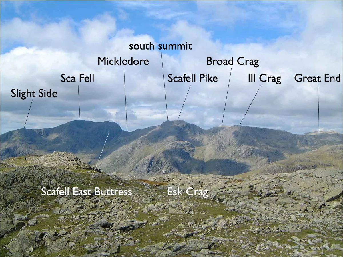
Scafell ( or ; also spelled Sca Fell, previously Scawfell) is a mountain in the Lake District region of Cumbria, England. It has a height of 964 metres (3,163 feet), making it the second-highest mountain in England after its neighbour, Scafell Pike, from which it is separated by Mickledore col.
Excerpt from Wikipedia under CC BY-SA 4.0. See the source article linked in Sources below.
- Coordinates
- 54.4475, -3.2247
- Address
- Cumbria, England
- Nearest railway station
- Dalegarth — 6.6 km
Sources
- osm: n29877963 (ODbL)
- wikipedia: Scafell (CC BY-SA 4.0)
- commons: Annotated Scafell range.jpg (CC BY-SA 4.0)
Other places nearby
Loading nearby places…
Nearby
 📷 5
📷 5Natural landmarks · North West England
Sca Fell
Sca Fell is a natural landmark in the United Kingdom.
Climbing & bouldering crags · North West England
Deep Gill Buttress
Deep Gill Buttress — a climbing crag in england north west.
Climbing & bouldering crags · North West England
The Pinnacle
The Pinnacle — a climbing crag in england north west.
Climbing & bouldering crags · North West England
East Buttress
East Buttress — a climbing crag in england north west.
Climbing & bouldering crags · North West England
Pisgah
Pisgah — a climbing crag in england north west.
Climbing & bouldering crags · North West England
Central Buttress
Central Buttress — a climbing crag in england north west.
More mountains in this region
 📷 3
📷 3Mountains & hills · North West England
Allen Crags
Allen Crags — Named summit at 785 m.
 📷 3
📷 3Mountains & hills · North West England
Alum Pot
Alum Pot — Open shaft pothole in North Yorkshire.
 📷 3
📷 3Mountains & hills · North West England
Arnside Knott
Arnside Knott — Named summit at 159 m.
 📷 3
📷 3Mountains & hills · North West England
Aye Gill Pike
Aye Gill Pike — Named summit at 556.3 m.
Frequently asked questions
- Where is Sca Fell?
- Sca Fell is in North-West England, United Kingdom.
- Is Sca Fell a protected site?
- Yes — Sca Fell is part of the Scafell Pikes SSSI Site of Special Scientific Interest.
- Is Sca Fell free to visit?
- Yes, Sca Fell is free to enter.
- How do I get to Sca Fell?
- The nearest railway station is Dalegarth, about 6.6 km away.