Natural landmarks · North West England
Plover Hill
Plover Hill — mountain in United Kingdom.

Wikimedia Commons contributors — see linked file page for photographer and licence licence
Plan your visit
- Typical visit
- 1 h–2 h
- Nearest railway station
- Horton-in-Ribblesdale · 5.2 km
- Free entry
- Dog-friendly
About
Plover Hill is a named natural landmark in the United Kingdom. Part of Yorkshire Dales. Wikidata describes it as: "mountain in United Kingdom". Coordinates: 54.1724°, -2.2328°.
Photo gallery
Protected designations
- Site of Special Scientific Interest: Pen-Y-Ghent SSSI
Designations sourced from Natural England open data under OGL v3.
From the Wikipedia article
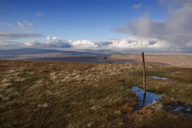
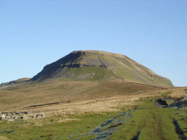
Plover Hill is an area of moorland lying to the north of Pen-y-ghent in the Yorkshire Dales and connected to it by an unbroken area of high ground. Whilst the whole area is now "open access land", the main right-of-way footpaths come directly from the north off Foxup Road and directly from the south from the summit of Pen-y-ghent. Plover Hill rises between two side valleys of Littondale: the valley of Hesleden Beck to the south and that of Foxup Beck to the north. It lies within the civil parish of Halton Gill.
Excerpt from Wikipedia under CC BY-SA 4.0. See the source article linked in Sources below.
- Coordinates
- 54.1724, -2.2328
- District
- North Yorkshire
- Parish
- Halton Gill
- Postcode
- BD23 5QR
- Parliamentary constituency
- Skipton and Ripon
- Nearest railway station
- Horton-in-Ribblesdale — 5.2 km
Sources
- wikidata: Q7205174 (CC0)
- wikipedia: Plover Hill (CC BY-SA 4.0)
- commons: Way marker on Plover Hill - geograph.org.uk - 1578307.jpg (CC BY-SA 4.0)
Other places nearby
Loading nearby places…
Nearby
 📷 3
📷 3Mountains & hills · North West England
Plover Hill
Plover Hill — Named summit at 680.0 m.
 📷 5
📷 5Caves · North West England
Snatcher Pot
Snatcher Pot — a cave broad in england-north-west, United Kingdom.
 📷 3
📷 3Caves · North West England
Lante Shop Cave
Lante Shop Cave is a cave in the United Kingdom.
 📷 5
📷 5Mountains & hills · North West England
Pen-y-ghent
Pen-y-ghent — Named summit at 694 m.
 📷 3
📷 3Archaeological sites · North West England
Dawson Close iron age settlement
Dawson Close iron age settlement — a archaeological in england-north-west, United Kingdom.
 📷 5
📷 5Natural landmarks · North West England
Pen-y-ghent
Pen-y-ghent — mountain in the United Kingdom.
More natural landmarks in this region
 ★ Iconic📷 4
Natural landmarks · North West England
Coniston Water
Lake District lake — Swallows and Amazons setting and Donald Campbell water-speed history.
 📷 3
📷 3Natural landmarks · North West England
Elter Water
Elter Water — lake in the United Kingdom.
 📷 3
📷 3Natural landmarks · North West England
Esthwaite Water
Esthwaite Water — lake in the United Kingdom.
 Flagship📷 5
Natural landmarks · North West England
Semerwater
Semerwater — lake in North Yorkshire, England, UK.
Frequently asked questions
- Where is Plover Hill?
- Plover Hill is in North-West England, United Kingdom (postcode BD23 5QR), in the parish of Halton Gill.
- Is Plover Hill a protected site?
- Yes — Plover Hill is part of the Pen-Y-Ghent SSSI Site of Special Scientific Interest.
- Is Plover Hill free to visit?
- Yes, Plover Hill is free to enter.
- How do I get to Plover Hill?
- The nearest railway station is Horton-in-Ribblesdale, about 5.2 km away. Drivers can navigate to postcode BD23 5QR.