Hill forts · South East England
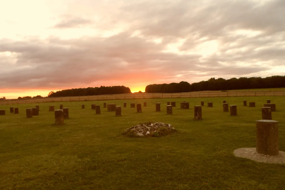
Woodhenge
Woodhenge — Neolithic henge and timber circle monument near Stonehenge.

Wikimedia Commons contributors — see linked file page for photographer and licence licence
Plan your visit
- Typical visit
- 1 h–2 h
- Free entry
- Family-friendly
- Dog-friendly
- Limited wheelchair access
About
Woodhenge is a hill fort in the United Kingdom. Owned by English Heritage. Managed by English Heritage. Part of Stonehenge, Avebury and Associated Sites. Wikidata describes it as: "Neolithic henge and timber circle monument near Stonehenge". Coordinates: 51.1896°, -1.7867°.
Photo gallery
From English Heritage
Dating from about 2500 BC, markers now replace rings of timber posts, which once possibly supported a ring-shaped building. Discovered in 1925 when rings of dark spots were noticed in a crop of wheat.
Read more on the official property page.
Protected designations
- Site of Special Scientific Interest: River Avon System SSSI
- Site of Special Scientific Interest: Salisbury Plain SSSI
- Area of Outstanding Natural Beauty: Cranborne Chase & West Wiltshire Downs
Designations sourced from Natural England open data under OGL v3.
From the Wikipedia article
Woodhenge is a Neolithic Class II henge and timber circle monument within the Stonehenge World Heritage Site in Wiltshire, England. It is 2 miles (3.2 km) northeast of Stonehenge, in Durrington parish, just north of the town of Amesbury.
Excerpt from Wikipedia under CC BY-SA 4.0. See the source article linked in Sources below.
Background
Architecture
The site consists of six concentric oval rings of postholes, the outermost being about 43 by wide. They are surrounded first by a single flat-bottomed ditch, 2.4 m deep and up to 12 m wide, and finally by an outer bank, about 10 m wide and 1 m high. Subsequent theories have indicated that the weight and pressure of the soil over the years could have caused the skull to fragment. After excavation, the remains were taken to London, where they were destroyed during The Blitz, making further examination impossible. Cunnington also found a crouched inhumation of a teenager within a grave dug in the eastern section of the ditch, opposite the entrance. Most of the 168 post holes held wooden posts,…
Sourced from Wikipedia under CC BY-SA 4.0.
- Coordinates
- 51.1896, -1.7867
- District
- Wiltshire
- Parish
- Durrington
- Postcode
- SP4 8LY
- Parliamentary constituency
- East Wiltshire
- Phone
- 0870 3331181
- Official site
- www.english-heritage.org.uk
Sources
- wikidata: Q534028 (CC0)
- wikipedia: Woodhenge (CC BY-SA 4.0)
- commons: Woodhenge in the rain - panoramio.jpg (CC BY-SA 4.0)
Other places nearby
Loading nearby places…
Nearby
 📷 5
📷 5Archaeological sites · South East England
Henge monuments at Durrington Walls and Woodhenge, a round barrow cemetery, two additional round barrows and four settlements
Henge monuments at Durrington Walls and Woodhenge, a round barrow cemetery, two additional round barrows and four settlements — archaeological site in Durrington, Wiltshire, England, UK.
 ★ Iconic📷 5
Hill forts · South East England
Durrington Walls
Durrington Walls — the site of a large Neolithic settlement, village; also it enclosed several hedges;.
 📷 5
📷 5Archaeological sites · South East England
Cuckoo Stone
Cuckoo Stone — a archaeological in england-south-east, United Kingdom.
 📷 5
📷 5Natural landmarks · South East England
BCAC Hanger
BCAC Hanger — a other in england-south-east, United Kingdom.
 📷 5
📷 5Burial mounds & barrows · South East England
Neolithic Long Barrow
Neolithic Long Barrow — a burial mound in england-south-east, United Kingdom.
 📷 5
📷 5Archaeological sites · South East England
Blick Mead
Blick Mead — a archaeological in england-south-east, United Kingdom.
More places run by English Heritage
 Flagship📷 10
Museums · London
Kenwood House
Kenwood House — art museum and historic house in Hampstead, London.
 📷 5
📷 5Galleries · London
Apsley House
Apsley House — London townhouse of the Dukes of Wellington.
 ★ Iconic📷 5
Abbeys & priories · London
Denny Abbey
Denny Abbey — church in South Cambridgeshire, England, UK.
 📷 5
📷 5Chapels · London
Duxford Chapel
Duxford Chapel — chapel in Whittlesford, Cambridgeshire, England, UK.
More places in this region
 Flagship📷 10
Hill forts · South East England
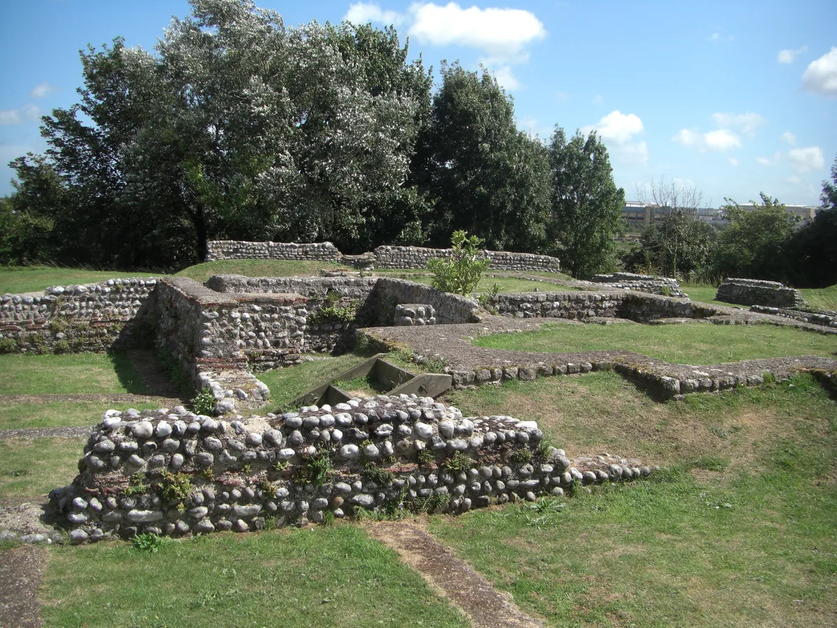
Castrum Anderitum
Castrum Anderitum — 3rd century Roman fort in the province of Britannia.
 Flagship📷 10
Hill forts · South East England
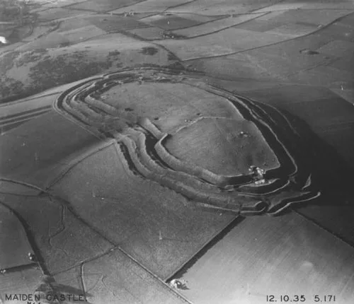
Maiden Castle
Maiden Castle — Iron Age hill fort in Dorset, England, UK.
 Flagship📷 10
Hill forts · South East England
Portus Adurni
Portus Adurni is a hill fort in the United Kingdom.
 Flagship📷 10
Hill forts · South East England
Richborough Roman Fort
Richborough Roman Fort — Roman fort at Richborough, Ash, United Kingdom.
Frequently asked questions
- Where is Woodhenge?
- Woodhenge is in South-East England, United Kingdom (postcode SP4 8LY), in the parish of Durrington.
- Who runs Woodhenge?
- Woodhenge is operated by English Heritage.
- Is Woodhenge a protected site?
- Yes — Woodhenge is part of the River Avon System SSSI Site of Special Scientific Interest and the Salisbury Plain SSSI Site of Special Scientific Interest.
- Is Woodhenge free to visit?
- Yes, Woodhenge is free to enter.
- How do I get to Woodhenge?
- Drivers can navigate to postcode SP4 8LY. It sits within the East Wiltshire parliamentary constituency.