Towns & cities · West Midlands
West Malvern
West Malvern — village in Worcestershire, England, UK.

Wikimedia Commons contributors — see linked file page for photographer and licence licence
Plan your visit
- Typical visit
- 3 h–6 h
- Nearest railway station
- Great Malvern · 2.1 km
- Free entry
- Family-friendly
- Dog-friendly
About
West Malvern is a town, city, village or settlement in the United Kingdom. Recent population estimates put it at around 1,216 people. Address: WR14. Wikidata describes it as: "village in Worcestershire, England, UK". Coordinates: 52.1163°, -2.3461°.
Photo gallery
Protected designations
- Site of Special Scientific Interest: The Malvern Hills SSSI
- Area of Outstanding Natural Beauty: Cotswolds
- Area of Outstanding Natural Beauty: Malvern Hills
Designations sourced from Natural England open data under OGL v3.
From the Wikipedia article
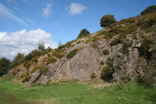
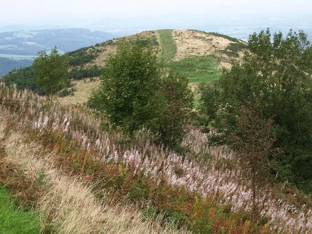
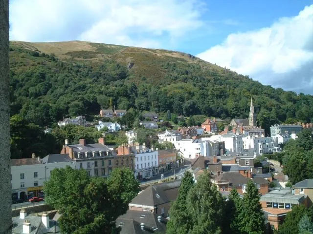
West Malvern is a village and a civil parish on the west side of the north part of the Malvern Hills, on the western edge of Worcestershire, England. It has become effectively an outer suburb of Malvern and part of an urban area often called The Malverns, locally administered by Malvern Hills District Council and its own parish council. Its altitude up to 250 metres gives West Malvern panoramic views of the adjacent Herefordshire countryside to the west. The Church of St James, built in 1840, has an adjacent Church of England primary school. The churchyard includes the grave of Peter Mark Roget, author of Roget's Thesaurus, who died while on holiday in the village. The 2011 Census population of 1,385 was estimated at 1,263 in 2019.
Excerpt from Wikipedia under CC BY-SA 4.0. See the source article linked in Sources below.
- Coordinates
- 52.1163, -2.3461
- County
- Worcestershire
- District
- Malvern Hills
- Parish
- West Malvern
- Postcode
- WR14
- Parliamentary constituency
- West Worcestershire
- Population
- 1,216
- Nearest railway station
- Great Malvern — 2.1 km
Sources
- wikidata: Q1911268 (CC0)
- wikipedia: West Malvern (CC BY-SA 4.0)
- commons: West Malvern - geograph.org.uk - 787326.jpg (CC BY-SA 4.0)
Other places nearby
Loading nearby places…
Nearby
 📷 3
📷 3Mountains & hills · West Midlands
Table Hill
Table Hill — Named summit at 375 m.
Ironworks & forges · West Midlands
Regents Theological College
Regents Theological College — theological college in West Malvern, Worcestershire, United Kingdom.
 📷 3
📷 3Mountains & hills · West Midlands
End Hill
End Hill — Named summit at 328 m.
 📷 3
📷 3Memorials & monuments · West Midlands
West Malvern War Memorial
West Malvern War Memorial — Grade II listed building-listed memorial in england-west-midlands, United Kingdom.
Mountain bike trails · West Midlands
Malvern Hills Short Mountain Bike Trail
Malvern Hills Short Mountain Bike Trail — a mtb trail in england west midlands.
 📷 3
📷 3Mountains & hills · West Midlands
North Hill
North Hill — Named summit at 398 m.
More towns in this region
 Flagship📷 3
Towns & cities · West Midlands
Adderbury
Adderbury — village and civil parish in Cherwell district, Oxfordshire, England.
 Flagship📷 3
Towns & cities · West Midlands
Admington
Admington — village in Warwickshire, England, UK.
 Flagship📷 3
Towns & cities · West Midlands
Aldington
Aldington — village in Worcestershire, United Kingdom.
 Flagship📷 5
Towns & cities · West Midlands
Anstey
Anstey — large village in Leicestershire, England.
Frequently asked questions
- Where is West Malvern?
- West Malvern is in Worcestershire, the West Midlands, United Kingdom (postcode WR14), in the parish of West Malvern.
- Is West Malvern a protected site?
- Yes — West Malvern is part of the The Malvern Hills SSSI Site of Special Scientific Interest and the Cotswolds National Landscape (AONB).
- Is West Malvern free to visit?
- Yes, West Malvern is free to enter.
- How do I get to West Malvern?
- The nearest railway station is Great Malvern, about 2.1 km away. Drivers can navigate to postcode WR14.