Mountains & hills · West Midlands
Sugarloaf Hill
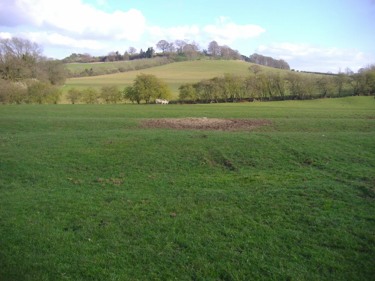
Sugarloaf Hill — Named summit at 369 m.

Wikimedia Commons contributors — see linked file page for photographer and licence licence
_-_geograph.org.uk_-_180685.jpg)
Plan your visit
- Typical visit
- 3 h–8 h
- Best time of year
- Late spring – early autumn (May–Oct)
- Nearest railway station
- Great Malvern · 1.6 km
- Free entry
- Dog-friendly
About
Sugarloaf Hill is a named summit in the United Kingdom. Wikidata describes it as: "Named summit at 369 m.". Coordinates: 52.1100°, -2.3418°.
Photo gallery
Protected designations
- Site of Special Scientific Interest: The Malvern Hills SSSI
- Area of Outstanding Natural Beauty: Cotswolds
- Area of Outstanding Natural Beauty: Malvern Hills
Designations sourced from Natural England open data under OGL v3.
From the Wikipedia article
Sugarloaf Hill lies between the Worcestershire Beacon and North Hill in the range of Malvern Hills that runs about 13 kilometres (8 mi) north-south along the Herefordshire-Worcestershire border. The summit of Sugarloaf Hill is 368 metres (1,207 ft) above sea level and is a popular peak usually passed by walkers hiking between the Worcestershire Beacon and North Hill—respectively the highest and second highest Malvern Hills summits.
Excerpt from Wikipedia under CC BY-SA 4.0. See the source article linked in Sources below.
- Coordinates
- 52.1100, -2.3418
- County
- Worcestershire
- District
- Malvern Hills
- Parish
- West Malvern
- Postcode
- WR14 4BE
- Parliamentary constituency
- West Worcestershire
- Nearest railway station
- Great Malvern — 1.6 km
- Official site
- www.malvernhillsaonb.org.uk
Sources
- osm: n469955885 (ODbL)
- wikipedia: Sugarloaf Hill, Malvern (CC BY-SA 4.0)
- commons: Sugarloaf Hill (with Table Hill and North Hill) - geograph.org.uk - 180685.jpg (CC BY-SA 4.0)
Other places nearby
Loading nearby places…
Nearby
Mountain bike trails · West Midlands
Malvern Hills Medium Mountain Bike Trail
Malvern Hills Medium Mountain Bike Trail — a mtb trail in england west midlands.
 📷 3
📷 3Memorials & monuments · West Midlands
West Malvern War Memorial
West Malvern War Memorial — Grade II listed building-listed memorial in england-west-midlands, United Kingdom.
 📷 4
📷 4Historic churches · West Midlands
St. Ann's Well, Malvern
St. Ann's Well is set on the slopes of the Malvern Hills above Great Malvern. It is a popular site on a path leading up to the Worcestershire Beacon and lies on the final descent of the Worcestershire
Ironworks & forges · West Midlands
Regents Theological College
Regents Theological College — theological college in West Malvern, Worcestershire, United Kingdom.
Mountain bike trails · West Midlands
Malvern Hills Short Mountain Bike Trail
Malvern Hills Short Mountain Bike Trail — a mtb trail in england west midlands.
Mountains & hills · West Midlands
Worcestershire Beacon
Worcestershire Beacon — Named summit at 425 m.
More mountains in this region
 📷 5
📷 5Mountains & hills · West Midlands
Arbury Hill
Arbury Hill — Named summit at 224.3 m.
Mountains & hills · West Midlands
Barr Beacon
Barr Beacon — Named summit at 227 m.
 📷 3
📷 3Mountains & hills · West Midlands
Barrow Hill
Barrow Hill — Named summit at 179 m.
Mountains & hills · West Midlands
Beacon Hill
Beacon Hill — Named summit at 237 m.
Frequently asked questions
- Where is Sugarloaf Hill?
- Sugarloaf Hill is in Worcestershire, the West Midlands, United Kingdom (postcode WR14 4BE), in the parish of West Malvern.
- Is Sugarloaf Hill a protected site?
- Yes — Sugarloaf Hill is part of the The Malvern Hills SSSI Site of Special Scientific Interest and the Cotswolds National Landscape (AONB).
- Is Sugarloaf Hill free to visit?
- Yes, Sugarloaf Hill is free to enter.
- How do I get to Sugarloaf Hill?
- The nearest railway station is Great Malvern, about 1.6 km away. Drivers can navigate to postcode WR14 4BE.