Towns & cities · Yorkshire & the Humber
Wath
Wath — village in High and Low Bishopside, North Yorkshire, England, United Kingdom.

Wikimedia Commons contributors — see linked file page for photographer and licence licence
Plan your visit
- Typical visit
- 3 h–6 h
- Free entry
- Family-friendly
- Dog-friendly
About
Wath is a town, city, village or settlement in the United Kingdom. Address: HG3. Wikidata describes it as: "village in High and Low Bishopside, North Yorkshire, England, United Kingdom". Coordinates: 54.1054°, -1.7749°.
Photo gallery
Protected designations
- Site of Special Scientific Interest: East Nidderdale Moors (Flamstone Pin - High Ruckles) SSSI
- Site of Special Scientific Interest: West Nidderdale, Barden and Blubberhouses Moors SSSI
- Area of Outstanding Natural Beauty: Nidderdale
Designations sourced from Natural England open data under OGL v3.
From the Wikipedia article
Wath, sometimes known as Wath-in-Nidderdale to distinguish it from other places named Wath, is a village in the county of North Yorkshire, England. It is near Gouthwaite Reservoir and about 3 miles (4.8 km) north of Pateley Bridge. The toponym is derived from the Old Norse vað, meaning "ford". In the Middle Ages Wath was divided between the lands of Fountains Abbey, north of a small stream known as Dauber Gill, and the lands of the Archbishop of York on the south side. The northern part, including the Sportsman's Arms inn, is now in the civil parish of Fountains Earth, historically a township in the parish of Kirkby Malzeard. The southern and higher part is now in the civil parish of High and Low Bishopside, historically a township in the parish of Ripon. From 1974 to 2023 it was part of the Borough of Harrogate, it is now administered by the unitary North Yorkshire Council. Sigsworth Grange was a grange of Fountains Abbey. The present building on the site of the grange dates from the early 18th century. The small Wath Methodist Chapel in the upper part of the village, has an unusual 5-sided shape. It was built in 1859, and was designated a Grade II listed building in 2018. The ford over the River Nidd, which gave the place its name, was replaced by a bridge by the 16th century. The present bridge, a narrow road bridge, dates from the early 19th century and is a Grade II listed building. In the early 20th century Wath had a railway station on the Nidd Valley Light Railway.
Excerpt from Wikipedia under CC BY-SA 4.0. See the source article linked in Sources below.
- Coordinates
- 54.1054, -1.7749
- District
- North Yorkshire
- Parish
- High and Low Bishopside
- Postcode
- HG3
- Parliamentary constituency
- Skipton and Ripon
Sources
- wikidata: Q692483 (CC0)
- wikipedia: Wath-in-Nidderdale (CC BY-SA 4.0)
- commons: The Sportman's Arms.jpg (CC BY-SA 4.0)
Other places nearby
Loading nearby places…
Nearby
 📷 3
📷 3Historic bridges · Yorkshire & the Humber
Wath Bridge
Wath Bridge — Grade II listed building-listed bridge in england-yorkshire, United Kingdom.
 📷 5
📷 5Watermills · Yorkshire & the Humber
Water Mill Inn
Water Mill Inn — Grade II listed building-listed watermill in england-yorkshire, United Kingdom.
Caravan parks · Yorkshire & the Humber
Heathfield Farm
Heathfield Farm — a caravan park in england yorkshire.
 📷 3
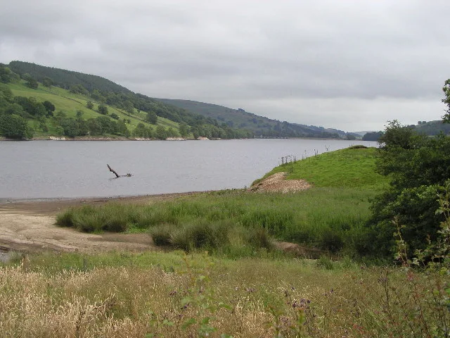
📷 3Reservoirs & lochs · Yorkshire & the Humber
Gouthwaite Reservoir
Gouthwaite Reservoir — reservoir in North Yorkshire, England, UK.
Caravan parks · Yorkshire & the Humber
Low Wood Farm
Low Wood Farm — a caravan park in england yorkshire.
Caravan parks · Yorkshire & the Humber
Westfield Farm
Westfield Farm — a caravan park in england yorkshire.
More towns in this region
 Flagship📷 4
Towns & cities · Yorkshire & the Humber
Bradford
Bradford — city and largest settlement in the City of Bradford district, Yorkshire, England.
 Flagship📷 5
Towns & cities · Yorkshire & the Humber
Coxwold
Coxwold — village and civil parish in North Yorkshire, England.
 Flagship📷 5
Towns & cities · Yorkshire & the Humber
Great Ayton
Great Ayton — village in North Yorkshire, England, UK.
May2005.jpg?width=1200) Flagship📷 5
Flagship📷 5Towns & cities · Yorkshire & the Humber
Great Langton
Great Langton — village in North Yorkshire, England, UK.
Frequently asked questions
- Where is Wath?
- Wath is in Yorkshire, United Kingdom (postcode HG3), in the parish of High and Low Bishopside.
- Is Wath a protected site?
- Yes — Wath is part of the East Nidderdale Moors (Flamstone Pin - High Ruckles) SSSI Site of Special Scientific Interest and the West Nidderdale, Barden and Blubberhouses Moors SSSI Site of Special Scientific Interest.
- Is Wath free to visit?
- Yes, Wath is free to enter.
- How do I get to Wath?
- Drivers can navigate to postcode HG3. It sits within the Skipton and Ripon parliamentary constituency.