Towns & cities · West Midlands
Disley
Disley — village in Cheshire East, Cheshire, England, UK.

Wikimedia Commons contributors — see linked file page for photographer and licence licence
Plan your visit
- Typical visit
- 3 h–6 h
- Nearest railway station
- Disley · 0.1 km
- Free entry
- Family-friendly
- Dog-friendly
- Wheelchair accessible
About
Disley is a town, city, village or settlement in the United Kingdom. Recent population estimates put it at around 4,294 people. Address: SK12. Wikidata describes it as: "village in Cheshire East, Cheshire, England, UK". Coordinates: 53.3570°, -2.0430°.
Photo gallery
From the Wikipedia article
Disley is a village and civil parish in Cheshire, England. It is located on the edge of the Peak District in the Goyt Valley, south of Stockport and close to the county boundary with Derbyshire at New Mills. The population at the 2011 Census was 4,294. To the north, the River Goyt and the Peak Forest Canal, which opened in 1800, pass along the edge of the village. Today, it is a commuter town, retaining a semi-rural character. The parish includes part of the neighbouring area of Newtown, the bulk of which is in Derbyshire.
Excerpt from Wikipedia under CC BY-SA 4.0. See the source article linked in Sources below.
Background
History
Its Anglo-Saxon name was Dystiglegh, meaning "wood or clearing by a mound" or possibly "windy settlement". In the 13th century, in the time of Edward I, there are references to confirmatory grants of land made to Jordan de Dystelegh of Disley Hall and Roger de Stanley-de-Dystelegh of Stanley Hall in the district, pointing to even older local settlements. It later had the name Dystelegh. Sir Piers Legh of Lyme founded St Mary's Church, completed in 1524 and consecrated as parish church in 1558. The earliest parish register is from 1591. In 1724, the road from Manchester to Buxton became a turnpike road and in the early 1800s the road was rerouted from its original route along Jackson's Edge…
Sourced from Wikipedia under CC BY-SA 4.0.
- Coordinates
- 53.3570, -2.0430
- District
- Cheshire East
- Parish
- Disley
- Postcode
- SK12
- Parliamentary constituency
- Macclesfield
- Population
- 4,294
- Nearest railway station
- Disley — 0.1 km
- Official site
- www.theramsheaddisley.co.uk
Sources
- wikidata: Q23063 (CC0)
- wikipedia: Disley (CC BY-SA 4.0)
- commons: Disley in 2005.jpg (CC BY-SA 4.0)
Other places nearby
Loading nearby places…
Nearby
 📷 3
📷 3Historic churches · West Midlands
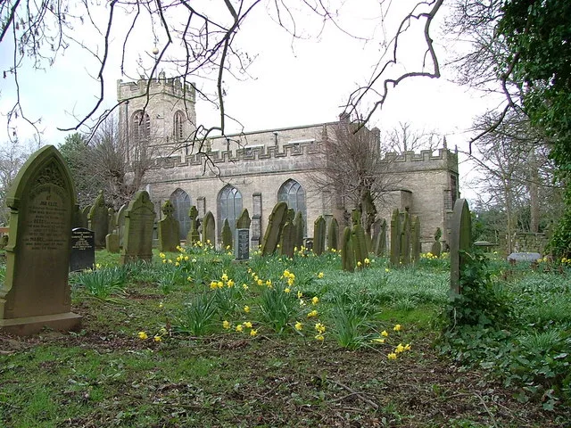
St Mary's Church, Disley
St Mary's Church, Disley — church in Disley, Cheshire, England, UK.
 📷 3
📷 3Historic pubs · West Midlands
Rams Head Hotel
Rams Head Hotel — Historic pub — listed building or notable heritage status.
 📷 3
📷 3Memorials & monuments · West Midlands
Disley War Memorial
Disley War Memorial — War memorial, dating to 1920.
 📷 3
📷 3Memorials & monuments · West Midlands
Tower In Garden Of Woodbank House
Tower In Garden Of Woodbank House — Grade II listed building-listed memorial in england-west-midlands, United Kingdom.
 📷 3
📷 3Historic bridges · West Midlands
Canal Bridge Number 26
Canal Bridge Number 26 — Grade II listed building-listed bridge in england-west-midlands, United Kingdom.
 📷 5
📷 5Canals · West Midlands
Peak Forest Canal
Peak Forest Canal — canal in Derbyshire/Cheshire/Greater Manchester, England, UK.
More towns in this region
 Flagship📷 3
Towns & cities · West Midlands
Adderbury
Adderbury — village and civil parish in Cherwell district, Oxfordshire, England.
 Flagship📷 3
Towns & cities · West Midlands
Admington
Admington — village in Warwickshire, England, UK.
 Flagship📷 3
Towns & cities · West Midlands
Aldington
Aldington — village in Worcestershire, United Kingdom.
 Flagship📷 5
Towns & cities · West Midlands
Anstey
Anstey — large village in Leicestershire, England.
Frequently asked questions
- Where is Disley?
- Disley is in the West Midlands, United Kingdom (postcode SK12), in the parish of Disley.
- Is Disley free to visit?
- Yes, Disley is free to enter.
- How do I get to Disley?
- The nearest railway station is Disley, about 0.1 km away. Drivers can navigate to postcode SK12.