Natural landmarks · Northern Ireland
Tandragee
Also known as: Tóin re Gaoith
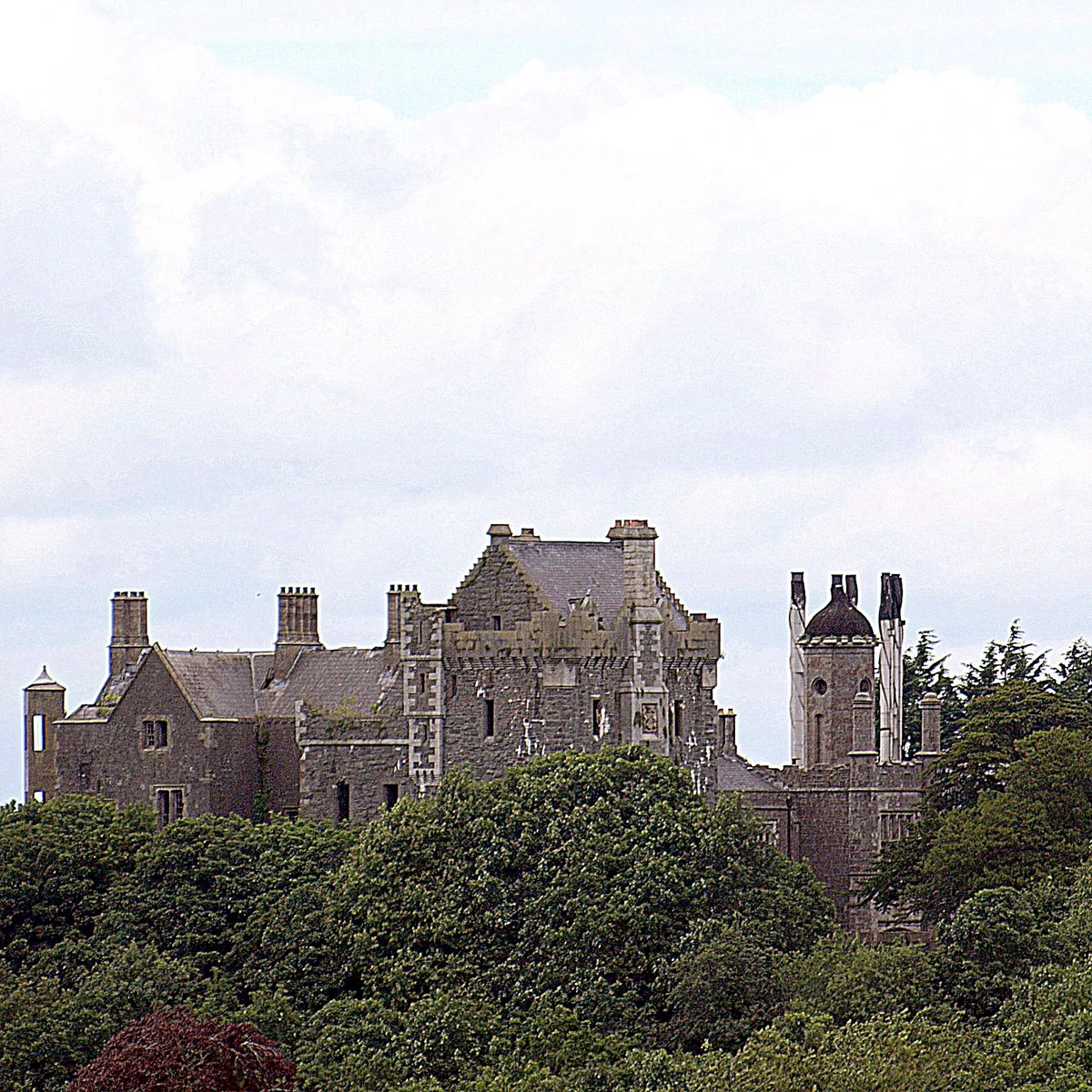
Tandragee in Northern Ireland, United Kingdom.

james denham — CC BY-SA 2.0 via Wikimedia Commons licence
Plan your visit
- Typical visit
- 1 h–2 h
- Free entry
- Dog-friendly
About
Tandragee is a place of interest in Northern Ireland, United Kingdom — drawn from open-data sources for visitor reference. See the linked Wikipedia article for the full description.
Photo gallery
From the Wikipedia article
Tandragee (from Irish Tóin re Gaoith, meaning 'backside to the wind') is a town in County Armagh, Northern Ireland. It is on a hillside above the Cusher River, and is overlooked by Tandragee Castle. The town is in the civil parish of Ballymore and the historic barony of Orior Lower. Earlier spellings of the name include 'Tanderagee' and 'Tonregee'. It had a population of 3,545 people in the 2021 census.
Excerpt from Wikipedia under CC BY-SA 4.0. See the source article linked in Sources below.
Background
History
Overlooking the town is Tandragee Castle. It was originally the seat of the chief of the O'Hanlon clan, who was Lord of Orior. Because some of the O'Hanlons took part in the Nine Years' War, the castle and surrounding territory were confiscated from the O'Hanlons and granted to Oliver St John and his heirs. Tandragee Castle was rebuilt in about 1837, after having previously been destroyed during the Irish Rebellion of 1641, for George Montagu, 6th Duke of Manchester. Its grounds have been home to the Tayto potato-crisp factory since 1956, after being bought by businessman Thomas Hutchinson.
Description
In February 1973, a confrontation occurred between three gunmen and British soldiers at the Tandragee power station, resulting in one of the gunmen being hit. In 2000, Tandragee was scene of the Murders of Andrew Robb and David McIlwaine, two teenaged local Protestants who were unaffiliated with any paramilitary organization, by three members of the UVF Mid-Ulster Brigade and as part of an ongoing Loyalist feud between the UVF and LVF.
Sourced from Wikipedia under CC BY-SA 4.0.
- Coordinates
- 54.3543, -6.4154
- Postcode
- BT62 2AA
- Parliamentary constituency
- Newry and Armagh
Sources
Other places nearby
Loading nearby places…
Nearby
 📷 3
📷 3Castles · Northern Ireland
Tayto Castle
Tayto Castle — a castle in northern-ireland, United Kingdom.
 📷 3
📷 3Castles · Northern Ireland
Tandragee Castle
Tandragee Castle is a castle in the United Kingdom.
 📷 4
📷 4Historic churches · Northern Ireland
Ballymore Parish Church
Ballymore Parish Church in Northern Ireland, United Kingdom.
 📷 3
📷 3Natural landmarks · Northern Ireland
Cargans
Cargans in Northern Ireland, United Kingdom.
Caravan parks · Northern Ireland
Clare Glen Caravan Park
Clare Glen Caravan Park — a caravan park in northern ireland.
 📷 3
📷 3Natural landmarks · Northern Ireland
Coolyhill
Coolyhill in Northern Ireland, United Kingdom.
More natural landmarks in this region
 Flagship📷 4
Natural landmarks · Northern Ireland
Lough Erne
Lough Erne — lake in County Fermanagh, Northern Ireland, UK.
 Flagship📷 4
Natural landmarks · Northern Ireland
Lough Neagh
Lough Neagh — large lake in Northern Ireland.
 📷 3
📷 3Natural landmarks · Northern Ireland
Ballysaggart Lough
Ballysaggart Lough — lake in the United Kingdom.
 📷 5
📷 5Natural landmarks · Northern Ireland
Belmore Mountain
Belmore Mountain — mountain in the United Kingdom.
Frequently asked questions
- Where is Tandragee?
- Tandragee is in Northern Ireland, United Kingdom (postcode BT62 2AA).
- Is Tandragee free to visit?
- Yes, Tandragee is free to enter.
- How do I get to Tandragee?
- Drivers can navigate to postcode BT62 2AA. It sits within the Newry and Armagh parliamentary constituency.