Towns & cities · West Midlands
Stockton Heath
Stockton Heath — village and civil parish in Warrington, Cheshire, United Kingdom.

Wikimedia Commons contributors — see linked file page for photographer and licence licence
Plan your visit
- Typical visit
- 3 h–6 h
- Nearest railway station
- Warrington Bank Quay · 2.1 km
- Free entry
- Family-friendly
- Dog-friendly
About
Stockton Heath is a town, city, village or settlement in the United Kingdom. Recent population estimates put it at around 6,237 people. Address: WA4. Wikidata describes it as: "village and civil parish in Warrington, Cheshire, United Kingdom". Coordinates: 53.3732°, -2.5794°.
Photo gallery
From the Wikipedia article
Stockton Heath is a civil parish and suburb of Warrington, in the Borough of Warrington, Cheshire, England. It is located to the north of the Bridgewater Canal and to the south of the Manchester Ship Canal, which divides Stockton Heath from Latchford and north Warrington. It has a total resident population of 6,396. Victoria Square is at the centre of Stockton Heath and is on the crossroads of the A49 and A56. Until the 1970s, the Victoria Hotel stood on this square but its location has been redeveloped. North of the square is the main shopping area which includes the Forge Shopping Centre, developed on the site of the old forge (Caldwell's). Stockton Heath is home to a number of modern bars and restaurants, as well as traditional public houses. The Red Lion Inn dates back to the early 19th century. The Mulberry Tree Inn on Victoria Square opened its present building in March 1907, replacing earlier premises from 1725. Since 1988, much of the centre of Stockton Heath has been designated a conservation area to preserve its character but, at the same time, there has been redevelopment work with several new bars and restaurants moving into the centre of Stockton Heath.
Excerpt from Wikipedia under CC BY-SA 4.0. See the source article linked in Sources below.
Background
History
A Roman road ran through Stockton Heath, along the route now known as Roman Road. There have been some excavations; more information is available at Warrington Museum. Excavations of the large Roman industrial settlement in the suburbs of modern-day Wilderspool and Stockton Heath have unearthed a Roman mask, one of only a handful found in Europe, and the first evidence of this settlement was unearthed during the early excavation of the Bridgewater Canal in Stockton Heath in 1770. Primary evidence points to a probable temple to Minerva on the site, a strong focus on pottery and glass bead paste making industries, and a trapezoidal building of unidentified purpose. that one author suggests…
Sourced from Wikipedia under CC BY-SA 4.0.
- Coordinates
- 53.3732, -2.5794
- District
- Warrington
- Parish
- Stockton Heath
- Postcode
- WA4
- Parliamentary constituency
- Warrington South
- Population
- 6,237
- Nearest railway station
- Warrington Bank Quay — 2.1 km
Sources
- wikidata: Q821890 (CC0)
- wikipedia: Stockton Heath (CC BY-SA 4.0)
- commons: Stocktonheath.jpg (CC BY-SA 4.0)
Other places nearby
Loading nearby places…
Nearby
 📷 3
📷 3Historic churches · West Midlands
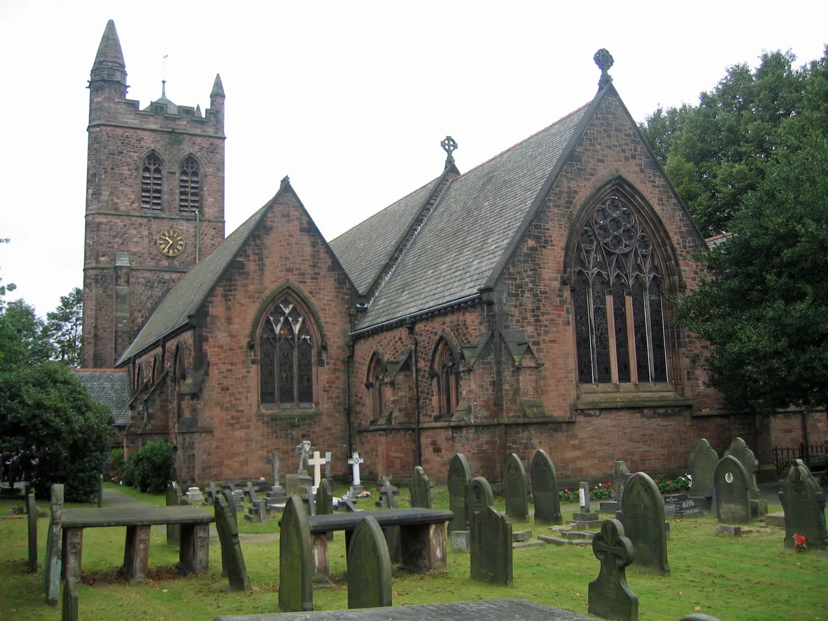
St Thomas' Church, Stockton Heath
St Thomas' Church, Stockton Heath — grade II listed church in Stockton Heath, Warrington, Cheshire, England, UK.
 📷 3
📷 3Galleries · West Midlands
Stockton Heath Gallery
Stockton Heath Gallery — a gallery in england-west-midlands, United Kingdom.
 📷 3
📷 3Aqueducts · West Midlands
Lumb Brook Bridge (An Aqueduct)
Lumb Brook Bridge (An Aqueduct) — aqueduct in Stockton Heath, Warrington, Cheshire, England, UK.
 📷 3
📷 3Historic bridges · West Midlands
Lumb Brook Bridge
Lumb Brook Bridge is a historic bridge in the United Kingdom.
 📷 5
📷 5Historic bridges · West Midlands
Cantilever Bridge
Cantilever Bridge is a historic bridge in the United Kingdom.
 📷 3
📷 3Historic bridges · West Midlands
Red Lane Bridge
Red Lane Bridge is a historic bridge in the United Kingdom.
More towns in this region
 Flagship📷 3
Towns & cities · West Midlands
Adderbury
Adderbury — village and civil parish in Cherwell district, Oxfordshire, England.
 Flagship📷 3
Towns & cities · West Midlands
Admington
Admington — village in Warwickshire, England, UK.
 Flagship📷 3
Towns & cities · West Midlands
Aldington
Aldington — village in Worcestershire, United Kingdom.
 Flagship📷 5
Towns & cities · West Midlands
Anstey
Anstey — large village in Leicestershire, England.
Frequently asked questions
- Where is Stockton Heath?
- Stockton Heath is in the West Midlands, United Kingdom (postcode WA4), in the parish of Stockton Heath.
- Is Stockton Heath free to visit?
- Yes, Stockton Heath is free to enter.
- How do I get to Stockton Heath?
- The nearest railway station is Warrington Bank Quay, about 2.1 km away. Drivers can navigate to postcode WA4.