Mountains & hills · North Wales
Rhinog Fach
Rhinog Fach — Named summit at 706 m.

Wikimedia Commons contributors — see linked file page for photographer and licence licence
Plan your visit
- Typical visit
- 3 h–8 h
- Best time of year
- Late spring – early autumn (May–Oct)
- Nearest railway station
- Llanbedr · 8.5 km
- Free entry
- Dog-friendly
About
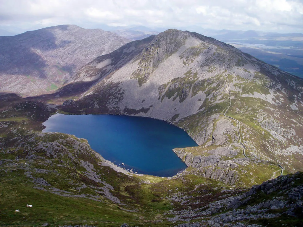
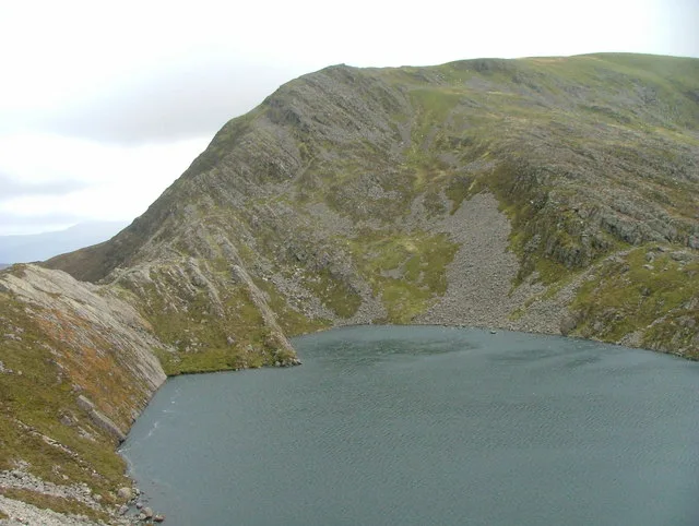
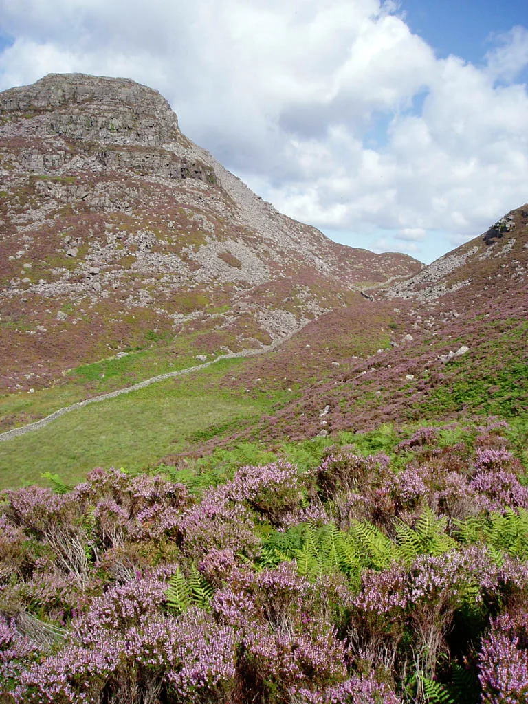
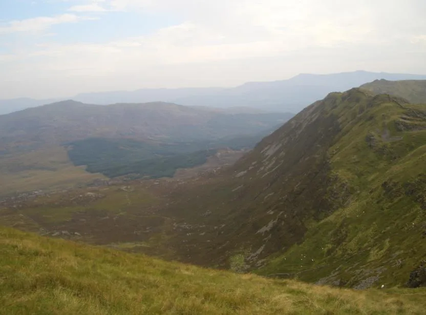
Rhinog Fach is a named summit in the United Kingdom. Wikidata describes it as: "Named summit at 706 m.". Coordinates: 52.8242°, -3.9830°.
Photo gallery
From the Wikipedia article
Rhinog Fach is a mountain in Snowdonia, North Wales and forms part of the Rhinogydd. Technically, Rhinog Fach is a subsidiary summit of Y Llethr, but is a Marilyn. To the north lies its higher cousin Rhinog Fawr, separated by the shapely pass of Bwlch Drws Ardudwy. Although lower than the highest mountain in the Rhinog range, Y Llethr, it is often regarded as the true 'king of the Rhinogydd' due to its spectacular rocky peak. Unlike Fach, Y Llethr's peak is grassy and unremarkable.
Excerpt from Wikipedia under CC BY-SA 4.0. See the source article linked in Sources below.
- Coordinates
- 52.8242, -3.9830
- Address
- Gwynedd, Wales
- Nearest railway station
- Llanbedr — 8.5 km
Sources
- osm: n324163642 (ODbL)
- wikipedia: Rhinog Fach (CC BY-SA 4.0)
- commons: Rhinog Fach.jpg (CC BY-SA 4.0)
Other places nearby
Loading nearby places…
Nearby
 📷 3
📷 3Natural landmarks · North Wales
Rhinog Fach
Rhinog Fach — mountain (712m) in Gwynedd.
 📷 3
📷 3Mountains & hills · North Wales
Craig y Llyn Hywel
Craig y Llyn Hywel — a mountain in wales-north, United Kingdom, 558 m.
 📷 3
📷 3Mountains & hills · North Wales
Y Llethr
Y Llethr — Named summit at 750 m.
 📷 3
📷 3Quarries · North Wales
Cefn Cam quarry
Cefn Cam quarry — Slate quarry near Ganllwyd, Wales, United Kingdom.
 📷 5
📷 5Mountains & hills · North Wales
Rhinog Fawr
Rhinog Fawr — Named summit at 715 m.
 📷 3
📷 3Mountains & hills · North Wales
Crib-Y-Rhiw
Crib-Y-Rhiw — Named summit at 681 m.
More mountains in this region
 📷 5
📷 5Mountains & hills · North Wales
Cemlyn Bay and lagoon
Cemlyn Bay and lagoon — Site of Special Scientific Interest in Wales.
 📷 3
📷 3Mountains & hills · North Wales
Aberffraw Bay
Aberffraw Bay — bay on the west coast of Anglesey, in Wales, UK.
 📷 3
📷 3Mountains & hills · North Wales
Allt-fawr
Allt-fawr — Named summit at 698 m.
 📷 3
📷 3Mountains & hills · North Wales
Aran Benllyn
Aran Benllyn — Named summit at 884 m.
Frequently asked questions
- Where is Rhinog Fach?
- Rhinog Fach is in North Wales, in the United Kingdom — coordinates 52.8242°, -3.9830°. The nearest railway station is Llanbedr, around 8.5 km away.
- Is Rhinog Fach free to visit?
- Yes — admission to Rhinog Fach is free.