Mountains & hills · North Wales
Y Llethr
Y Llethr — Named summit at 750 m.

Wikimedia Commons contributors — see linked file page for photographer and licence licence
Plan your visit
- Typical visit
- 3 h–8 h
- Best time of year
- Late spring – early autumn (May–Oct)
- Nearest railway station
- Llanbedr · 8.2 km
- Free entry
- Dog-friendly
About
Y Llethr is a named summit in the United Kingdom. Wikidata describes it as: "Named summit at 750 m.". Coordinates: 52.8129°, -3.9877°.
Photo gallery
From the Wikipedia article
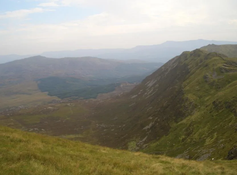
Y Llethr is the highest mountain in the Rhinogydd range of Snowdonia, in north Wales. The summit consists of a flat grassy top marked only by a small cairn. The summit is more in keeping with its southern flanks than its rugged northern approach. The shortest route to the summit goes from the valley of Cwm Nantcol in the west, either directly or via Bwlch Drws Ardudwy and over the mountain of Rhinog Fach. To the south lies the mountain of Diffwys, to the south-east lies the mountain of Y Garn, to the north lies Rhinog Fach and to the west lies the hill of Moelfre.
Excerpt from Wikipedia under CC BY-SA 4.0. See the source article linked in Sources below.
- Coordinates
- 52.8129, -3.9877
- Address
- Gwynedd, Wales
- Nearest railway station
- Llanbedr — 8.2 km
Sources
- osm: n29759802 (ODbL)
- wikipedia: Y Llethr (CC BY-SA 4.0)
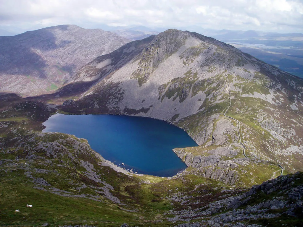
- commons: Y Llethr across Llyn Hywel from scree slope of Rhinog Fach - geograph.org.uk - 534766.jpg (CC BY-SA 4.0)
Other places nearby
Loading nearby places…
Nearby
 📷 3
📷 3Mountains & hills · North Wales
Crib-Y-Rhiw
Crib-Y-Rhiw — Named summit at 681 m.
 📷 3
📷 3Mountains & hills · North Wales
Craig y Llyn Hywel
Craig y Llyn Hywel — a mountain in wales-north, United Kingdom, 558 m.
 📷 3
📷 3Natural landmarks · North Wales
Rhinog Fach
Rhinog Fach — mountain (712m) in Gwynedd.
 📷 3
📷 3Mountains & hills · North Wales
Rhinog Fach
Rhinog Fach — Named summit at 706 m.
 📷 5
📷 5Reservoirs & lochs · North Wales
Llyn Dulyn
Llyn Dulyn — lake in Gwynedd, Wales.
 📷 3
📷 3Quarries · North Wales
Cefn Cam quarry
Cefn Cam quarry — Slate quarry near Ganllwyd, Wales, United Kingdom.
More mountains in this region
 📷 5
📷 5Mountains & hills · North Wales
Cemlyn Bay and lagoon
Cemlyn Bay and lagoon — Site of Special Scientific Interest in Wales.
 📷 3
📷 3Mountains & hills · North Wales
Aberffraw Bay
Aberffraw Bay — bay on the west coast of Anglesey, in Wales, UK.
 📷 3
📷 3Mountains & hills · North Wales
Allt-fawr
Allt-fawr — Named summit at 698 m.
 📷 3
📷 3Mountains & hills · North Wales
Aran Benllyn
Aran Benllyn — Named summit at 884 m.
Frequently asked questions
- Where is Y Llethr?
- Y Llethr is in North Wales, in the United Kingdom — coordinates 52.8129°, -3.9877°. The nearest railway station is Llanbedr, around 8.2 km away.
- Is Y Llethr free to visit?
- Yes — admission to Y Llethr is free.