Natural landmarks · North East England
Rannerdale Knotts
Rannerdale Knotts — mountain in United Kingdom.

Wikimedia Commons contributors — see linked file page for photographer and licence licence
Plan your visit
- Typical visit
- 1 h–2 h
- Free entry
- Dog-friendly
About
Rannerdale Knotts is a named natural landmark in the United Kingdom. Wikidata describes it as: "mountain in United Kingdom". Coordinates: 54.5522°, -3.2894°.
Photo gallery
Protected designations
- Site of Special Scientific Interest: River Derwent and Tributaries SSSI
- Site of Special Scientific Interest: Buttermere Fells SSSI
Designations sourced from Natural England open data under OGL v3.
From the Wikipedia article
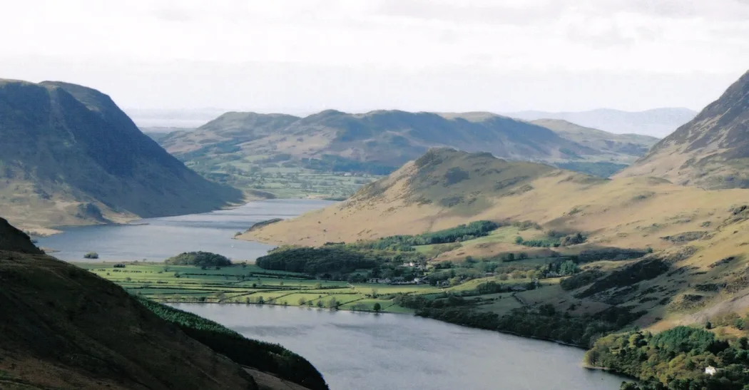
Rannerdale Knotts is a fell in the Lake District of Cumbria, England. Rising from the Buttermere valley, it is one of the smaller Cumbrian hills and is overlooked by a number of surrounding fells, such as Grasmoor, Whiteless Pike and, across Crummock Water, Mellbreak and the High Stile ridge. In modern legend Rannerdale Knotts is said to be the site of a battle between the native Cumbrians and Norsemen and the invading Normans in the late 11th or early 12th century.
Excerpt from Wikipedia under CC BY-SA 4.0. See the source article linked in Sources below.
- Coordinates
- 54.5522, -3.2894
- District
- Cumberland
- Parish
- Buttermere
- Postcode
- CA13 9FG
- Parliamentary constituency
- Penrith and Solway
Sources
- wikidata: Q7293388 (CC0)
- wikipedia: Rannerdale Knotts (CC BY-SA 4.0)
- commons: Rannerdale Knotts.jpg (CC BY-SA 4.0)
Other places nearby
Loading nearby places…
Nearby
 📷 3
📷 3Mountains & hills · North East England
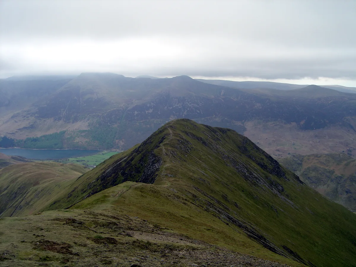
Rannerdale Knotts
Rannerdale Knotts — Named summit at 355 m.
 📷 4
📷 4Natural landmarks · North East England
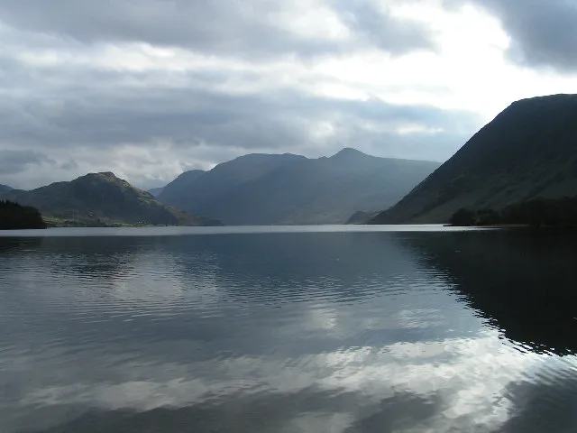
Crummock Water
Crummock Water — lake in the Lake District in Cumbria, North West England.
Campsites · North East England
Syke Farm Campsite
Syke Farm Campsite — a campsite in england north east.
 📷 3
📷 3Towns & cities · North East England
Buttermere
Buttermere — village and civil parish in Cumbria, England, UK.
 📷 3
📷 3Mountains & hills · North East England
Whiteless Pike
Whiteless Pike — Named summit at 660 m.
 📷 4
📷 4Caves · North West England
Scale Force
Scale Force is considered the highest waterfall in the English Lake District. Opinions vary about how its precise height is calculated, but the total height is normally stated as 170 feet (51.8m). It
More natural landmarks in this region
 Flagship📷 5
Natural landmarks · North East England
Brothers Water
Brothers Water — lake in Cumbria, England, UK.
 📷 5
📷 5Natural landmarks · North East England
Angle Tarn
Angle Tarn — lake near Patterdale, Cumbria, England, United Kingdom.
 📷 3
📷 3Natural landmarks · North East England
Angletarn Pikes
Angletarn Pikes — mountain in United Kingdom.
 📷 3
📷 3Natural landmarks · North East England
Ard Crags
Ard Crags — mountain in United Kingdom.
Frequently asked questions
- Where is Rannerdale Knotts?
- Rannerdale Knotts is in North-East England, United Kingdom (postcode CA13 9FG), in the parish of Buttermere.
- Is Rannerdale Knotts a protected site?
- Yes — Rannerdale Knotts is part of the River Derwent and Tributaries SSSI Site of Special Scientific Interest and the Buttermere Fells SSSI Site of Special Scientific Interest.
- Is Rannerdale Knotts free to visit?
- Yes, Rannerdale Knotts is free to enter.
- How do I get to Rannerdale Knotts?
- Drivers can navigate to postcode CA13 9FG. It sits within the Penrith and Solway parliamentary constituency.