Natural landmarks · North East England
Mellbreak
Mellbreak — mountain in United Kingdom.

Wikimedia Commons contributors — see linked file page for photographer and licence licence
Plan your visit
- Typical visit
- 1 h–2 h
- Free entry
- Dog-friendly
About
Mellbreak is a named natural landmark in the United Kingdom. Wikidata describes it as: "mountain in United Kingdom". Coordinates: 54.5554°, -3.3189°.
Photo gallery
Protected designations
- Site of Special Scientific Interest: River Derwent and Tributaries SSSI
Designations sourced from Natural England open data under OGL v3.
From the Wikipedia article
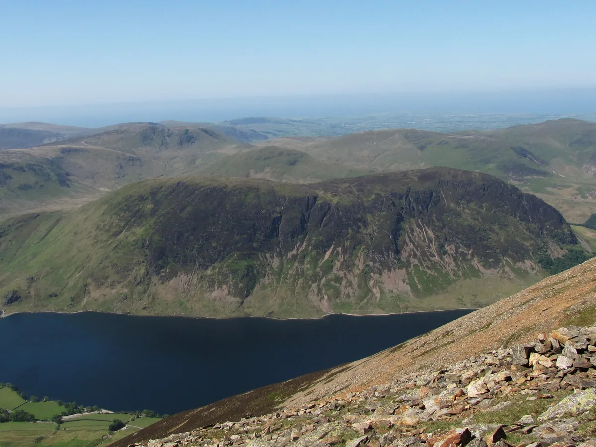
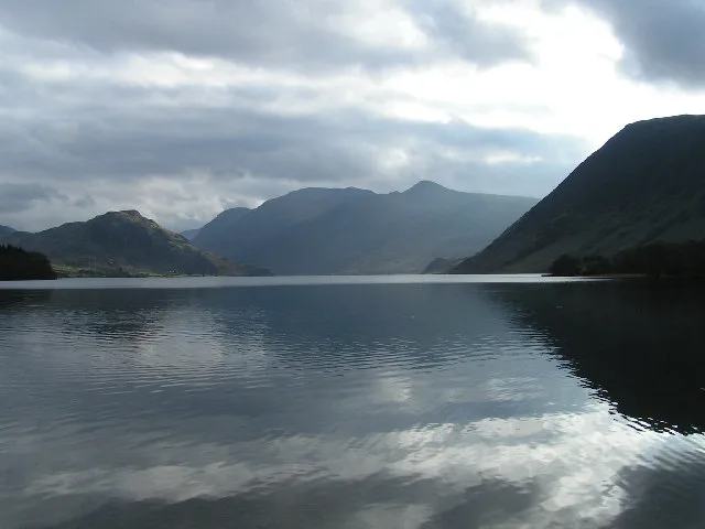
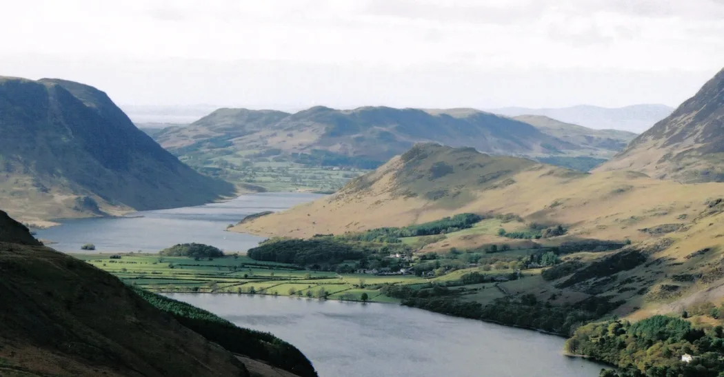
Mellbreak is a hill in the Western part of the English Lake District. Despite being surrounded on all sides by higher fells (the Loweswater Fells, the High Stile Ridge and the Grasmoor Group), it stands in isolation. It is surrounded on three sides by a "moat" of deep marshy land, and on the east side by the lake of Crummock Water. The fell forms a partnership with the lake, running parallel to it, falling sheer into it, and regularly providing the backdrop for pictures of it.
Excerpt from Wikipedia under CC BY-SA 4.0. See the source article linked in Sources below.
- Coordinates
- 54.5554, -3.3189
- Address
- Cumbria, England
Sources
- wikidata: Q6813053 (CC0)
- wikipedia: Mellbreak (CC BY-SA 4.0)
- commons: Mellbreak from Grasmoor summit.JPG (CC BY-SA 4.0)
Other places nearby
Loading nearby places…
Nearby
 📷 3
📷 3Mountains & hills · North East England
Mellbreak
Mellbreak — Named summit at 511.1 m.
 📷 4
📷 4Natural landmarks · North East England
Crummock Water
Crummock Water — lake in the Lake District in Cumbria, North West England.
 📷 4
📷 4Caves · North West England
Scale Force
Scale Force is considered the highest waterfall in the English Lake District. Opinions vary about how its precise height is calculated, but the total height is normally stated as 170 feet (51.8m). It
 📷 3
📷 3Mountains & hills · North East England
Hen Comb
Hen Comb — Named summit at 506.2 m.
 📷 3
📷 3Natural landmarks · North East England
Rannerdale Knotts
Rannerdale Knotts — mountain in United Kingdom.
 📷 3
📷 3Mountains & hills · North East England
Rannerdale Knotts
Rannerdale Knotts — Named summit at 355 m.
More natural landmarks in this region
 Flagship📷 5
Natural landmarks · North East England
Brothers Water
Brothers Water — lake in Cumbria, England, UK.
 📷 5
📷 5Natural landmarks · North East England
Angle Tarn
Angle Tarn — lake near Patterdale, Cumbria, England, United Kingdom.
 📷 3
📷 3Natural landmarks · North East England
Angletarn Pikes
Angletarn Pikes — mountain in United Kingdom.
 📷 3
📷 3Natural landmarks · North East England
Ard Crags
Ard Crags — mountain in United Kingdom.
Frequently asked questions
- Where is Mellbreak?
- Mellbreak is in North-East England, United Kingdom.
- Is Mellbreak a protected site?
- Yes — Mellbreak is part of the River Derwent and Tributaries SSSI Site of Special Scientific Interest.
- Is Mellbreak free to visit?
- Yes, Mellbreak is free to enter.