Mountains & hills · North East England
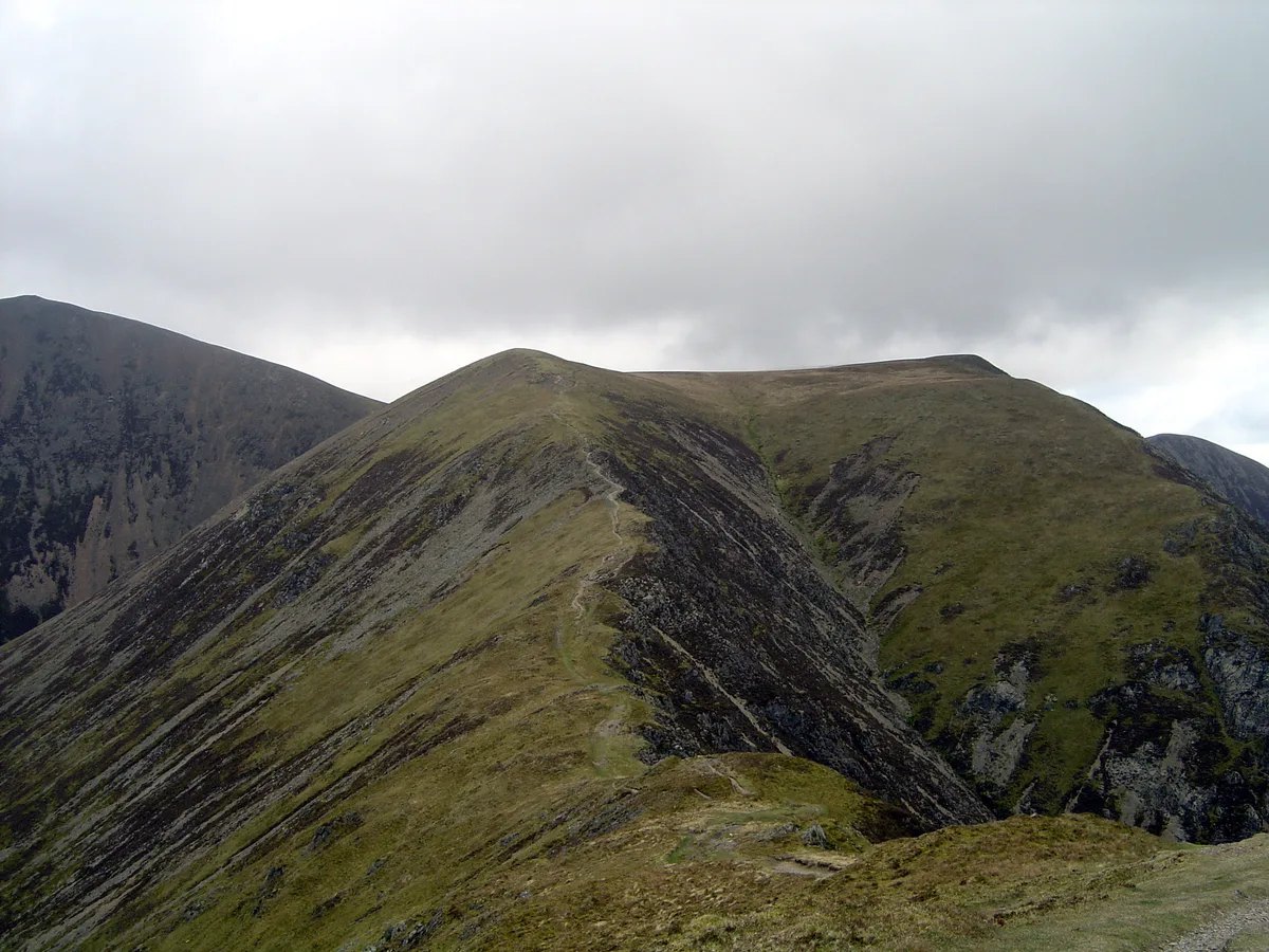
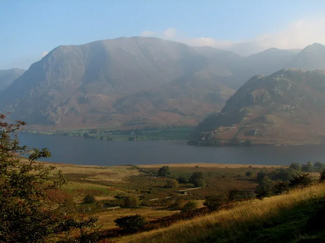
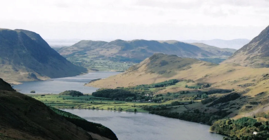
Whiteless Pike
Whiteless Pike — Named summit at 660 m.

Wikimedia Commons contributors — see linked file page for photographer and licence licence
Plan your visit
- Typical visit
- 3 h–8 h
- Best time of year
- Late spring – early autumn (May–Oct)
- Free entry
- Dog-friendly
About
Whiteless Pike is a named summit in the United Kingdom. Wikidata describes it as: "Named summit at 660 m.". Coordinates: 54.5594°, -3.2693°.
Photo gallery
Protected designations
- Site of Special Scientific Interest: River Derwent and Tributaries SSSI
- Site of Special Scientific Interest: Buttermere Fells SSSI
Designations sourced from Natural England open data under OGL v3.
From the Wikipedia article
Whiteless Pike, 660 metres (2,170 ft) high, is a fell in the north-western English Lake District. It stands immediately east of Crummock Water and forms a pyramid shape when viewed from Rannerdale. In his celebrated guide to the Lakeland fells, A Wainwright called it "the Weisshorn of Buttermere". There are good views of Great Gable and the Scafells from the summit.
Excerpt from Wikipedia under CC BY-SA 4.0. See the source article linked in Sources below.
- Coordinates
- 54.5594, -3.2693
- District
- Cumberland
- Parish
- Buttermere
- Postcode
- CA13 9FG
- Parliamentary constituency
- Penrith and Solway
Sources
- osm: n29953933 (ODbL)
- wikipedia: Whiteless Pike (CC BY-SA 4.0)
- commons: Whiteless Pike.jpg (CC BY-SA 4.0)
Other places nearby
Loading nearby places…
Nearby
 📷 3
📷 3Natural landmarks · North East England
Wandope
Wandope — mountain in United Kingdom.
 📷 3
📷 3Mountains & hills · North East England
Wandope
Wandope — Named summit at 773.9 m.
 📷 3
📷 3Natural landmarks · North East England
Grasmoor
Grasmoor is a natural landmark in the United Kingdom.
 📷 3
📷 3Mountains & hills · North East England
Grasmoor
Grasmoor — Named summit at 851.6 m.
 📷 3
📷 3Mountains & hills · North East England
Rannerdale Knotts
Rannerdale Knotts — Named summit at 355 m.
 📷 3
📷 3Natural landmarks · North East England
Rannerdale Knotts
Rannerdale Knotts — mountain in United Kingdom.
More mountains in this region
 📷 3
📷 3Mountains & hills · North East England
Angletarn Pikes
Angletarn Pikes — Named summit at 566 m.
 📷 3
📷 3Mountains & hills · North East England
Angletarn Pikes South Top
Angletarn Pikes South Top — Named summit at 563.6 m.
 📷 3
📷 3Mountains & hills · North East England
Ard Crags
Ard Crags — Named summit at 581 m.
 📷 3
📷 3Mountains & hills · North East England
Arnison Crag
Arnison Crag — Named summit at 433 m.
Frequently asked questions
- Where is Whiteless Pike?
- Whiteless Pike is in North-East England, United Kingdom (postcode CA13 9FG), in the parish of Buttermere.
- Is Whiteless Pike a protected site?
- Yes — Whiteless Pike is part of the River Derwent and Tributaries SSSI Site of Special Scientific Interest and the Buttermere Fells SSSI Site of Special Scientific Interest.
- Is Whiteless Pike free to visit?
- Yes, Whiteless Pike is free to enter.
- How do I get to Whiteless Pike?
- Drivers can navigate to postcode CA13 9FG. It sits within the Penrith and Solway parliamentary constituency.