Towns & cities · South Wales
Raglan
Raglan — village in Monmouthshire, Wales.

Wikimedia Commons contributors — see linked file page for photographer and licence licence
Plan your visit
- Typical visit
- 3 h–6 h
- Free entry
- Family-friendly
- Dog-friendly
About
Raglan is a town, city, village or settlement in the United Kingdom. Recent population estimates put it at around 1,706 people. Address: NP15. Wikidata describes it as: "village in Monmouthshire, Wales". Coordinates: 51.7649°, -2.8500°.
Photo gallery
Protected designations
- Site of Special Scientific Interest: River Wye SSSI
Designations sourced from Natural England open data under OGL v3.
From the Wikipedia article
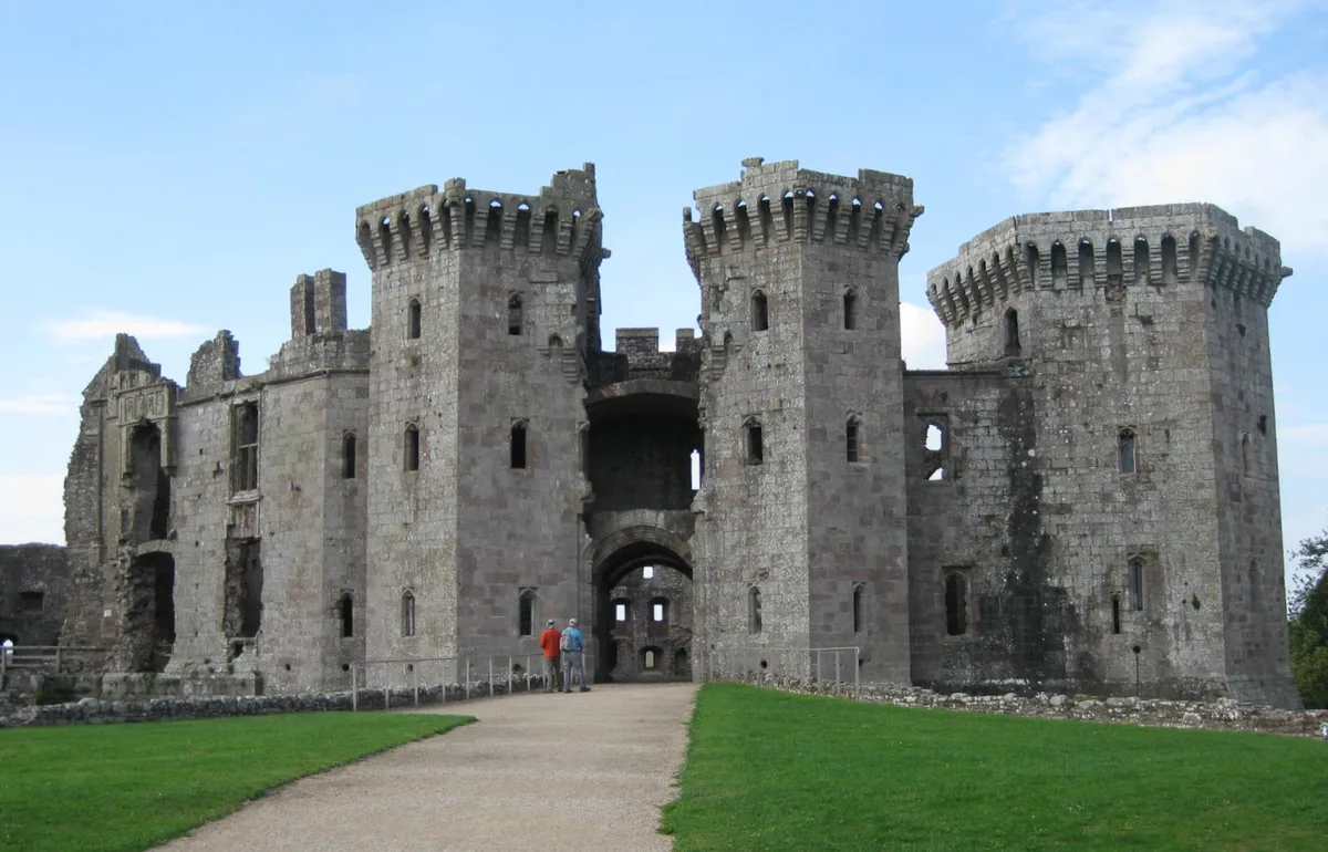
Raglan (; Welsh: Rhaglan) is a village and community in Monmouthshire, south-east Wales. It is located some 9 miles south-west of Monmouth, midway between Monmouth and Abergavenny on the A40 road very near to the junction with the A449 road. It is the location of Raglan Castle, built for William ap Thomas and now maintained by Cadw. The community includes the villages of Llandenny and Pen-y-clawdd. Raglan itself has a population of 1,183.
Excerpt from Wikipedia under CC BY-SA 4.0. See the source article linked in Sources below.
Background
History
The village stands at the crossing point of two Roman roads, that from Gloucester to Usk, and that from Chepstow to Abergavenny. Raglan was first mentioned in the will of Walter de Clare. The earliest market in Raglan was recorded in 1354. The market cross stands in the edge of the crossroads between the church and the Beaufort Arms Inn. It now consists only of the base, with a lamp post mounted on top. In the large space around this stone the markets were held, the base of the cross forming the table on which bargains were struck. The agricultural roots of Raglan are illustrated by a 1397 account of discussions between the reeve Ieuan Hire and Ieuan ap Grono and haywards (hedge wardens)…
Sourced from Wikipedia under CC BY-SA 4.0.
- Coordinates
- 51.7649, -2.8500
- District
- Monmouthshire
- Parish
- Raglan
- Postcode
- NP15
- Parliamentary constituency
- Monmouthshire
- Population
- 1,706
- Official site
- neighbourhood.statistics.gov.uk
Sources
- wikidata: Q744944 (CC0)
- wikipedia: Raglan, Monmouthshire (CC BY-SA 4.0)
- commons: SDJ Raglan Castle Front.jpg (CC BY-SA 4.0)
Other places nearby
Loading nearby places…
Nearby
 📷 3
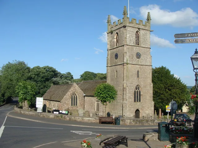
📷 3Historic churches · South Wales
St Cadoc's Church
St Cadoc's Church — church in Raglan, Monmouthshire, Wales.
Hotels · South Wales
The Beaufort
The Beaufort — a hotel in wales south.
 📷 5
📷 5Castles · South Wales
Raglan Castle
Raglan Castle — late medieval castle in Monmouthshire, Wales.
 📷 3
📷 3Parks · South Wales
Raglan Farm Park
Raglan Farm Park — a other in wales-south, United Kingdom.
 📷 2
📷 2Historic houses · South Wales
Pwll
Pwll — house in Tregare, Monmouthshire, Wales.
 📷 4
📷 4Gardens · South Wales
The Artha
The Artha — a garden in wales-south, United Kingdom.
More towns in this region
 📷 4
📷 4Towns & cities · South Wales
Argoed
Argoed — village and community in Caerphilly County Borough, Wales.
 Flagship📷 3
Towns & cities · South Wales
Betws
Betws — village and community in Carmarthenshire, Wales.
 Flagship📷 5
Towns & cities · South Wales
Caerleon
Caerleon — village and community in Newport, Wales, UK.
 Flagship📷 3
Towns & cities · South Wales
Camrose
Camrose — village and community in Pembrokeshire, Wales, UK.
Frequently asked questions
- Where is Raglan?
- Raglan is in South Wales, United Kingdom (postcode NP15), in the parish of Raglan.
- Is Raglan a protected site?
- Yes — Raglan is part of the River Wye SSSI Site of Special Scientific Interest.
- Is Raglan free to visit?
- Yes, Raglan is free to enter.
- How do I get to Raglan?
- Drivers can navigate to postcode NP15. It sits within the Monmouthshire parliamentary constituency.