Islands · West Midlands
Osney
Osney — riverside community in the west of the city of Oxford, England.

Wikimedia Commons contributors — see linked file page for photographer and licence licence
Plan your visit
- Typical visit
- 4 h–12 h
- Nearest railway station
- Oxford · 0.3 km
- Free entry
- Dog-friendly
About
Osney is a island in the United Kingdom. Address: OX1. Wikidata describes it as: "riverside community in the west of the city of Oxford, England". Coordinates: 51.7520°, -1.2740°.
Photo gallery
From the Wikipedia article
Osney or Osney Island (; an earlier spelling of the name is Oseney) is a riverside community in the west of the city of Oxford, England. In modern times the name is applied to a community also known as Osney Town astride Botley Road, just west of the city's main railway station, on an island surrounded by the River Thames, Osney Ditch, and Osney Stream. Until the early 20th century the name was applied to the larger island of Oxford Castle and New Osney (between Castle Mill Stream and the main stream of the Thames) on which Osney Abbey and Osney Mill were established during the Middle Ages. The place plays a minor but significant role in The Miller's Tale in Chaucer's The Canterbury Tales.
Excerpt from Wikipedia under CC BY-SA 4.0. See the source article linked in Sources below.
Background
History
The name "Osney" is Old English, and means either "Osa's Island" or "island in the Ouse": Ouzen Ait is a base form and Ouse is an Old English word for a (large) river. Until the early twentieth century the name was applied to the island formed by two streams of the River Thames immediately west of the centre of Oxford, Castle Mill Stream and the stream which is now the main channel of the river. To the north the island is bounded by a short channel between the River Thames and the Castle Mill Stream, the Sheepwash Channel, which separates it from Fiddler's Island and Cripley. Osney Abbey was founded on the south part of the island in 1129, and Rewley Abbey was founded in the north of the…
Sourced from Wikipedia under CC BY-SA 4.0.
- Coordinates
- 51.7520, -1.2740
- County
- Oxfordshire
- District
- Oxford
- Parish
- Oxford, unparished area
- Postcode
- OX1
- Parliamentary constituency
- Oxford West and Abingdon
- Nearest railway station
- Oxford — 0.3 km
- Official site
- www.oxford.gov.uk
Sources
- wikidata: Q7107283 (CC0)
- wikipedia: Osney (CC BY-SA 4.0)
- commons: OsneyIsland.jpg (CC BY-SA 4.0)
Other places nearby
Loading nearby places…
Nearby
 📷 3
📷 3Historic bridges · West Midlands
Bridge At North End Of Street Forming The Junction With Botley Road
Bridge At North End Of Street Forming The Junction With Botley Road — Grade II listed building-listed bridge in england-west-midlands, United Kingdom.
 📷 5
📷 5Historic churches · West Midlands
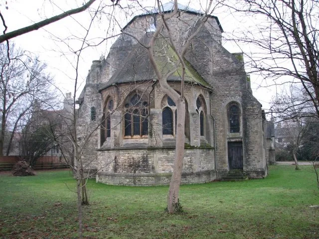
St Frideswide's Church
St Frideswide's Church — church in Oxford, UK.
 📷 4
📷 4Historic bridges · West Midlands
Seven Arches Bridge
Seven Arches Bridge — Grade II listed building-listed bridge in england-west-midlands, United Kingdom.
 📷 3
📷 3Historic bridges · West Midlands
Osney Bridge
Osney Bridge is a historic bridge in the United Kingdom.
Hotels · West Midlands
River Hotel
River Hotel — a hotel in england west midlands.
 📷 3
📷 3Country parks · West Midlands
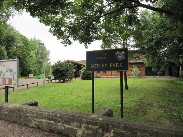
Botley Park
Botley Park — West Oxford public park.
More places in this region

Frequently asked questions
- Where is Osney?
- Osney is in Oxfordshire, the West Midlands, United Kingdom (postcode OX1), in the parish of Oxford, unparished area.
- Is Osney free to visit?
- Yes, Osney is free to enter.
- How do I get to Osney?
- The nearest railway station is Oxford, about 0.3 km away. Drivers can navigate to postcode OX1.