Reservoirs & lochs · North West England
Manchester Bolton & Bury Reservoir
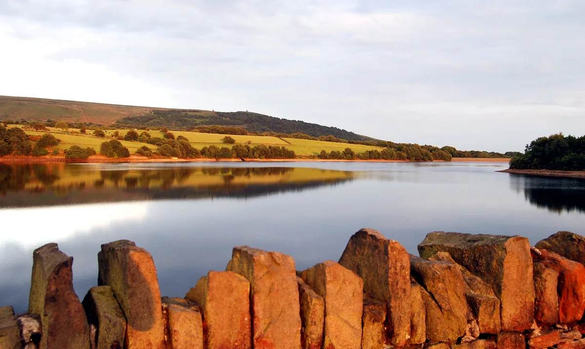
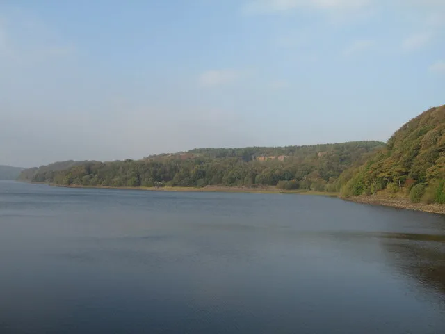
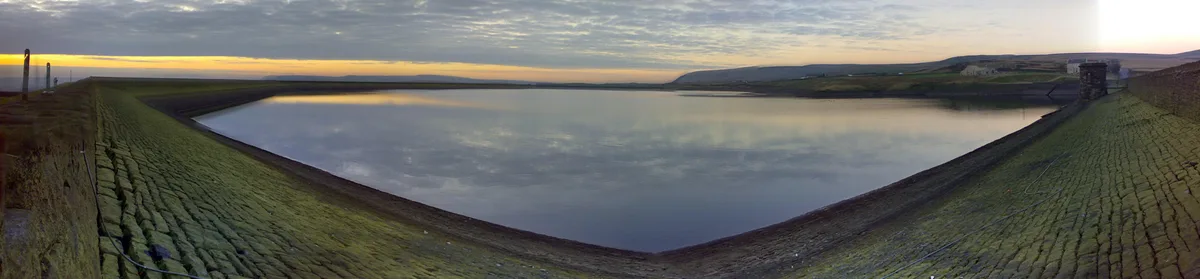
Manchester Bolton & Bury Reservoir — lake in the United Kingdom.

Wikimedia Commons contributors — see linked file page for photographer and licence licence
Plan your visit
- Typical visit
- 1 h–2.5 h
- Nearest railway station
- Bury, Bolton Street · 1.9 km
- Free entry
- Dog-friendly
About
Manchester Bolton & Bury Reservoir is a reservoir in the United Kingdom. Wikidata describes it as: "lake in the United Kingdom". Coordinates: 53.5800°, -2.3192°.
Photo gallery
From the Wikipedia article
Manchester, Bolton and Bury Canal Reservoir, commonly called Elton Reservoir, is located near the A58 Bolton Road in Greater Manchester, about 3 km (1.8 mi) south west of the town of Bury, Greater Manchester. Constructed between 1802 and 1808 at the height of the canal era, and later enlarged, it continues to supply water to the canal, and remains a legacy of the industrial era and a major leisure facility for residents of Bury, Bolton and North Manchester.
Excerpt from Wikipedia under CC BY-SA 4.0. See the source article linked in Sources below.
Background
History
It was originally conceived that Manchester, Bolton and Bury Canal would be supplied with water chiefly from the River Irwell at a point just above the Bury Bridge Weir. Mill owners would though have prior rights of supply, meaning water could be drawn into the canal only when the river ran above a certain level. The Manchester, Bolton and Bury Canal Act 1791 (31 Geo. 3. c. 68) was passed in May 1791 and construction of the canal began almost straight away. At the same time, the company began exploring opportunities to extend their navigation in a manner reminiscent of proposals made as early as 1766, to connect the ports of Hull and Liverpool and their river navigations, by way of an…
Description
The reservoir covers 226,000 sq m (56 acres) and contains some 1 million cubic metres (220 million imperial gallons). It is an important area for both resident and migrating water fowl, attracting many species throughout the year.
Sourced from Wikipedia under CC BY-SA 4.0.
- Coordinates
- 53.5800, -2.3192
- District
- Bury
- Parish
- Bury, unparished area
- Postcode
- M26 4FN
- Parliamentary constituency
- Bury South
- Nearest railway station
- Bury, Bolton Street — 1.9 km
Sources
- wikidata: Q7348674 (CC0)
- wikipedia: Manchester Bolton & Bury Reservoir (CC BY-SA 4.0)
- commons: Aerial view of Elton Reservoir.jpg (CC BY-SA 4.0)
Other places nearby
Loading nearby places…
Nearby
 📷 3
📷 3Beaches · North West England
Stone Beach
Stone Beach is a beach in the United Kingdom.
 📷 3
📷 3Memorials & monuments · North West England
RE6
RE6 — a memorial in england-north-west, United Kingdom.
 📷 3
📷 3Beaches · North West England
Creek Beach South
Creek Beach South is a beach in the United Kingdom.
📷 3Memorials & monuments · North West England
RW12
RW12 — a memorial in england-north-west, United Kingdom.
📷 3Beaches · North West England
Creek Beach North
Creek Beach North is a beach in the United Kingdom.
📷 3Memorials & monuments · North West England
RW13
RW13 — a memorial in england-north-west, United Kingdom.
More places in this region
 Flagship📷 5
Reservoirs & lochs · North West England
Yarrow Reservoir
Yarrow Reservoir — reservoir in Lancashire, England, UK.
.jpg?width=1200) 📷 3
📷 3Reservoirs & lochs · North West England
Abbey Village Reservoir
Abbey Village Reservoir — reservoir in Lancashire, England, UK.
 📷 3
📷 3Reservoirs & lochs · North West England
Anglezarke Reservoir
Anglezarke Reservoir — reservoir in Lancashire, England, UK.
 📷 3
📷 3Reservoirs & lochs · North West England
Ashworth Moor Reservoir
Ashworth Moor Reservoir — reservoir in Greater Manchester, England, UK.
Frequently asked questions
- Where is Manchester Bolton & Bury Reservoir?
- Manchester Bolton & Bury Reservoir is in North West England, in the United Kingdom — coordinates 53.5800°, -2.3192°. The nearest railway station is Bury, Bolton Street, around 1.9 km away.
- Is Manchester Bolton & Bury Reservoir free to visit?
- Yes — admission to Manchester Bolton & Bury Reservoir is free.