Hill forts · West Midlands
Knave Hill
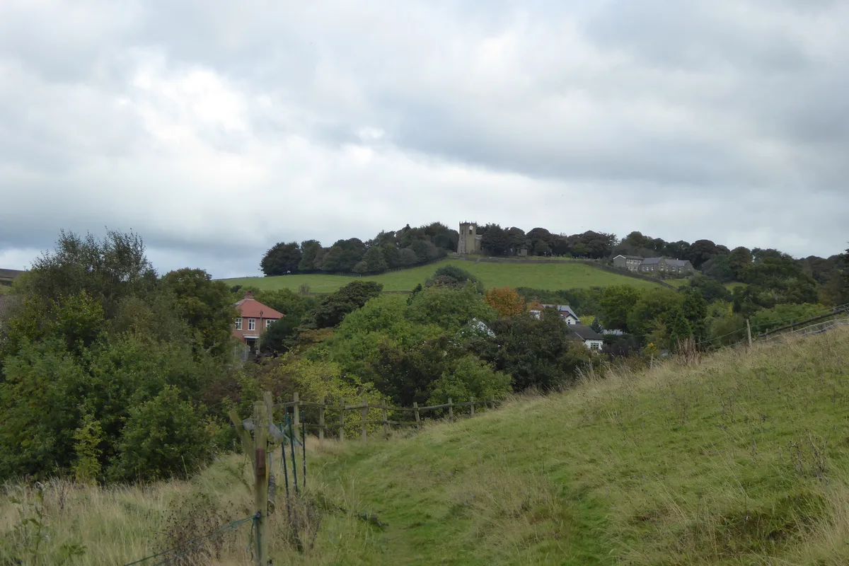
Knave Hill — English archeological site.

Mat Fascione — CC BY-SA 2.0 via Wikimedia Commons licence
Plan your visit
- Typical visit
- 1 h–2 h
- Nearest railway station
- Market Harborough · 5.9 km
- Free entry
- Dog-friendly
About
Knave Hill is a hill fort in the United Kingdom. Wikidata describes it as: "English archeological site". Coordinates: 52.5331°, -0.9073°.
Photo gallery
From the Wikipedia article
Knave Hill is an archaeological site near the village of Stonton Wyville, Leicestershire, in the English East Midlands. It was excavated by Channel 4's archaeological television programme Time Team, which found evidence of settlement dating back some 1400 years, including Iron Age, Roman and Anglo-Saxon periods. It appears that the site was abandoned as the population concentrated into villages, leaving the land free for cultivation.
Excerpt from Wikipedia under CC BY-SA 4.0. See the source article linked in Sources below.
- Coordinates
- 52.5331, -0.9073
- County
- Leicestershire
- District
- Harborough
- Parish
- Thorpe Langton
- Postcode
- LE16 7FU
- Parliamentary constituency
- Harborough, Oadby and Wigston
- Nearest railway station
- Market Harborough — 5.9 km
Sources
- wikidata: Q6421821 (CC0)
- wikipedia: Knave Hill (CC BY-SA 4.0)
Other places nearby
Loading nearby places…
Nearby
 📷 3
📷 3Memorials & monuments · West Midlands
Thorpe Langton War Memorial
Thorpe Langton War Memorial — Grade II listed building-listed memorial in england-west-midlands, United Kingdom.
Vineyards · West Midlands
Medieval village earthworks, fishponds and mill leat at Stonton Wyville
Medieval village earthworks, fishponds and mill leat at Stonton Wyville — a UK vineyard in england west midlands, producing English or Welsh wine from cool-climate grape varieties.
 📷 3
📷 3Memorials & monuments · West Midlands
Church Langton War Memorial
Church Langton War Memorial — Grade II listed building-listed memorial in england-west-midlands, United Kingdom.
 Flagship📷 3
Towns & cities · West Midlands
East Langton
East Langton — village in Leicestershire, England, UK.
 📷 3
📷 3Memorials & monuments · West Midlands
Tur Langton War Memorial
Tur Langton War Memorial — Grade II listed building-listed memorial in england-west-midlands, United Kingdom.
📷 3Theatres · East Midlands
Central Hall Cinema
Central Hall Cinema in England East Midlands, United Kingdom.
More places in this region
 Flagship📷 3
Hill forts · West Midlands
Mellor hill fort
Mellor hill fort — prehistoric site in North West England.
 📷 3
📷 3Hill forts · West Midlands
Ariconium
Ariconium — Ariconium was a road station of Roman Britain mentioned in Iter XIII of the Iter Britanniarum of the Antonine Itineraries. It was located at Bury Hill.
 📷 3
📷 3Hill forts · West Midlands
Ascot d'Oilly Castle
Ascot d'Oilly Castle — castle in Oxfordshire, England, UK.
 📷 3
📷 3Hill forts · West Midlands
Aves ditch
Aves ditch — archaeological site in Oxfordshire.
Frequently asked questions
- Where is Knave Hill?
- Knave Hill is in Leicestershire, the West Midlands, United Kingdom (postcode LE16 7FU), in the parish of Thorpe Langton.
- Is Knave Hill free to visit?
- Yes, Knave Hill is free to enter.
- How do I get to Knave Hill?
- The nearest railway station is Market Harborough, about 5.9 km away. Drivers can navigate to postcode LE16 7FU.