Caves · North West England
Jingling Pot
Jingling Pot is a cave in the United Kingdom.

Wikimedia Commons licence
Plan your visit
- Typical visit
- 45 min–1.5 h
- Nearest railway station
- Ribblehead · 6.7 km
- Free entry
- Dog-friendly
About
Jingling Pot is a named cave entrance in the United Kingdom. Coordinates: 54.2003°, -2.4628°. This entry is part of The Great Britain Guide, a free, ad-free, open-data tourist directory.
Photo gallery
Protected designations
- Site of Special Scientific Interest: Whernside SSSI
Designations sourced from Natural England open data under OGL v3.
From the Wikipedia article
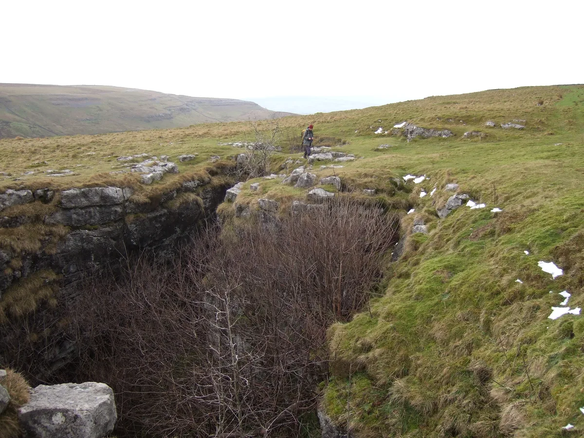
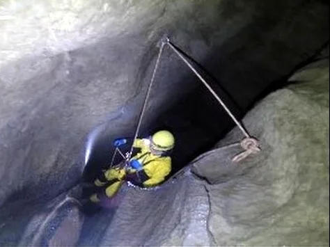
Jingling Pot is a limestone cave in West Kingsdale, North Yorkshire, England. Located adjacent to Jingling Beck, it is a lenticular-shaped 45-metre (148 ft) deep shaft that descends straight from the surface. At the bottom the rift extends to the north and descends steeply into a further chamber, at the end of which the initials of the original explorers may be seen scratched into the rock. A narrow shaft in this second chamber drops into a complex of small crawls and rifts, which approach close to a passage in the One-armed Bandit Series of Aquamole Pot. A second set of shafts descend parallel to the surface shaft. These can be entered through a rock window a little way below the entrance.
Excerpt from Wikipedia under CC BY-SA 4.0. See the source article linked in Sources below.
Background
History
The first reference to Jingling Pot was by John Covel (1638-1722) who wrote in a description of his travels that he was "particularly pleased with Gingling Cove and Reeking Cove near Ingleton, which outdoe Oakey Hole in Somersetshire, and all the wonders of the Peak". The next reference appeared in verse in Thomas Dixon's A Description of the Environs of Ingleborough of 1781:<blockquote>"Near which are seen the clefts of GINGLING-COVE<br />The form and depth the curious ne'er could prove;<br />The falling stones from rock to rock rebound,<br />The dark abyss returns a tinkling sound." </blockquote> A more prosaic description was provided by John Hutton in 1784 in an Appendix to Thomas…
Sourced from Wikipedia under CC BY-SA 4.0.
- Coordinates
- 54.2003, -2.4628
- District
- North Yorkshire
- Parish
- Thornton in Lonsdale
- Postcode
- LA6 3PH
- Parliamentary constituency
- Skipton and Ripon
- Nearest railway station
- Ribblehead — 6.7 km
Sources
- osm: n2950450978 (ODbL)
- wikipedia: Jingling Pot (CC BY-SA 4.0)
Other places nearby
Loading nearby places…
Nearby
 📷 3
📷 3Caves · North West England
Aquamole Pot
Aquamole Pot is a cave in the United Kingdom.
 📷 3
📷 3Caves · North West England
Rowten Pot
Rowten Pot is a cave in the United Kingdom.
 📷 3
📷 3Mountains & hills · North West England
Rowten Pot
Rowten Pot — cave in the parish of Thorton-in-Craven, North Yorkshire, UK.
 📷 3
📷 3Caves · North West England
Rowten Cave
Rowten Cave is a cave in the United Kingdom.
 📷 3
📷 3Caves · North West England
Simpson Pot
Simpson Pot is a cave in the United Kingdom.
 📷 3
📷 3Mountains & hills · North West England
Simpson Pot
Simpson Pot — cave in North Yorkshire, England.
More caves in this region
 📷 3
📷 3Caves · North West England
Alum Pot
Alum Pot is a cave in the United Kingdom.
 📷 3
📷 3Caves · North West England
Antler Hole
Antler Hole is a cave in the United Kingdom.
📷 3Caves · North West England
Aquamole Pot
Aquamole Pot is a cave in the United Kingdom.
 📷 3
📷 3Caves · North West England
Austwick Beck Head
Austwick Beck Head is a cave in the United Kingdom.
Frequently asked questions
- Where is Jingling Pot?
- Jingling Pot is in North-West England, United Kingdom (postcode LA6 3PH), in the parish of Thornton in Lonsdale.
- Is Jingling Pot a protected site?
- Yes — Jingling Pot is part of the Whernside SSSI Site of Special Scientific Interest.
- Is Jingling Pot free to visit?
- Yes, Jingling Pot is free to enter.
- How do I get to Jingling Pot?
- The nearest railway station is Ribblehead, about 6.7 km away. Drivers can navigate to postcode LA6 3PH.