Caves · North West England
Aquamole Pot
Aquamole Pot is a cave in the United Kingdom.

Wikimedia Commons licence
Plan your visit
- Typical visit
- 45 min–1.5 h
- Nearest railway station
- Ribblehead · 6.6 km
- Free entry
- Dog-friendly
About
Aquamole Pot is a named cave entrance in the United Kingdom. Coordinates: 54.1999°, -2.4625°. This entry is part of The Great Britain Guide, a free, ad-free, open-data tourist directory.
Photo gallery
Protected designations
- Site of Special Scientific Interest: Whernside SSSI
Designations sourced from Natural England open data under OGL v3.
From the Wikipedia article
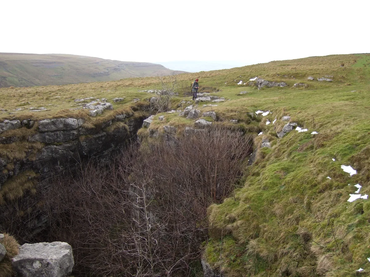
Aquamole Pot is a limestone cave in West Kingsdale, North Yorkshire, England. It was originally discovered by cave divers who negotiated 168 metres (551 ft) of sump passage from Rowten Pot in 1974, to enter a high aven above the river passage. All subsequent major explorations were undertaken from below before an entrance was opened up from the surface. It is part of a 27-kilometre (17 mi) long cave system that drains both flanks of Kingsdale.
Excerpt from Wikipedia under CC BY-SA 4.0. See the source article linked in Sources below.
Background
History
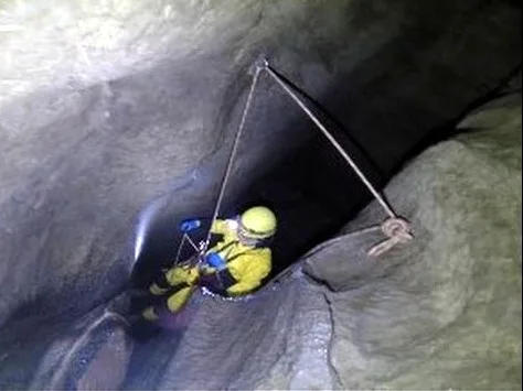
The bottom of the cave, Aquamole Aven was discovered by Geoff Yeadon and 'Bear' Statham in 1974 after diving the upstream sump at the bottom of Rowten Pot. They started to bolt up the aven which now leads into the One-armed Bandit Series, but retired after reaching a height of 9 m. A team returned in 1980, and they used bolting equipment to complete the climb. They then climbed up the rift at the top to reach the bottom of the 24 m aven. Scaling poles were taken through the sumps by a large team, and its ascent was completed in two trips. The passage towards Jingling Pot was explored, and a series of avens climbed which reached near the surface. The upstream junction in the One-armed Bandit…
Description
The entrance is a 60 m deep shaft, some 40 m from Jingling Pot, the top section of which is lined with breeze-blocks. Below this a short drop enters a small stream passage which leads after some 50 m to a 10 m pitch. This enters a chamber, and a crawl continues which soon descends into a continuation of the stream passage. After a few metres (feet) this opens out at the head of Aquamole Aven - a 40 m deep shaft that passes a large ledge 5 m down. At the base of the shaft, downstream quickly leads to a large sump pool, and upstream terminates where a small stream descends from an aven. From the downstream sump a 168 m dive leads into Frake's Passage in Rowten Pot. The upstream sump has been…
Sourced from Wikipedia under CC BY-SA 4.0.
- Coordinates
- 54.1999, -2.4625
- District
- North Yorkshire
- Parish
- Thornton in Lonsdale
- Postcode
- LA6 3PH
- Parliamentary constituency
- Skipton and Ripon
- Nearest railway station
- Ribblehead — 6.6 km
Sources
- osm: n2952604794 (ODbL)
- wikipedia: Aquamole Pot (CC BY-SA 4.0)
Other places nearby
Loading nearby places…
Nearby
 📷 3
📷 3Caves · North West England
Jingling Pot
Jingling Pot is a cave in the United Kingdom.
 📷 3
📷 3Caves · North West England
Rowten Pot
Rowten Pot is a cave in the United Kingdom.
 📷 3
📷 3Mountains & hills · North West England
Rowten Pot
Rowten Pot — cave in the parish of Thorton-in-Craven, North Yorkshire, UK.
 📷 3
📷 3Caves · North West England
Rowten Cave
Rowten Cave is a cave in the United Kingdom.
 📷 3
📷 3Caves · North West England
Simpson Pot
Simpson Pot is a cave in the United Kingdom.
 📷 3
📷 3Mountains & hills · North West England
Simpson Pot
Simpson Pot — cave in North Yorkshire, England.
More caves in this region
 📷 3
📷 3Caves · North West England
Alum Pot
Alum Pot is a cave in the United Kingdom.
 📷 3
📷 3Caves · North West England
Antler Hole
Antler Hole is a cave in the United Kingdom.
 📷 3
📷 3Caves · North West England
Austwick Beck Head
Austwick Beck Head is a cave in the United Kingdom.
 📷 3
📷 3Caves · North West England
Bar Pot
Bar Pot is a cave in the United Kingdom.
Frequently asked questions
- Where is Aquamole Pot?
- Aquamole Pot is in North-West England, United Kingdom (postcode LA6 3PH), in the parish of Thornton in Lonsdale.
- Is Aquamole Pot a protected site?
- Yes — Aquamole Pot is part of the Whernside SSSI Site of Special Scientific Interest.
- Is Aquamole Pot free to visit?
- Yes, Aquamole Pot is free to enter.
- How do I get to Aquamole Pot?
- The nearest railway station is Ribblehead, about 6.6 km away. Drivers can navigate to postcode LA6 3PH.