Mountains & hills · North West England
Simpson Pot
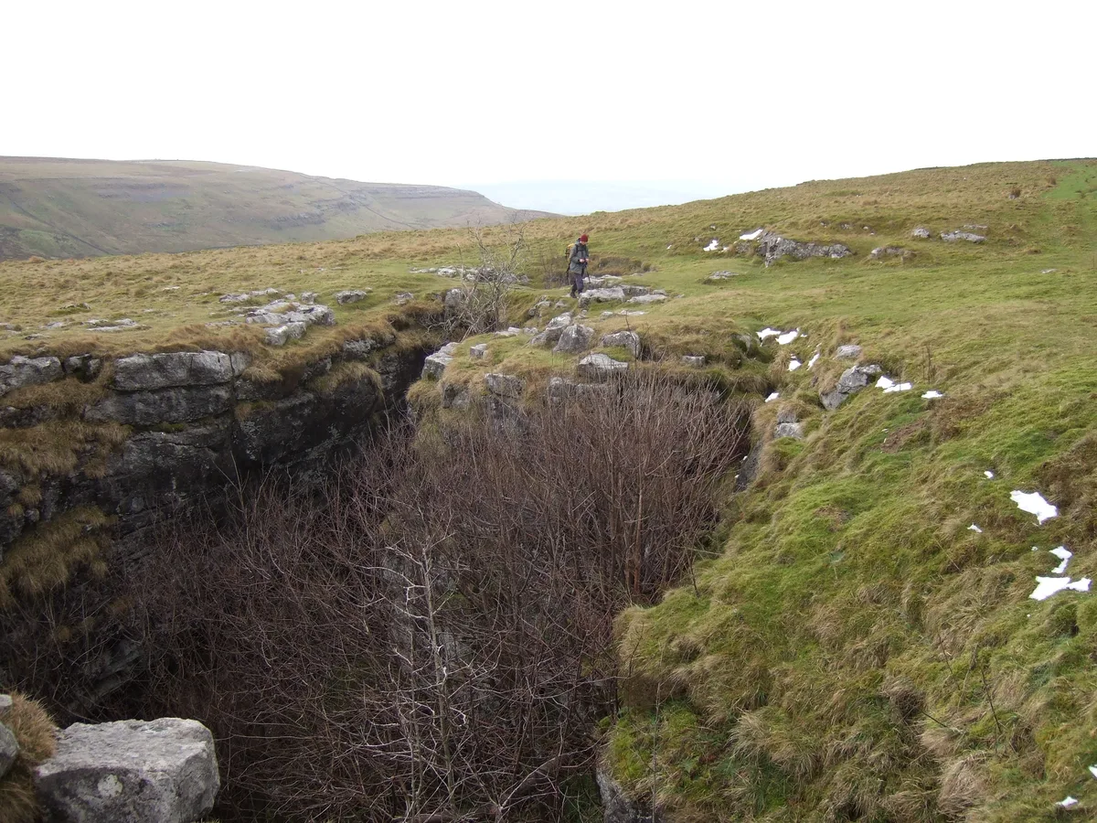
Simpson Pot — cave in North Yorkshire, England.

Wikimedia Commons contributors — see linked file page for photographer and licence licence
Plan your visit
- Typical visit
- 3 h–8 h
- Best time of year
- Late spring – early autumn (May–Oct)
- Nearest railway station
- Ribblehead · 7.0 km
- Free entry
- Dog-friendly
About
Simpson Pot is a named summit in the United Kingdom. Wikidata describes it as: "cave in North Yorkshire, England". Coordinates: 54.1956°, -2.4671°.
Photo gallery
Protected designations
- Site of Special Scientific Interest: Whernside SSSI
Designations sourced from Natural England open data under OGL v3.
From the Wikipedia article
Named after Eli Simpson, Simpson Pot is a limestone cave in West Kingsdale, North Yorkshire, England. It leads into Swinsto Cave and thence into Kingsdale Master Cave, and it is popular with cavers as it is possible to descend it by abseiling down the pitches, retrieving the rope each time, and exiting through Valley Entrance of Kingsdale Master Cave at the base of the hill. It is part of a 27-kilometre (17 mi) long cave system that drains both flanks of Kingsdale.
Excerpt from Wikipedia under CC BY-SA 4.0. See the source article linked in Sources below.
Background
History
The entrance to Simpson Pot was noted by Eli Simpson in about 1910, but it wasn't until 1940 that he showed it to a group from the British Speleological Association, including Bob Leakey. On the first trip Bob Leakey, having left his companion near the entrance, free-climbed Five Steps Pot and traversed across The Pit before being stopped by a 6 m pitch. The following day the cave was explored as far as the Blasted Hole where the passage appeared to sump. Leakey visited the site on a solo trip, and found a crack above water emitting a strong draught. A party returned and removed the surrounding flake of rock with explosives allowing access to the passage beyond. The connection with Swinsto…
Description
The entrance is in a shakehole, and enters a small active stream passage. This soon enlarges to walking size before plunging down a series of short drops called Five Step Pot. Below here the water drops down a 11 m deep hole called The Pit, but the voie normale traverses over the hole into a dry series. The passage drops down a couple of climbs and a further two short pitches before arriving at the 9 m deep Storm Pot, where the stream reappears in the roof. It is possible to follow the water through passages below The Pit. Below Storm Pot, it is necessary to negotiate a waist deep pool with limited airspace, known as The Blasted Hole. Beyond here the passage enlarges, and descends a further…
Sourced from Wikipedia under CC BY-SA 4.0.
- Coordinates
- 54.1956, -2.4671
- Address
- Kingsdale, North Yorkshire
- Nearest railway station
- Ribblehead — 7 km
Sources
- wikidata: Q7521132 (CC0)
- wikipedia: Simpson Pot (CC BY-SA 4.0)
- commons: Pitch in Simpson Pot.jpg (CC BY-SA 4.0)
Other places nearby
Loading nearby places…
Nearby
 📷 3
📷 3Caves · North West England
Simpson Pot
Simpson Pot is a cave in the United Kingdom.
 📷 3
📷 3Caves · North West England
Rowten Cave
Rowten Cave is a cave in the United Kingdom.
 📷 3
📷 3Mountains & hills · North West England
Rowten Pot
Rowten Pot — cave in the parish of Thorton-in-Craven, North Yorkshire, UK.
 📷 3
📷 3Caves · North West England
Rowten Pot
Rowten Pot is a cave in the United Kingdom.
 📷 5
📷 5Caves · North West England
Turbary Pot
Turbary Pot — a cave broad in england-north-west, United Kingdom.
 📷 3
📷 3Caves · North West England
Swinsto Hole
Swinsto Hole is a cave in the United Kingdom.
More mountains in this region
 📷 3
📷 3Mountains & hills · North West England
Allen Crags
Allen Crags — Named summit at 785 m.
 📷 3
📷 3Mountains & hills · North West England
Alum Pot
Alum Pot — Open shaft pothole in North Yorkshire.
 📷 3
📷 3Mountains & hills · North West England
Arnside Knott
Arnside Knott — Named summit at 159 m.
 📷 3
📷 3Mountains & hills · North West England
Aye Gill Pike
Aye Gill Pike — Named summit at 556.3 m.
Frequently asked questions
- Where is Simpson Pot?
- Simpson Pot is in North-West England, United Kingdom.
- Is Simpson Pot a protected site?
- Yes — Simpson Pot is part of the Whernside SSSI Site of Special Scientific Interest.
- Is Simpson Pot free to visit?
- Yes, Simpson Pot is free to enter.
- How do I get to Simpson Pot?
- The nearest railway station is Ribblehead, about 7.0 km away.