Towns & cities · South East England
Hangleton
Hangleton — suburban erea of Brighton and Hove, England.

Wikimedia Commons contributors — see linked file page for photographer and licence licence
Plan your visit
- Typical visit
- 3 h–6 h
- Nearest railway station
- Portslade · 1.6 km
- Free entry
- Family-friendly
- Dog-friendly
About
Hangleton is a town, city, village or settlement in the United Kingdom. Recent population estimates put it at around 14,720 people. Address: BN3. Wikidata describes it as: "suburban erea of Brighton and Hove, England". Coordinates: 50.8500°, -0.2000°.
Photo gallery
From the Wikipedia article
Hangleton is a suburb of Brighton and Hove, in the ceremonial county of East Sussex, England. The area was developed in the 1930s after it was incorporated into the Borough of Hove, but has ancient origins: its parish church was founded in the 11th century and retains 12th-century fabric; the medieval manor house is Hove's oldest secular building. The village became depopulated in the medieval era and the church fell into ruins, and the population in the isolated hilltop parish only reached 100 in the early 20th century; but rapid 20th-century development resulted in more than 6,000 people living in Hangleton in 1951 and over 9,000 in 1961. By 2013, the population exceeded 14,000. The church and manor house (now a pub) are now surrounded by modern development. Following the parish's incorporation into the Borough of Hove in 1928, a mixture of council housing and lower-density private houses were built between the 1930s and the 1950s, along with facilities such as shopping parades, schools and more churches and pubs. Regular bus links were developed to other parts of Hove and Brighton, but a short-lived railway that ran through the area had closed by the time residential development got underway.
Excerpt from Wikipedia under CC BY-SA 4.0. See the source article linked in Sources below.
Background
History
The present Hangleton Lane is an ancient trackway used since prehistoric times. It was also used by the Romans as part of their route from London to their port at the River Adur in present-day Southwick. A small village gradually developed around a bend on this trackway, close to the church and original manor house. The rest of the parish—rectangular in size, longer from north to south and covering 1120 acre—was downland forming part of the South Downs; Round Hill, around which the track ran and which has traces of ancient field systems, rises to 445 ft. St Helen's Church was first documented in 1093 as a possession of Lewes Priory, to which it was granted by William de Warenne, 2nd Earl of…
Sourced from Wikipedia under CC BY-SA 4.0.
- Coordinates
- 50.8500, -0.2000
- District
- Brighton and Hove
- Parish
- Brighton and Hove, unparished area
- Postcode
- BN3
- Parliamentary constituency
- Hove and Portslade
- Population
- 14,720
- Nearest railway station
- Portslade — 1.6 km
Sources
- wikidata: Q738784 (CC0)
- wikipedia: Hangleton (CC BY-SA 4.0)
- commons: St Helen's Church, Hangleton 07.jpg (CC BY-SA 4.0)
Other places nearby
Loading nearby places…
Nearby
 📷 5
📷 5Historic churches · South East England
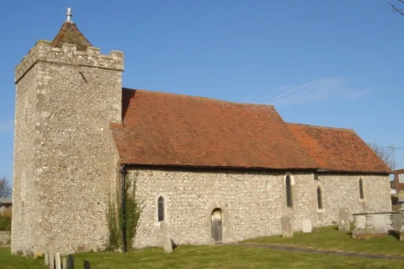
St Helen's Church, Hangleton
St Helen's Church, Hangleton — church in Brighton and Hove, East Sussex, England, UK.
 📷 5
📷 5Stately homes · South East England
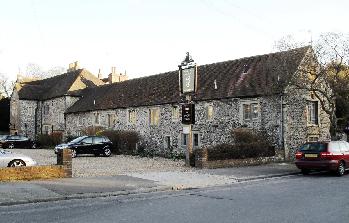
Hangleton Manor Inn
Hangleton Manor Inn — historic manor house in Hove, Sussex, England, UK.
.jpg?width=1200) 📷 5
📷 5Historic pubs · South East England
Hangleton Manor
Hangleton Manor — Historic pub — listed building or notable heritage status.
 📷 5
📷 5Historic churches · South East England
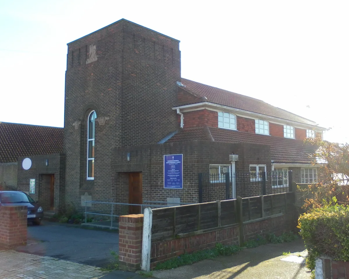
Hounsom Memorial Church
Hounsom Memorial Church — church in Brighton and Hove, United Kingdom.
 📷 5
📷 5Forests & woodlands · South East England
Benfield Hill Local Nature Reserve
Benfield Hill Local Nature Reserve is a forest or woodland in the United Kingdom.
 📷 5
📷 5Historic churches · South East England
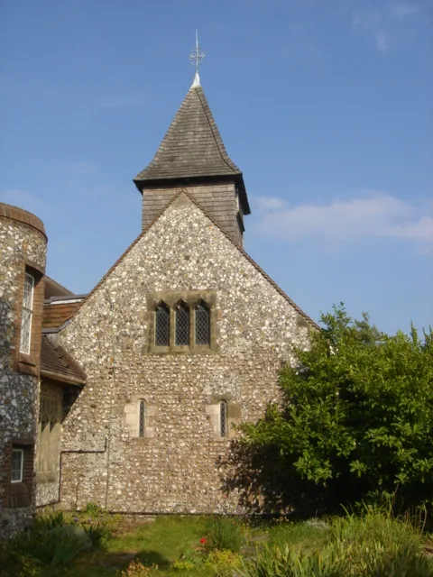
St Peter's Church, West Blatchington
St Peter's Church, West Blatchington — church in West Blatchington, East Sussex, England, UK.
More towns in this region
 Flagship📷 10
Towns & cities · South East England
Aldermaston
Aldermaston — village and civil parish in West Berkshire in England, UK.
 Flagship📷 10
Towns & cities · South East England
Aldingbourne
Aldingbourne — village and civil parish in Arun, West Sussex, UK.
 Flagship📷 10
Towns & cities · South East England
Aldington
Aldington — village and civil parish in the Ashford District of Kent, England.
 Flagship📷 10
Towns & cities · South East England
Aldworth
Aldworth — village and civil parish in the English county of Berkshire.
Frequently asked questions
- Where is Hangleton?
- Hangleton is in South-East England, United Kingdom (postcode BN3), in the parish of Brighton and Hove, unparished area.
- Is Hangleton free to visit?
- Yes, Hangleton is free to enter.
- How do I get to Hangleton?
- The nearest railway station is Portslade, about 1.6 km away. Drivers can navigate to postcode BN3.