Beaches · South East England
Portslade
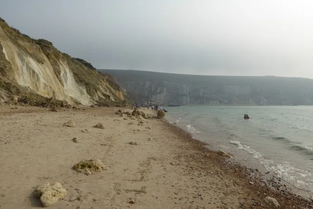
Portslade is a beach in the United Kingdom.

steve — CC BY-SA 2.0 via Wikimedia Commons licence
Plan your visit
- Typical visit
- 1 h–3 h
- Best time of year
- Summer (Jun–Aug)
- Nearest railway station
- Fishersgate · 0.7 km
- Free entry
- Family-friendly
- Dog-friendly
About
Portslade is a named beach on the United Kingdom coastline. Coordinates: 50.8281°, -0.2222°. This entry is part of The Great Britain Guide, a free, ad-free, open-data tourist directory.
Photo gallery
From the Wikipedia article
Portslade is a western suburb of the city of Brighton and Hove in the ceremonial county of East Sussex, England. Portslade Village, the original settlement a mile inland to the north, was built up in the 16th century. The arrival of the railway from Brighton in 1840 encouraged rapid development of the coastal area and in 1898 the southern part, formerly known as Copperas Gap, was granted urban district status and renamed Portslade-by-Sea, making it distinct from Portslade Village. After World War II the district of Mile Oak to the north was added. Today, Portslade is bisected from east to west by the old A27 road (now the A270) between Brighton and Worthing, each part having a distinct character.
Excerpt from Wikipedia under CC BY-SA 4.0. See the source article linked in Sources below.
Background
History
Portslade has been suggested as being the Roman port Novus Portus mentioned in Ptolemy's Geography of the 2nd century AD. Drove Road, in the original Portslade Village, has been linked with the Roman road (sometimes known as the "London to Portslade Way") that passes through Patcham valley to Haywards Heath and on to Streatham in London. The Old Shoreham Road is thought to form part of the Chichester (Noviomagus Reginorum) to Portslade Roman road. Roman remains and a Roman burial site were found in Roman Road. The name of the town had been thought to stem from the Roman placename Portus Adurni, but this is based on a misidentification of Shoreham-by-Sea as Portus Adurni by Michael Drayton…
Sourced from Wikipedia under CC BY-SA 4.0.
- Coordinates
- 50.8281, -0.2222
- County
- West Sussex
- District
- Adur
- Parish
- Adur, unparished area
- Postcode
- BN41 1AZ
- Parliamentary constituency
- East Worthing and Shoreham
- Nearest railway station
- Fishersgate — 0.7 km
- Official site
- www.naturistholiday.info
Sources
- osm: n1797360078 (ODbL)
- wikipedia: Portslade (CC BY-SA 4.0)
Other places nearby
Loading nearby places…
Nearby
 📷 5
📷 5Canals · South East England
Southwick Ship Canal
Southwick Ship Canal is a canal in the United Kingdom.
 📷 5
📷 5Bowling alleys · South East England
Adur Indoor Bowling Club
Adur Indoor Bowling Club — a bowling in england-south-east, United Kingdom.
 📷 5
📷 5Historic churches · South East England
Shri Swaminarayan Mandir, Brighton
Shri Swaminarayan Mandir, Brighton — a hindu temple in england-south-east, United Kingdom.
 📷 5
📷 5Theatres · South East England
Rothbury Cinema
Rothbury Cinema in England South East, United Kingdom.
 📷 5
📷 5Memorials & monuments · South East England
Adur Dry Dock
Adur Dry Dock — a memorial in england-south-east, United Kingdom.
📷 5Memorials & monuments · South East England
Prince George Lock
Prince George Lock — a memorial in england-south-east, United Kingdom.
More beaches in this region
 📷 5
📷 5Beaches · South East England
Abbot's Cliff Beach
Abbot's Cliff Beach is a beach in the United Kingdom.
 📷 5
📷 5Beaches · South East England
Allhallows Beach
Allhallows Beach is a beach in the United Kingdom.
 📷 5
📷 5Beaches · South East England
Alum Bay Beach
Alum Bay Beach — beach in the United Kingdom.
 📷 5
📷 5Beaches · South East England
Alum Bay Beach
Alum Bay Beach — Beach (pebblestone).
Frequently asked questions
- Where is Portslade?
- Portslade is in West Sussex, South-East England, United Kingdom (postcode BN41 1AZ), in the parish of Adur, unparished area.
- Is Portslade free to visit?
- Yes, Portslade is free to enter.
- How do I get to Portslade?
- The nearest railway station is Fishersgate, about 0.7 km away. Drivers can navigate to postcode BN41 1AZ.