Castles · West Midlands
Dukinfield
Dukinfield ( DUK-in-feeld; locally DUUK-in-fi-yuhld) is a town in Tameside, Greater Manchester, England, on the south bank of the River Tame opposite Ashton-under-Lyne, 6.3 miles (10.1 km) east of Ma

Gerald England — CC BY-SA 2.0 via Wikimedia Commons licence
Plan your visit
- Typical visit
- 1.5 h–3 h
- Family-friendly
- Limited wheelchair access
About
Dukinfield ( DUK-in-feeld; locally DUUK-in-fi-yuhld) is a town in Tameside, Greater Manchester, England, on the south bank of the River Tame opposite Ashton-under-Lyne, 6.3 miles (10.1 km) east of Manchester. At the 2021 census, the built up area as defined by the Office for National Statistics had a population of 21,155. It lies within the historic county boundaries of Cheshire, and became part of Greater Manchester in 1974. The town developed as a result of the Industrial Revolution when it became the site of coal mining and cotton manufacturing.
Photo gallery
From the Wikipedia article
Dukinfield ( DUK-in-feeld; locally DUUK-in-fi-yuhld) is a town in Tameside, Greater Manchester, England, on the south bank of the River Tame opposite Ashton-under-Lyne, 6.3 miles (10.1 km) east of Manchester. At the 2021 census, the built up area as defined by the Office for National Statistics had a population of 21,155. It lies within the historic county boundaries of Cheshire, and became part of Greater Manchester in 1974. The town developed as a result of the Industrial Revolution when it became the site of coal mining and cotton manufacturing.
Excerpt from Wikipedia under CC BY-SA 4.0. See the source article linked in Sources below.
Background
History
The earliest evidence of human activity around Dukinfield comes from a collection of four flints from the late Neolithic/early Bronze Age. The artifacts were discovered on the site of Dukinfield Hall and have been taken as evidence of a prehistoric settlement on the site. There is no further evidence of activity in the area until the Roman period. A 3rd century bronze Roman coin, from the reign of Emperor Tetricus I was discovered in the town. Dukinfield means "Raven of the Field" and derives from the Old English duce and feld. Early records show the township was included in the fee of Dunham Massey. It was held by Matthew de Bramhall in about 1190, and after that by a family who took the…
Sourced from Wikipedia under CC BY-SA 4.0.
- Coordinates
- 53.4739, -2.0828
- District
- Tameside
- Parish
- Tameside, unparished area
- Postcode
- SK16 4AX
- Parliamentary constituency
- Ashton-under-Lyne
Sources
- wikipedia: Dukinfield (CC BY-SA 4.0)
Other places nearby
Loading nearby places…
Nearby
 📷 3
📷 3Natural landmarks · West Midlands
Dukinfield Swimming Pool
Dukinfield Swimming Pool — a other in england-west-midlands, United Kingdom.
📷 3Theatres · North West England
Oxford Super Cinema
Oxford Super Cinema in England North West, United Kingdom.
 📷 3
📷 3Memorials & monuments · West Midlands
Dukinfield War Memorial
Dukinfield War Memorial — Grade II listed building-listed memorial in england-west-midlands, United Kingdom.
 📷 3
📷 3Chapels · West Midlands
Dukinfield Old Chapel
Dukinfield Old Chapel — chapel in Dukinfield, Greater Manchester, England, UK.
 📷 4
📷 4Historic churches · West Midlands
St John's Church, Dukinfield
St John's Church, Dukinfield — grade II listed church in Dukinfield, Tameside, Greater Manchester, England, UK.
 📷 3
📷 3Historic churches · West Midlands
Dukinfield Moravian Church
Dukinfield Moravian Church is a historic church in the United Kingdom.
More castles in this region
 📷 3
📷 3Castles · West Midlands
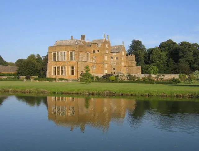
Broughton Castle
Broughton Castle — medieval manor house in Oxfordshire, England, UK.
 📷 3
📷 3Castles · West Midlands
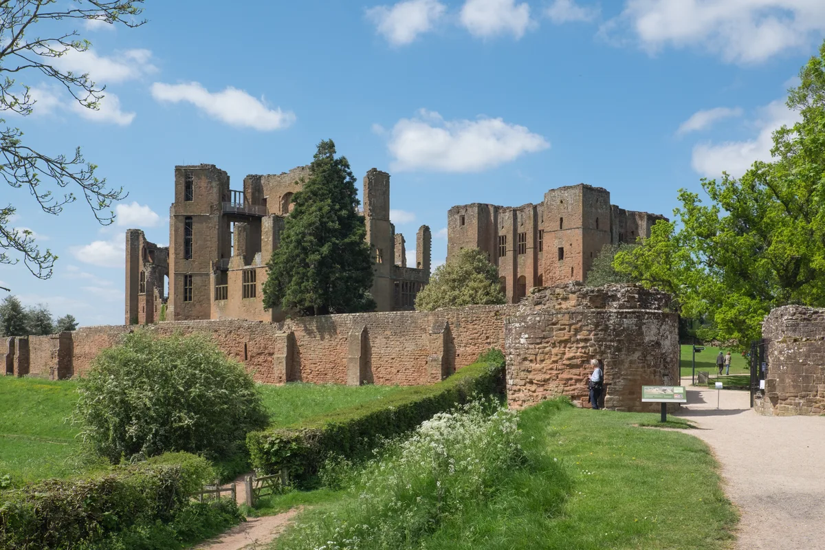
Kenilworth Castle
Kenilworth Castle — castle ruin in the town of Kenilworth, Warwickshire, England, UK.
 📷 3
📷 3Castles · West Midlands
Allesley Castle
Allesley Castle — motte-and-bailey castle in Coventry, West Midlands, England, UK.
 📷 3
📷 3Castles · West Midlands
Ardley Castle
Ardley Castle is a castle in the United Kingdom.
Frequently asked questions
- Where is Dukinfield?
- Dukinfield is in the West Midlands, United Kingdom (postcode SK16 4AX), in the parish of Tameside, unparished area.
- Does Dukinfield charge admission?
- Dukinfield typically charges admission. Check the official site for current ticket prices and opening hours.
- How do I get to Dukinfield?
- Drivers can navigate to postcode SK16 4AX. It sits within the Ashton-under-Lyne parliamentary constituency.