Museums · East Midlands
Dinnington, South Yorkshire
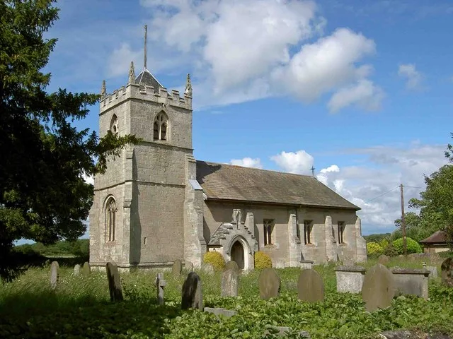
Dinnington is a town in the civil parish of Dinnington St John's, in the Metropolitan Borough of Rotherham, in South Yorkshire, England. It is near to the towns of Worksop and Rotherham and cities of

Steve F — CC BY-SA 2.0 via Wikimedia Commons licence
Plan your visit
- Typical visit
- 1.5 h–3 h
- Best time of year
- Year-round
- Family-friendly
- Limited wheelchair access
About
Dinnington is a town in the civil parish of Dinnington St John's, in the Metropolitan Borough of Rotherham, in South Yorkshire, England. It is near to the towns of Worksop and Rotherham and cities of Sheffield and Doncaster. Historically part of the West Riding of Yorkshire, Dinnington is the principal settlement in the civil parish of Dinnington St John's, which also includes the small satellite hamlets of Throapham and St John's. The Dinnington St John's parish is the most populous constituent of the St John's ward, which also includes the parishes of Laughton-en-le-Morthen, Firbeck, Letwell and Gildingwells. In 2001 this ward had a population of 11,476, with Dinnington St John's itself making up 9,161 of that figure. The population of the ward at the 2011 Census had increased to 12,517. Dinnington is about 330 feet (101 m) above sea level.
Photo gallery
From the Wikipedia article
Dinnington is a town in the civil parish of Dinnington St John's, in the Metropolitan Borough of Rotherham, in South Yorkshire, England. It is near to the towns of Worksop and Rotherham and cities of Sheffield and Doncaster. Historically part of the West Riding of Yorkshire, Dinnington is the principal settlement in the civil parish of Dinnington St John's, which also includes the small satellite hamlets of Throapham and St John's. The Dinnington St John's parish is the most populous constituent of the St John's ward, which also includes the parishes of Laughton-en-le-Morthen, Firbeck, Letwell and Gildingwells. In 2001 this ward had a population of 11,476, with Dinnington St John's itself making up 9,161 of that figure. The population of the ward at the 2011 Census had increased to 12,517. Dinnington is about 330 feet (101 m) above sea level.
Excerpt from Wikipedia under CC BY-SA 4.0. See the source article linked in Sources below.
Background
History
Excavations show Dinnington to have been inhabited since at least Neolithic times, and it has been suggested that the settlement takes its name from a local barrow, though a more traditional interpretation of "Dinnington" would be "Dunn's Farmstead", or "Town of Dunn's People". Dinnington was originally a small, isolated farming community, based around the New Road area of the town. Quarrying in the area helped expand the population, but it was the sinking of the Dinnington Main Colliery in 1905 that led to the real growth of the settlement. The census of 1911 shows a twenty-fold increase in population of the parish since 1901, from 250 to 5,000. In 1951 the parish had a population of…
Sourced from Wikipedia under CC BY-SA 4.0.
- Coordinates
- 53.3667, -1.2000
- District
- Rotherham
- Parish
- Dinnington St. John's
- Postcode
- S25 2SP
- Parliamentary constituency
- Rother Valley
- Official site
- web.archive.org
Sources
- wikipedia: Dinnington, South Yorkshire (CC BY-SA 4.0)
Other places nearby
Loading nearby places…
Nearby
 📷 3
📷 3Zoos & aquariums · East Midlands
Tropical Butterfly House
Tropical Butterfly House — a zoo aquarium in england-east-midlands, United Kingdom.
 📷 5
📷 5Other places · East Midlands
Laughton en le Morthen
Laughton en le Morthen — a other in england-east-midlands, United Kingdom.
 📷 4
📷 4Historic churches · East Midlands
St John's Church, Throapham
St John's Church, Throapham — a Grade I-listed church in england-east-midlands, United Kingdom.
 📷 3
📷 3Historic bridges · East Midlands
Anston Bridge
Anston Bridge — Grade II listed building-listed bridge in england-east-midlands, United Kingdom.
 📷 5
📷 5Caves · East Midlands
Dead Man's Cave, Anston
Dead Man's Cave, Anston — a cave broad in england-east-midlands, United Kingdom.
 📷 3
📷 3Historic churches · East Midlands
St Peter's Church, Letwell
St Peter's Church, Letwell — church in Letwell, Rotherham, South Yorkshire, England, UK.
More museums in this region
 📷 3
📷 3Museums · East Midlands
6 Former Filter Beds, Water Tank With Gazebo, And Steps At Swithland Reservoir Water Works
6 Former Filter Beds, Water Tank With Gazebo, And Steps At Swithland Reservoir Water Works — architectural ensemble in Quorndon, Charnwood, Leicestershire, England, UK.
 📷 3
📷 3Museums · East Midlands
Abbeydale Industrial Hamlet
Abbeydale Industrial Hamlet — hamlet and industrial museum in Sheffield, UK.
 📷 3
📷 3Museums · East Midlands
Alstonefield Geohut
Alstonefield Geohut — museum in Alstonefield, Staffordshire, England, UK.
 📷 3
📷 3Museums · East Midlands
Ashby de la Zouch Museum
Ashby de la Zouch Museum — local museum in Ashby de la Zouch, Leicestershire, United Kingdom.
Frequently asked questions
- Where is Dinnington, South Yorkshire?
- Dinnington, South Yorkshire is in East Midlands, in the United Kingdom — coordinates 53.3667°, -1.2000°.
- Is Dinnington, South Yorkshire wheelchair accessible?
- Partially — OpenStreetMap notes limited wheelchair access at Dinnington, South Yorkshire. Check ahead for specific facilities.