Hill forts · South East England
Bratton Castle
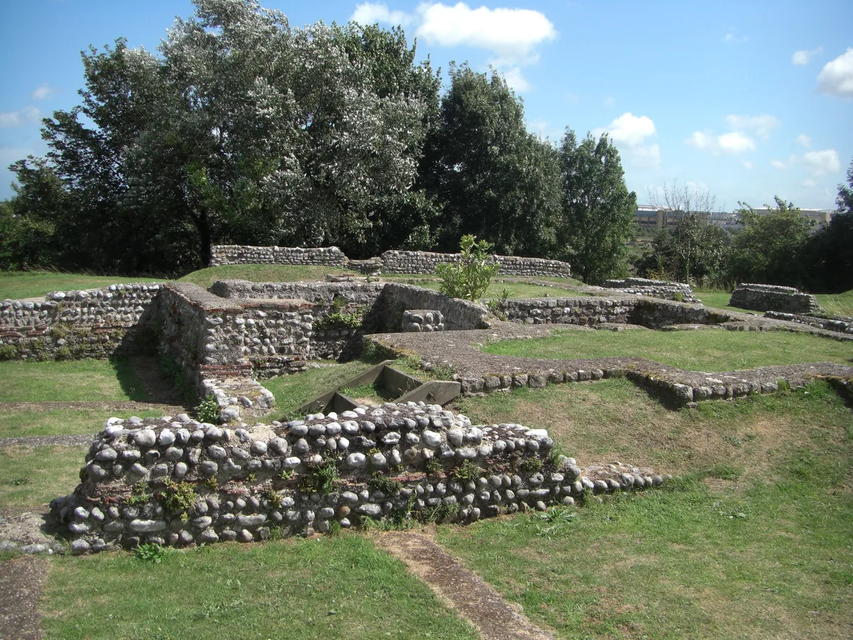
Bratton Castle — bivallate Iron Age hillfort on Bratton Down in Wiltshire, England.

Wikimedia Commons contributors — see linked file page for photographer and licence licence
Plan your visit
- Typical visit
- 1 h–2 h
- Nearest railway station
- Westbury · 4.0 km
- Free entry
- Family-friendly
- Dog-friendly
- Limited wheelchair access
About
Bratton Castle is a hill fort in the United Kingdom. Owned by English Heritage. Managed by English Heritage. Part of Bratton Camp Iron Age hillfort, the Westbury White Horse, barrows and trackways on Bratton Down. Wikidata describes it as: "bivallate Iron Age hillfort on Bratton Down in Wiltshire, England". Coordinates: 51.2638°, -2.1430°.
Photo gallery
Protected designations
- Site of Special Scientific Interest: Bratton Downs SSSI
- Site of Special Scientific Interest: River Avon System SSSI
- Site of Special Scientific Interest: Salisbury Plain SSSI
Designations sourced from Natural England open data under OGL v3.
From the Wikipedia article
Bratton Castle (also known as Bratton Camp) is a bivallate (two ramparts) Iron Age built hill fort on Bratton Down, at the western edge of the Salisbury Plain escarpment. The hill fort comprises two circuits of ditch and bank which together enclose a pentagonal area of 9.3 hectares (23 acres). The Westbury White Horse, a hill figure first documented in 1742, lies on the west side of the hill fort.
Excerpt from Wikipedia under CC BY-SA 4.0. See the source article linked in Sources below.
Background
History
Hill forts developed in the Late Bronze and Early Iron Age, roughly the start of the first millennium BC. The reason for their emergence in Britain, and their purpose, has been a subject of debate. It has been argued that they could have been military sites constructed in response to invasion from continental Europe, sites built by invaders, or a military reaction to social tensions caused by an increasing population and consequent pressure on agriculture. The dominant view since the 1960s has been that the increasing use of iron led to social changes in Britain. Deposits of iron ore were located in different places to the tin and copper ore necessary to make bronze, and as a result trading…
Description
The short west side and the long north side occupy the crest of steep escarpment slopes and the ditches are stepped one above the other, the rampart slopes rising 5 m and 6 m above the base of the ditches. The defences here span a total width of 30 m. The south side of the hill fort and the southern half of the east side cross Bratton Down and here the twin ramparts are of roughly equal height and 30 m in width. The northern half of the east side crosses the head of a re-entrant valley where the outer rampart and ditch have been largely destroyed by quarrying or landslips and the construction of a farm track. The short north east side straddles a narrow steep-sided ridge up which runs the…
Sourced from Wikipedia under CC BY-SA 4.0.
- Coordinates
- 51.2638, -2.1430
- District
- Wiltshire
- Parish
- Bratton
- Postcode
- BA13 4TA
- Parliamentary constituency
- South West Wiltshire
- Nearest railway station
- Westbury — 4 km
- Official site
- www.english-heritage.org.uk
Sources
- wikidata: Q4958135 (CC0)
- wikipedia: Bratton Castle (CC BY-SA 4.0)
- commons: Bratton Camp earthworks - geograph.org.uk - 367813.jpg (CC BY-SA 4.0)
Other places nearby
Loading nearby places…
Nearby
 📷 4
📷 4Other places · South West England
Westbury White Horse
The Westbury White Horse or Bratton White Horse is a hill figure on the escarpment of Salisbury Plain, approximately 1.5 miles (2.4 km) east of Westbury in Wiltshire. It is the oldest of eight white h
 📷 5
📷 5Viewpoints · South East England
White Horse
White Horse is a viewpoint in the United Kingdom.
 📷 5
📷 5Memorials & monuments · South East England
Ballard And Aldridge Monuments In The Churchyard About 4 Metres South Of Transept Of Church Of St James
Ballard And Aldridge Monuments In The Churchyard About 4 Metres South Of Transept Of Church Of St James — Grade II listed building-listed memorial in england-south-east, United Kingdom.
 📷 5
📷 5Memorials & monuments · South East England
Four Monuments In The Churchyard Between 4 And 12 Metres South East Of Church Of St James
Four Monuments In The Churchyard Between 4 And 12 Metres South East Of Church Of St James — Grade II listed building-listed memorial in england-south-east, United Kingdom.
 📷 5
📷 5Viewpoints · South East England
Westbury White Horse Viewing Point
Westbury White Horse Viewing Point is a viewpoint in the United Kingdom.
.jpg?width=1200) 📷 5
📷 5Historic houses · South East England
Bratton House
Bratton House — house in Bratton, Wiltshire, England, UK.
More places run by English Heritage
 Flagship📷 10
Museums · London
Kenwood House
Kenwood House — art museum and historic house in Hampstead, London.
 📷 5
📷 5Galleries · London
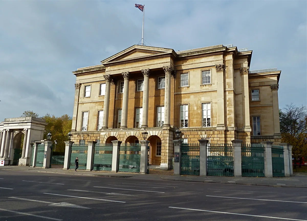
Apsley House
Apsley House — London townhouse of the Dukes of Wellington.
 ★ Iconic📷 5
Abbeys & priories · London
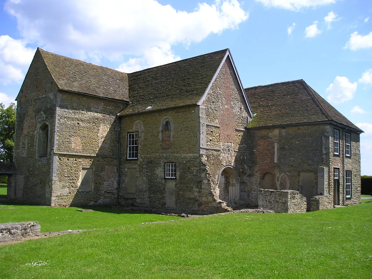
Denny Abbey
Denny Abbey — church in South Cambridgeshire, England, UK.
 📷 5
📷 5Chapels · London
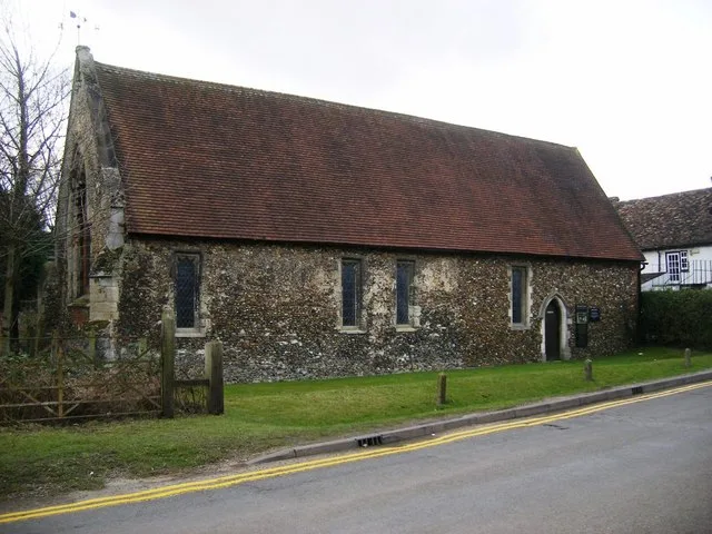
Duxford Chapel
Duxford Chapel — chapel in Whittlesford, Cambridgeshire, England, UK.
More places in this region
 Flagship📷 10
Hill forts · South East England
Castrum Anderitum
Castrum Anderitum — 3rd century Roman fort in the province of Britannia.
 Flagship📷 10
Hill forts · South East England
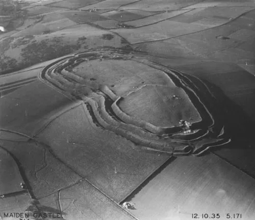
Maiden Castle
Maiden Castle — Iron Age hill fort in Dorset, England, UK.
 Flagship📷 10
Hill forts · South East England
Portus Adurni
Portus Adurni is a hill fort in the United Kingdom.
 Flagship📷 10
Hill forts · South East England
Richborough Roman Fort
Richborough Roman Fort — Roman fort at Richborough, Ash, United Kingdom.
Frequently asked questions
- Where is Bratton Castle?
- Bratton Castle is in South-East England, United Kingdom (postcode BA13 4TA), in the parish of Bratton.
- Who runs Bratton Castle?
- Bratton Castle is operated by English Heritage.
- Is Bratton Castle a protected site?
- Yes — Bratton Castle is part of the Bratton Downs SSSI Site of Special Scientific Interest and the River Avon System SSSI Site of Special Scientific Interest.
- Is Bratton Castle free to visit?
- Yes, Bratton Castle is free to enter.
- How do I get to Bratton Castle?
- The nearest railway station is Westbury, about 4.0 km away. Drivers can navigate to postcode BA13 4TA.