Mountains & hills · Scottish Highlands
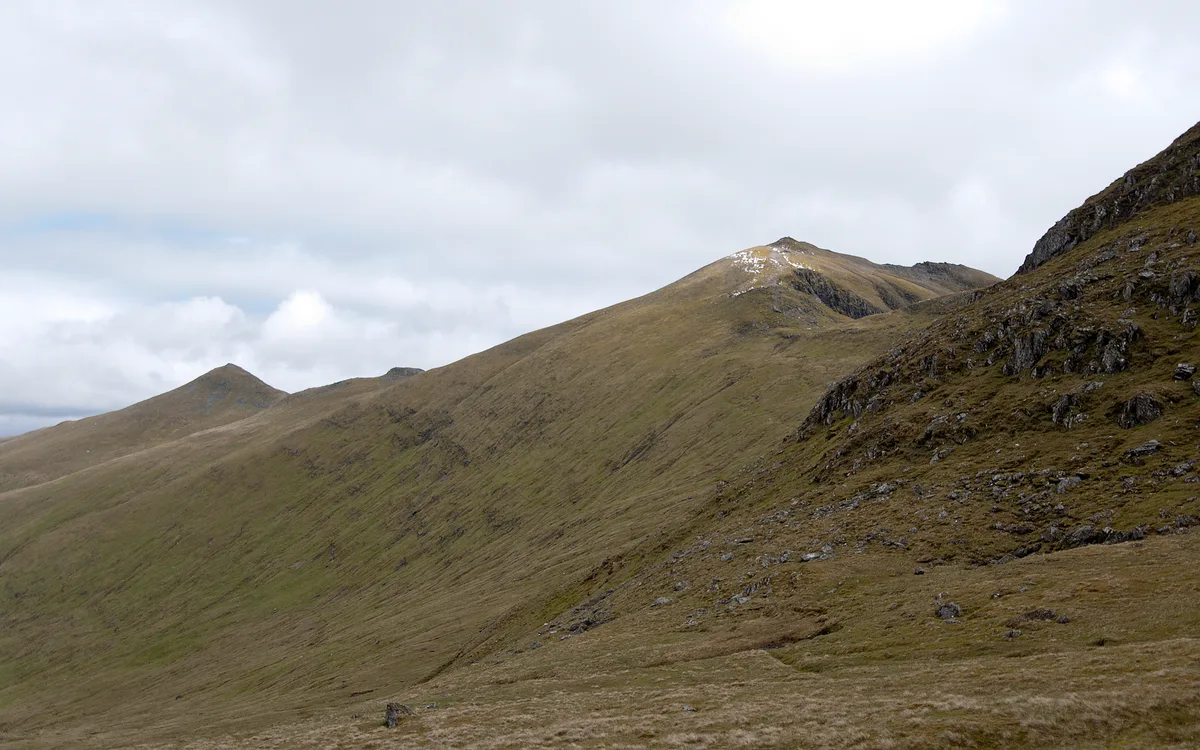
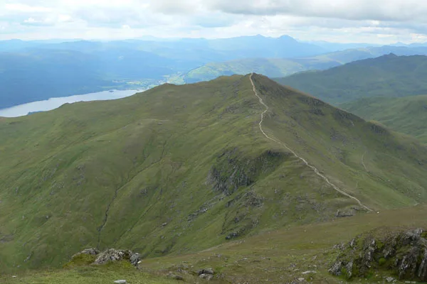
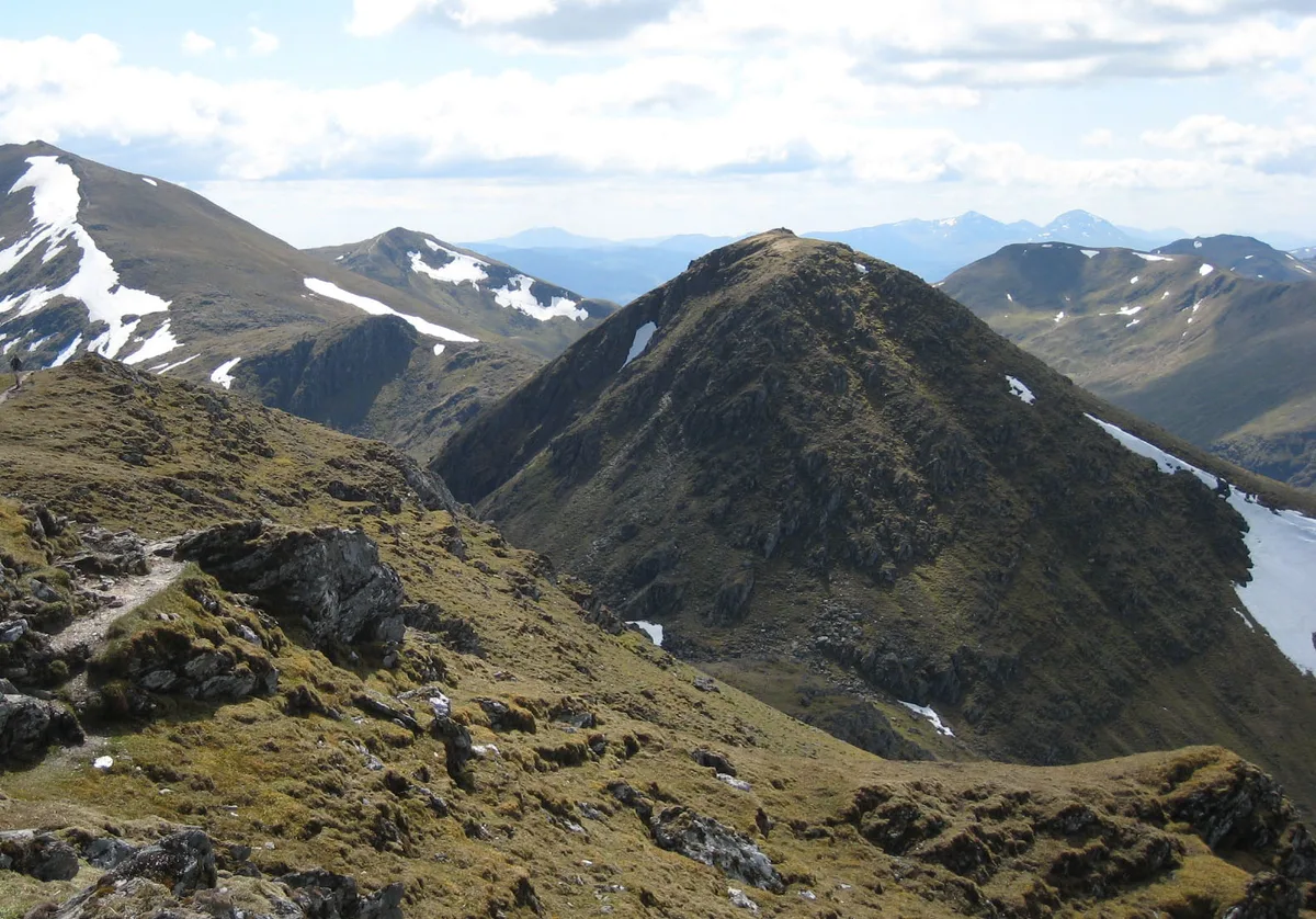
Ben Lawers
Also known as: Beinn Labhair
Ben Lawers — Named summit at 1214 m.

Wikimedia Commons contributors — see linked file page for photographer and licence licence
_en_Ben_Lawers_6-06-2011_14-54-13.png)
Plan your visit
- Typical visit
- 3 h–8 h
- Best time of year
- Late spring – early autumn (May–Oct)
- Free entry
- Dog-friendly
About
Ben Lawers is a named summit in the United Kingdom. Also known as: Beinn Labhair. Wikidata describes it as: "Named summit at 1214 m.". Coordinates: 56.5449°, -4.2209°.
Photo gallery
From the Wikipedia article
Ben Lawers (Scottish Gaelic: Beinn Labhair) is the highest mountain in the Breadalbane region of the Scottish Highlands. It lies north of Loch Tay and is the highest peak of the 'Ben Lawers group', a ridge that includes six other Munros: Beinn Ghlas, Meall Garbh, Meall Corranaich, An Stùc, Meall Greigh and Meall a' Choire Leith. It is also the highest peak in Perthshire, and the tenth highest Munro in Scotland. Ben Lawers was long thought to be over 4,000 feet (1,219 metres) in height, but accurate measurement in the 1870s showed it to be only 3,983 feet (1,214 m). (the figure of 3,983 ft is a conversion from metric - the surveyed height from the main triangulation has always been 3,984 ft on imperial maps published since the 1870s. Ben Lawers is formed of metamorphic rock, most notably calcareous mica-schists, and lower down, schistose grits. Although only the 11th highest Munro, it is the second highest non-igneous peak after Aonach Beag, which owes its exceptional height to proximity to Ben Nevis (the other high igneous group being the Cairngorms). Ben Lawers stands out by around 100-200 metres from neighbouring massifs as an isolated landmark 30 km east of the main Highlands watershed along or near which comparably high peaks are ranged. This associates with its proximity to the major Caledonide Loch Tay Fault along which kilometric displacements have occurred; adjacent to this fault are other landmark peaks at Ben Vorlich and Beinn a'Ghlo. The summit of Ben Lawers is affected by a pair of conspicuous Rock Slope Failures, providing shelter in their landslipped recesses, havens for wildlife, and large debris masses in the south corrie which if reinstated could restore a pre-historic summit in excess of 4,000 ft. Ben Lawers lies on the local watershed between the rivers Tay and Lyon. Since the 1950s, water has been captured from the numerous burns on the south face of Ben Lawers and Meall nan Tarmachan as part of the Breadalbane Hydro-Electric Scheme. The water…
Excerpt from Wikipedia under CC BY-SA 4.0. See the source article linked in Sources below.
Background
History
There is much evidence of former settlements and other human activity on the southern slopes of Ben Lawers above Loch Tay. The fertile limestone and schist soils on these southern slopes have been farmed since very early times and there are many Bronze Age remains. The discovery of many boulders with cup and ring marks led Derek Alexander, an archaeologist for the National Trust for Scotland, to note that the Ben Lawers was likely to have been "a very significant landscape in prehistory". Overgrown tracks climb up the mountain from the valley to the peat beds and sheilings on the hillside, and there are ruins of cottages each surrounded by a small group of trees. These, along with the…
Sourced from Wikipedia under CC BY-SA 4.0.
- Coordinates
- 56.5449, -4.2209
- Address
- Perth and Kinross, Scotland
- Official site
- www.hill-bagging.co.uk
Sources
- osm: n55560959 (ODbL)
- wikipedia: Ben Lawers (CC BY-SA 4.0)
- commons: 2011 Schotland An Stuc (links 1118 m) en Ben Lawers 6-06-2011 14-54-13.png (CC BY-SA 4.0)
Featured in this guide
Other places nearby
Loading nearby places…
Nearby
 📷 5
📷 5Natural landmarks · Scottish Highlands
Ben Lawers
Ben Lawers — 1214m high mountain in Perth and Kinross, Scotland, UK.
 📷 3
📷 3Mountains & hills · Scottish Highlands
Ben Lawers - Creag an Fhithich
Ben Lawers - Creag an Fhithich — a mountain in scotland-highlands, United Kingdom.
 📷 3
📷 3Natural landmarks · Scottish Highlands
Beinn Ghlas
Beinn Ghlas — 1103m high mountain in Perth and Kinross, Scotland, UK.
 📷 3
📷 3Mountains & hills · Scottish Highlands
Beinn Ghlas
Beinn Ghlas — Named summit at 1103 m.
 📷 5
📷 5Natural landmarks · Scottish Highlands
An Stùc
An Stùc — 1117m high mountain in Perth and Kinross, Scotland, UK.
 📷 5
📷 5Mountains & hills · Scottish Highlands
An Stùc
An Stùc — Named summit at 1118 m.
More mountains in this region
 📷 3
📷 3Mountains & hills · Scottish Highlands
A' Bhuidheanach Bheag
A' Bhuidheanach Bheag — Named summit at 936 m.
 📷 3
📷 3Mountains & hills · Scottish Highlands
A' Chailleach
A' Chailleach — Named summit at 997 m.
 📷 3
📷 3Mountains & hills · Scottish Highlands
A' Chailleach
A' Chailleach — Named summit at 930 m.
 📷 3
📷 3Mountains & hills · Scottish Highlands
A' Chaoirnich
A' Chaoirnich — Named summit at 875 m.
Frequently asked questions
- Where is Ben Lawers?
- Ben Lawers is in Scottish Highlands, in the United Kingdom — coordinates 56.5449°, -4.2209°.
- Is Ben Lawers free to visit?
- Yes — admission to Ben Lawers is free.