Natural landmarks · Scottish Highlands
An Stùc
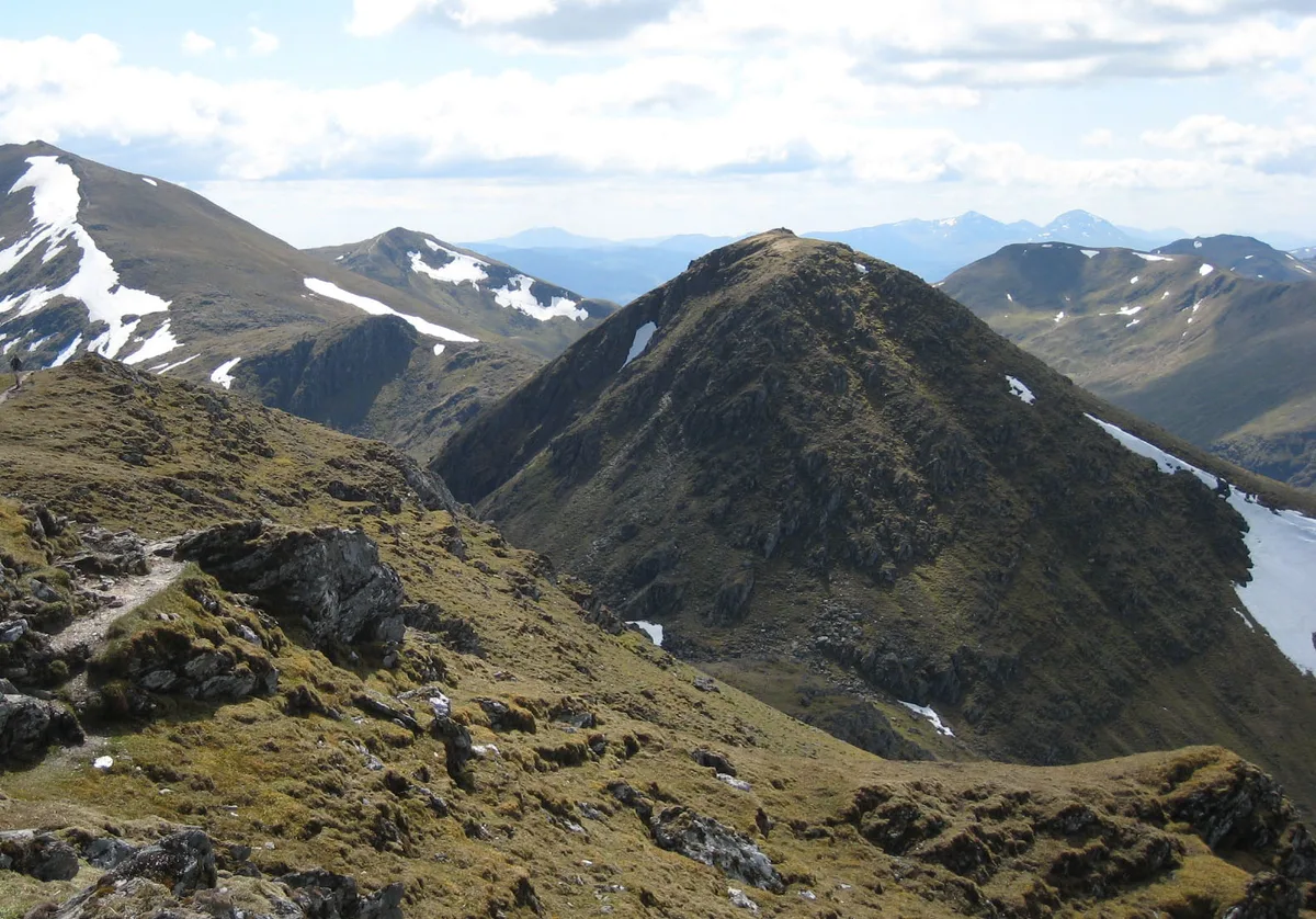
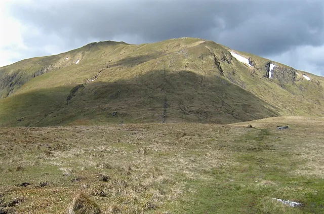
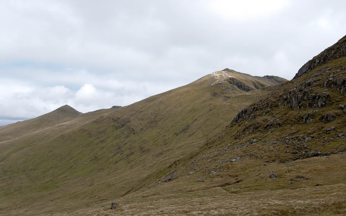
An Stùc — 1117m high mountain in Perth and Kinross, Scotland, UK.

Wikimedia Commons contributors — see linked file page for photographer and licence licence
Plan your visit
- Typical visit
- 1 h–2 h
- Free entry
- Dog-friendly
About
An Stùc is a named natural landmark in the United Kingdom. Wikidata describes it as: "1117m high mountain in Perth and Kinross, Scotland, UK". Coordinates: 56.5601°, -4.2163°.
Photo gallery
From the Wikipedia article
An Stùc, meaning "The Peak" in Gaelic, is a conically shaped Scottish mountain in the Ben Lawers range to the north of Loch Tay. It has been listed as a Munro since 1997, having previously been considered a subsidiary top of the Ben Lawers range. It lies on the main ridge of the Ben Lawers range, and its southern and eastern slopes form part of the Ben Lawers National Nature Reserve, which is owned and managed by the National Trust for Scotland. The normal routes of ascent are via the ridges from Ben Lawers or Meall Garbh, in combination with other summits in the range. It may also be ascended directly from the Lawers Burn to the east via a gully above Lochan nan Cat. There is another An Stùc in Assynt, standing at 364 m (1,194 ft) about 26 kilometres (16 mi) northeast of Ullapool at the head of Glenoykel.
Excerpt from Wikipedia under CC BY-SA 4.0. See the source article linked in Sources below.
- Coordinates
- 56.5601, -4.2163
- Address
- Perth and Kinross, Scotland
Sources
- wikidata: Q4750226 (CC0)
- wikipedia: An Stùc (CC BY-SA 4.0)
- commons: An Stuc.jpg (CC BY-SA 4.0)
Other places nearby
Loading nearby places…
Nearby
 📷 5
📷 5Mountains & hills · Scottish Highlands
An Stùc
An Stùc — Named summit at 1118 m.
 📷 3
📷 3Natural landmarks · Scottish Highlands
Meall Garbh
Meall Garbh — 1123m high mountain in Perth and Kinross, Scotland, UK.
 📷 3
📷 3Mountains & hills · Scottish Highlands
Meall Garbh
Meall Garbh — Named summit at 1118 m.
 📷 3
📷 3Mountains & hills · Scottish Highlands
Ben Lawers - Creag an Fhithich
Ben Lawers - Creag an Fhithich — a mountain in scotland-highlands, United Kingdom.
 📷 5
📷 5Natural landmarks · Scottish Highlands
Ben Lawers
Ben Lawers — 1214m high mountain in Perth and Kinross, Scotland, UK.
 📷 5
📷 5Mountains & hills · Scottish Highlands
Ben Lawers
Ben Lawers — Named summit at 1214 m.
More natural landmarks in this region
 Flagship📷 3
Natural landmarks · Scottish Highlands
Dunalastair Water
Dunalastair Water — lake in Perth and Kinross, Scotland, UK, on the River Tummel.
 Flagship📷 3
Natural landmarks · Scottish Highlands
Loch Arkaig
Loch Arkaig — lake in Highland, Scotland, UK, outflows east to River Arkaig.
 Flagship📷 3
Natural landmarks · Scottish Highlands
Loch Assynt
Loch Assynt — lake in Highland, Scotland, UK, outflows to the River Inver and Loch na Garbh Uidhe.
 Flagship📷 3
Natural landmarks · Scottish Highlands
Loch Awe
Loch Awe — lake in Argyll and Bute, Scotland, UK, outflows to the River Awe.
Frequently asked questions
- Where is An Stùc?
- An Stùc is in Scottish Highlands, in the United Kingdom — coordinates 56.5601°, -4.2163°.
- Is An Stùc free to visit?
- Yes — admission to An Stùc is free.