Mountains & hills · Scottish Highlands
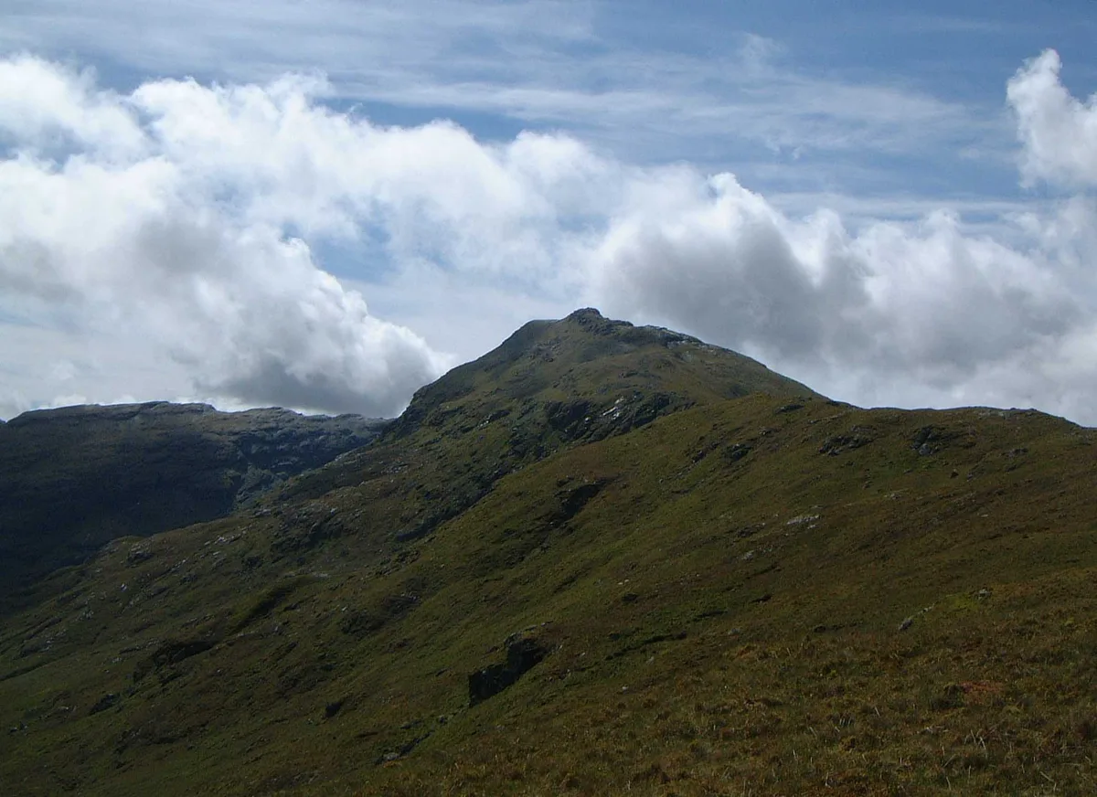
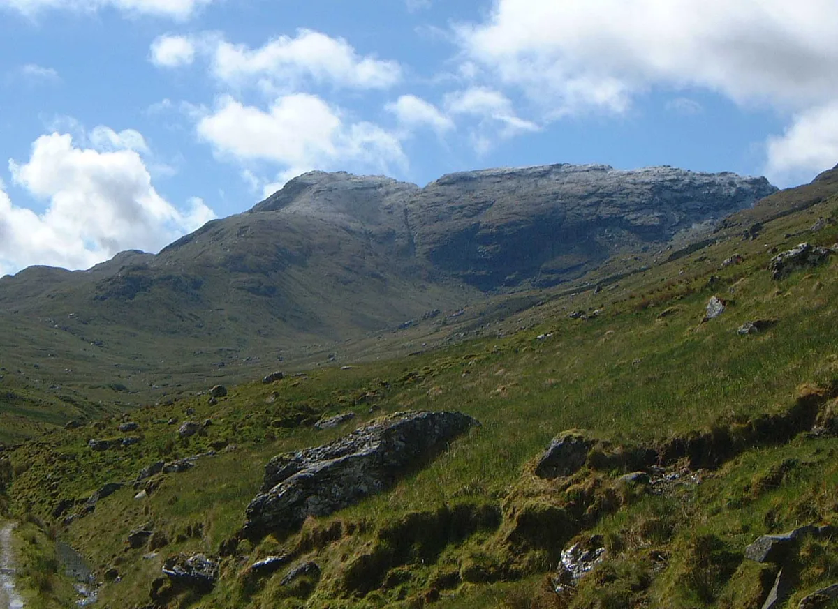
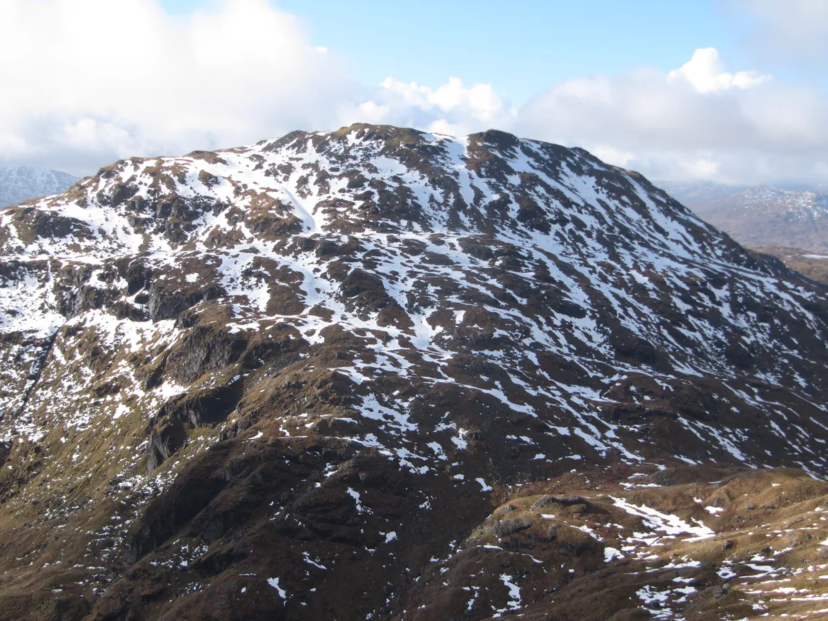
An Caisteal
An Caisteal — Named summit at 995 m.

Wikimedia Commons contributors — see linked file page for photographer and licence licence
Plan your visit
- Typical visit
- 3 h–8 h
- Best time of year
- Late spring – early autumn (May–Oct)
- Nearest railway station
- Crianlarich · 5.8 km
- Free entry
- Dog-friendly
About
An Caisteal is a named summit in the United Kingdom. Wikidata describes it as: "Named summit at 995 m.". Coordinates: 56.3386°, -4.6245°.
Photo gallery
From the Wikipedia article
An Caisteal (Scottish Gaelic for 'the castle') is a mountain in the Breadalbane region of the Scottish Highlands, south of the village of Crianlarich. It is a Munro with a height of 995 metres (3,264 ft).
Excerpt from Wikipedia under CC BY-SA 4.0. See the source article linked in Sources below.
Background
Description
An Caisteal, which qualifies as a Munro, is located in a popular area for hill walking within a group of seven Munros and fourteen tops which stand on the eastern side of Glen Falloch in the Loch Lomond and the Trossachs National Park. The mountain reaches a height of 995 metres (3,264 feet) and is usually climbed together with the neighbouring Munro of Beinn a' Chroin, to which it is connected by a high col to the south east. The mountain's name translates from Gaelic as "the castle" and is believed to refer to the prominent castellated rocks at the summit which serve as an easy way of identifying it from a distance.
Sourced from Wikipedia under CC BY-SA 4.0.
- Coordinates
- 56.3386, -4.6245
- Address
- Stirlingshire, Scotland
- Nearest railway station
- Crianlarich — 5.8 km
- Official site
- www.walkhighlands.co.uk
Sources
- osm: n258820961 (ODbL)
- wikipedia: An Caisteal (CC BY-SA 4.0)
- commons: An Caisteal summit from Twistin Hill.jpg (CC BY-SA 4.0)
Other places nearby
Loading nearby places…
Nearby
 📷 3
📷 3Natural landmarks · Scottish Highlands
An Caisteal
An Caisteal — 995m high mountain in Stirling, Scotland, UK.
 📷 3
📷 3Mountains & hills · Scottish Highlands
Beinn a' Chroin West Top
Beinn a' Chroin West Top — a mountain in scotland-highlands, United Kingdom.
 📷 5
📷 5Natural landmarks · Scottish Highlands
Beinn a' Chroin
Beinn a' Chroin — 941m high mountain in Stirling, Scotland, UK.
 📷 5
📷 5Mountains & hills · Scottish Highlands
Beinn a' Chroin
Beinn a' Chroin — Named summit at 942 m.
 📷 3
📷 3Mountains & hills · Scottish Highlands
Beinn a' Chroin East Top
Beinn a' Chroin East Top — a mountain in scotland-highlands, United Kingdom.
 📷 5
📷 5Mountains & hills · Scottish Highlands
Beinn Chabhair
Beinn Chabhair — Named summit at 933 m.
More mountains in this region
 📷 3
📷 3Mountains & hills · Scottish Highlands
A' Bhuidheanach Bheag
A' Bhuidheanach Bheag — Named summit at 936 m.
 📷 3
📷 3Mountains & hills · Scottish Highlands
A' Chailleach
A' Chailleach — Named summit at 997 m.
 📷 3
📷 3Mountains & hills · Scottish Highlands
A' Chailleach
A' Chailleach — Named summit at 930 m.
 📷 3
📷 3Mountains & hills · Scottish Highlands
A' Chaoirnich
A' Chaoirnich — Named summit at 875 m.
Frequently asked questions
- Where is An Caisteal?
- An Caisteal is in the Scottish Highlands, United Kingdom.
- Is An Caisteal free to visit?
- Yes, An Caisteal is free to enter.
- How do I get to An Caisteal?
- The nearest railway station is Crianlarich, about 5.8 km away.