Mountains & hills · Scottish Highlands
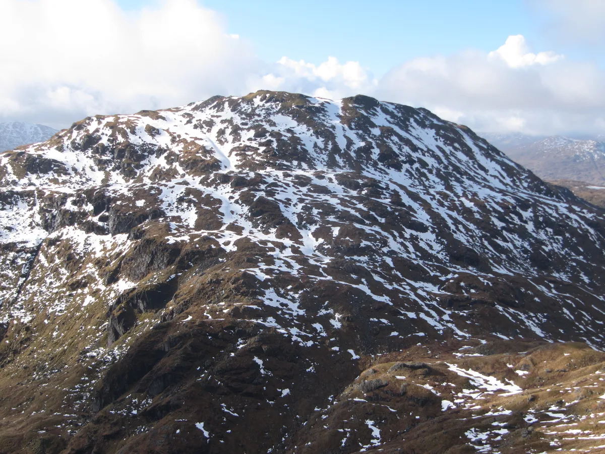
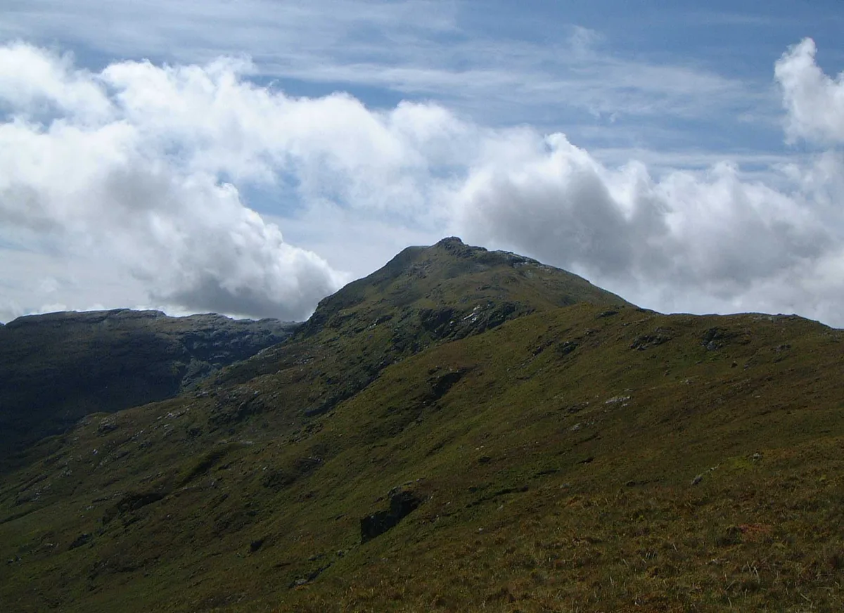
Beinn Chabhair
Beinn Chabhair — Named summit at 933 m.

Wikimedia Commons contributors — see linked file page for photographer and licence licence
Plan your visit
- Typical visit
- 3 h–8 h
- Best time of year
- Late spring – early autumn (May–Oct)
- Nearest railway station
- Ardlui · 5.6 km
- Free entry
- Dog-friendly
About
Beinn Chabhair is a named summit in the United Kingdom. Wikidata describes it as: "Named summit at 933 m.". Coordinates: 56.3258°, -4.6414°.
Photo gallery
From the Wikipedia article
Beinn Chabhair (Gaelic: Beinn a' Chabhair) is a Scottish mountain. It has fine views down to Loch Lomond. A common approach is from Inverarnan, up a steep eroded path beside the dramatic waterfalls of the Ben Glas Burn then finding a vague route across fairly level but very boggy moorland before walking up the hill itself and finding a way around a series of craggy outcrops to the summit.
Excerpt from Wikipedia under CC BY-SA 4.0. See the source article linked in Sources below.
- Coordinates
- 56.3258, -4.6414
- Address
- Stirling, Scotland
- Nearest railway station
- Ardlui — 5.6 km
- Official site
- www.walkhighlands.co.uk
Sources
- osm: n258820960 (ODbL)
- wikipedia: Beinn Chabhair (CC BY-SA 4.0)
- commons: Chabhair.jpg (CC BY-SA 4.0)
Other places nearby
Loading nearby places…
Nearby
 📷 5
📷 5Natural landmarks · Scottish Highlands
Beinn Chabhair
Beinn Chabhair — 932m high mountain in Stirling, Scotland, UK.
 📷 3
📷 3Mountains & hills · Scottish Highlands
Meall nan Tarmachan West Top
Meall nan Tarmachan West Top — a mountain in scotland-highlands, United Kingdom.
 📷 3
📷 3Mountains & hills · Scottish Highlands
Parlan Hill
Parlan Hill — a mountain in scotland-highlands, United Kingdom.
 📷 3
📷 3Mountains & hills · Scottish Highlands
An Caisteal
An Caisteal — Named summit at 995 m.
 📷 3
📷 3Natural landmarks · Scottish Highlands
An Caisteal
An Caisteal — 995m high mountain in Stirling, Scotland, UK.
 📷 3
📷 3Mountains & hills · Scottish Highlands
Beinn a' Chroin West Top
Beinn a' Chroin West Top — a mountain in scotland-highlands, United Kingdom.
More mountains in this region
 📷 3
📷 3Mountains & hills · Scottish Highlands
A' Bhuidheanach Bheag
A' Bhuidheanach Bheag — Named summit at 936 m.
 📷 3
📷 3Mountains & hills · Scottish Highlands
A' Chailleach
A' Chailleach — Named summit at 997 m.
 📷 3
📷 3Mountains & hills · Scottish Highlands
A' Chailleach
A' Chailleach — Named summit at 930 m.
 📷 3
📷 3Mountains & hills · Scottish Highlands
A' Chaoirnich
A' Chaoirnich — Named summit at 875 m.
Frequently asked questions
- Where is Beinn Chabhair?
- Beinn Chabhair is in the Scottish Highlands, United Kingdom.
- Is Beinn Chabhair free to visit?
- Yes, Beinn Chabhair is free to enter.
- How do I get to Beinn Chabhair?
- The nearest railway station is Ardlui, about 5.6 km away.