Hill forts · South West England
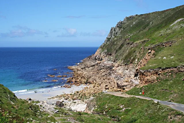
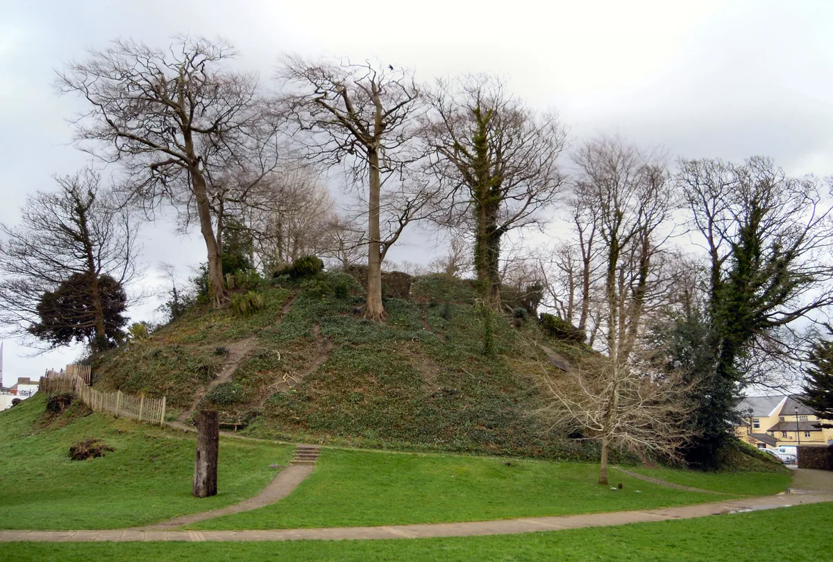
Ballowall Barrow
Ballowall Barrow — archaeological site in St Just, Cornwall, England, UK.

Wikimedia Commons contributors — see linked file page for photographer and licence licence
Plan your visit
- Typical visit
- 1 h–2 h
- Free entry
- Family-friendly
- Dog-friendly
- Limited wheelchair access
About
Ballowall Barrow is a hill fort in the United Kingdom. Heritage designation: scheduled monument. Owned by English Heritage. Managed by English Heritage. Wikidata describes it as: "archaeological site in St Just, Cornwall, England, UK". Coordinates: 50.1223°, -5.7014°.
Photo gallery
From English Heritage
In a spectacular cliff-edge position, this unique Bronze Age tomb had a long and complex history as a sacred site. Seen as excavated in 1878 by Cornish antiquarian William Borlase.
Read more on the official property page.
Protected designations
- Site of Special Scientific Interest: Aire Point to Carrick Du SSSI
- Area of Outstanding Natural Beauty: Cornwall
Designations sourced from Natural England open data under OGL v3.
From the Wikipedia article
Ballowall Barrow (Cornish: Krug Karrekloos) is a prehistoric funerary cairn (chambered tomb) which Ashbee (1982) and Hencken (1902–81) state contains several phases of use from the Neolithic to the Bronze Age. It is situated on the cliff top at Ballowall Common, near St Just in Cornwall, England, UK. It is also known as Carn Gluze Barrow. It was first excavated in 1878 by William Copeland Borlase, when it was discovered under mining debris. A report by Sharpe (1999) states that there are several discrepancies in the accounts of the excavation work, some of the finds were lost and interpretation of the site is difficult. Reconstruction work which was done after the excavation to make the inside more accessible has further complicated the site. The site today is a confused mix of original and reconstructions introduced by Borlase. The finds from excavations are in stored in museums at Truro, Cambridge and the British Museum The barrow is 72 feet (22 m) in diameter. The Cornwall and Scilly Historic Environment Record describes it as a central domed structure, containing cists and with a pit beneath, surrounded by an outer cairn also containing cists. An entrance grave is located in the external side of the outer cairn. The construction of the site is unique in consisting of a combination of Neolithic and Bronze Age funerary rituals. A similar site was recorded by Borlase but its location has been lost. The site is a protected Scheduled monument (ref. number 15410). It was included in the Schedule on 10/8/1923 and the scheduling was updated on 22/2/1996. The site is in the guardianship of English Heritage, and is managed by the National Trust.
Excerpt from Wikipedia under CC BY-SA 4.0. See the source article linked in Sources below.
- Coordinates
- 50.1223, -5.7014
- District
- Cornwall
- Parish
- St. Just
- Postcode
- TR19 7NP
- Parliamentary constituency
- St Ives
- Official site
- www.english-heritage.org.uk
Sources
- wikidata: Q1043850 (CC0)
- wikipedia: Ballowall Barrow (CC BY-SA 4.0)
- commons: Ballowall Barrow, near St Just - geograph.org.uk - 660261.jpg (CC BY-SA 4.0)
Featured in this guide
Other places nearby
Loading nearby places…
Nearby
 📷 5
📷 5Beaches · South West England
Porth Nanven
Porth Nanven is a beach in the United Kingdom.
 📷 3
📷 3Historic houses · South West England
St Just Amalgamated Mine Shaft
St Just Amalgamated Mine Shaft — a historic house in england-south-west, United Kingdom.
 📷 3
📷 3Natural landmarks · South West England
Cornwall Underground Adventures
Cornwall Underground Adventures — a other in england-south-west, United Kingdom.
 📷 5
📷 5Mountains & hills · South West England
Porth Nanven
Porth Nanven — bay in Cornwall, England, UK.
 📷 5
📷 5Chapels · South West England
Medieval chapel called St Helen's Chapel with a dwelling and enclosure at Cape Cornwall
Medieval chapel called St Helen's Chapel with a dwelling and enclosure at Cape Cornwall — chapel in St Just, Cornwall, England, UK.
 📷 3
📷 3Historic houses · South West England
St. Helen's Oratory
St. Helen's Oratory — a historic house in england-south-west, United Kingdom.
More places run by English Heritage
 Flagship📷 10
Museums · London
Kenwood House
Kenwood House — art museum and historic house in Hampstead, London.
 📷 5
📷 5Galleries · London
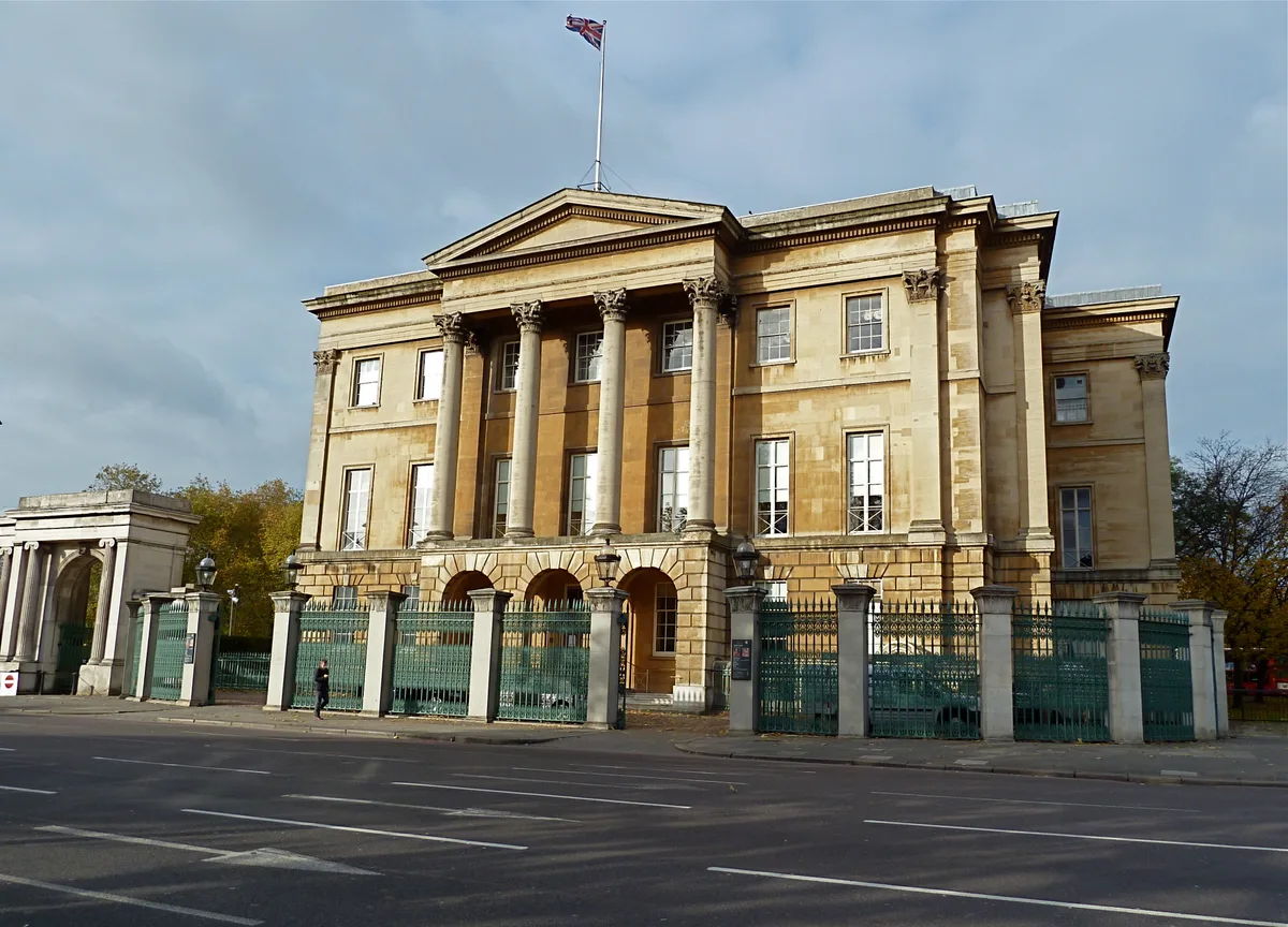
Apsley House
Apsley House — London townhouse of the Dukes of Wellington.
 ★ Iconic📷 5
Abbeys & priories · London
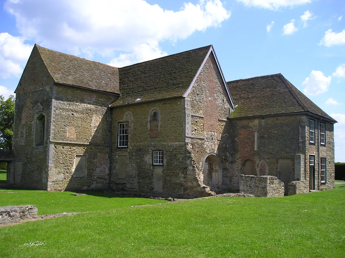
Denny Abbey
Denny Abbey — church in South Cambridgeshire, England, UK.
 📷 5
📷 5Chapels · London
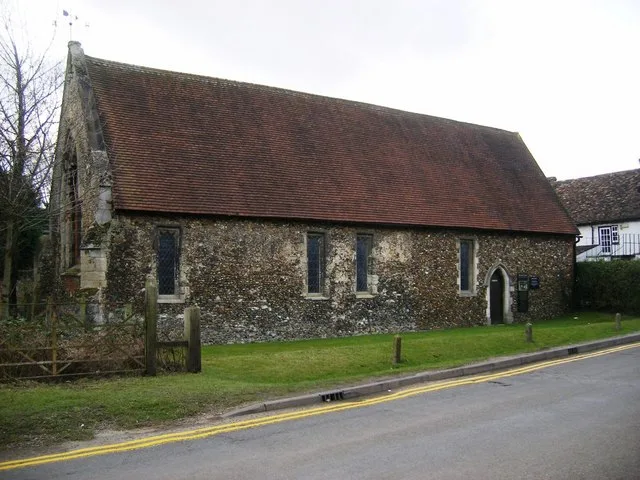
Duxford Chapel
Duxford Chapel — chapel in Whittlesford, Cambridgeshire, England, UK.
More places in this region
 📷 5
📷 5Hill forts · South West England
Barnstaple Castle
Barnstaple Castle — castle in Devon, England, UK.
 📷 5
📷 5Hill forts · South West England
Bartinney Castle
Bartinney Castle — Iron Age enclosure in Cornwall, England, UK.
 📷 5
📷 5Hill forts · South West England
Berry's Wood
Berry's Wood — iron Age hill fort in south Devon, England, UK.
 📷 5
📷 5Hill forts · South West England
Boscawen-Un
Boscawen-Un — stone circle in Cornwall.
Frequently asked questions
- Where is Ballowall Barrow?
- Ballowall Barrow is in South-West England, United Kingdom (postcode TR19 7NP), in the parish of St. Just.
- Who runs Ballowall Barrow?
- Ballowall Barrow is operated by English Heritage.
- Is Ballowall Barrow a listed building?
- Ballowall Barrow is officially recognised as scheduled monument listed.
- Is Ballowall Barrow a protected site?
- Yes — Ballowall Barrow is part of the Aire Point to Carrick Du SSSI Site of Special Scientific Interest and the Cornwall National Landscape (AONB).
- Is Ballowall Barrow free to visit?
- Yes, Ballowall Barrow is free to enter.
- How do I get to Ballowall Barrow?
- Drivers can navigate to postcode TR19 7NP. It sits within the St Ives parliamentary constituency.