Natural landmarks · Northern Ireland
Balloo
Balloo in Northern Ireland, United Kingdom.

Eric Jones — CC BY-SA 2.0 via Wikimedia Commons licence
Plan your visit
- Typical visit
- 1 h–2 h
- Free entry
- Dog-friendly
About
Balloo is a place of interest in Northern Ireland, United Kingdom — drawn from open-data sources for visitor reference. See the linked Wikipedia article for the full description.
Photo gallery
From the Wikipedia article
Balloo (from Irish Baile Aodha, meaning 'Hugh's townland') is a small village and townland near Killinchy in County Down, Northern Ireland. It is 5 miles south of Comber on the A22 road between Belfast and Downpatrick. It is situated in the townland of the same name, the civil parish of Killinchy and the historic barony of Dufferin. It lies within the Ards and North Down Borough. It had a population of 189 people (in 83 households) as of the 2011 census, an increase from 159 people in the 2001 census.
Excerpt from Wikipedia under CC BY-SA 4.0. See the source article linked in Sources below.
- Coordinates
- 54.4733, -5.6911
- District
- Ards and North Down
- Postcode
- BT23 6RA
- Parliamentary constituency
- Strangford
Sources
- wikidata: Q60761 (CC0)
- wikipedia: Balloo, County Down (CC BY-SA 4.0)
Other places nearby
Loading nearby places…
Nearby
 📷 3
📷 3Towns & cities · Northern Ireland
Killinchy
Killinchy — village in County Down, Northern Ireland.
 📷 5
📷 5Natural landmarks · Northern Ireland
Whiterock
Whiterock in Northern Ireland, United Kingdom.
 📷 3
📷 3Castles · Northern Ireland
Sketrick Castle
Sketrick Castle — castle in Killinchy, County Down, Northern Ireland.
 📷 3
📷 3Castles · Northern Ireland
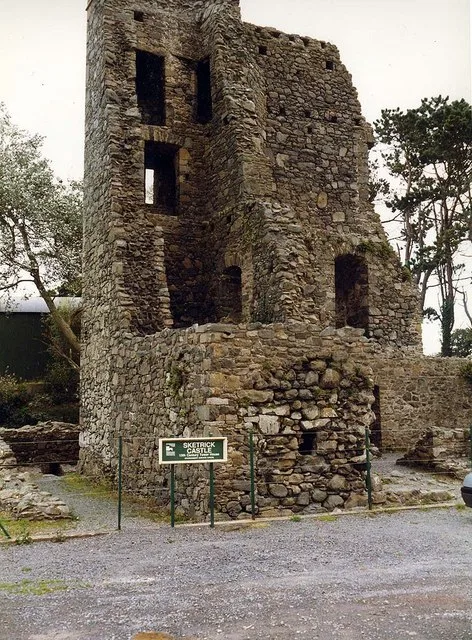
Sketrick Castle (ruin)
Sketrick Castle (ruin) — a castle in northern-ireland, United Kingdom.
Campsites · Northern Ireland
The Lodge at Quarterland Bay Camp Site
The Lodge at Quarterland Bay Camp Site — a campsite in northern ireland.
 📷 4
📷 4Natural landmarks · Northern Ireland
Lisbane
Lisbane in Northern Ireland, United Kingdom.
More natural landmarks in this region
 Flagship📷 4
Natural landmarks · Northern Ireland
Lough Erne
Lough Erne — lake in County Fermanagh, Northern Ireland, UK.
 Flagship📷 4
Natural landmarks · Northern Ireland
Lough Neagh
Lough Neagh — large lake in Northern Ireland.
 📷 3
📷 3Natural landmarks · Northern Ireland
Ballysaggart Lough
Ballysaggart Lough — lake in the United Kingdom.
 📷 5
📷 5Natural landmarks · Northern Ireland
Belmore Mountain
Belmore Mountain — mountain in the United Kingdom.
Frequently asked questions
- Where is Balloo?
- Balloo is in Northern Ireland, United Kingdom (postcode BT23 6RA).
- Is Balloo free to visit?
- Yes, Balloo is free to enter.
- How do I get to Balloo?
- Drivers can navigate to postcode BT23 6RA. It sits within the Strangford parliamentary constituency.