Mountains & hills · North Wales
Y Garn
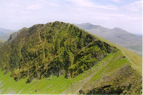
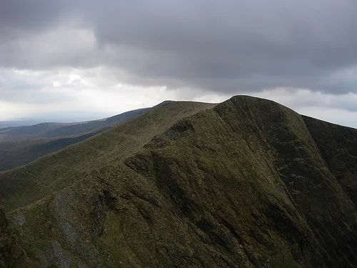
Y Garn — Named summit at 633 m.

Wikimedia Commons contributors — see linked file page for photographer and licence licence
Plan your visit
- Typical visit
- 3 h–8 h
- Best time of year
- Late spring – early autumn (May–Oct)
- Nearest railway station
- Rhyd Ddu · 2.0 km
- Free entry
- Dog-friendly
About
Y Garn is a named summit in the United Kingdom. Wikidata describes it as: "Named summit at 633 m.". Coordinates: 53.0514°, -4.1625°.
Photo gallery
Heritage listing
http://cadwpublic-api.azurewebsites.net/reports/listedbuilding/FullReport?lang=en&id=26806
From Cadw under OGL v3.
From the Wikipedia article
Y Garn is a top of Mynydd Drws-y-Coed in Snowdonia, north Wales and is the easterly end of the Nantlle Ridge. It has steep north-facing cliffs, the summit area being the highest point on a broad rocky plateau. The summit plateau contains two large shelter cairns.
Excerpt from Wikipedia under CC BY-SA 4.0. See the source article linked in Sources below.
- Coordinates
- 53.0514, -4.1625
- District
- Gwynedd
- Parish
- Betws Garmon
- Postcode
- LL54 6TL
- Parliamentary constituency
- Dwyfor Meirionnydd
- Nearest railway station
- Rhyd Ddu — 2 km
Sources
- osm: n333567315 (ODbL)
- wikipedia: Y Garn (Nantlle Ridge) (CC BY-SA 4.0)
- commons: Y Garn - geograph.org.uk - 22398.jpg (CC BY-SA 4.0)
Other places nearby
Loading nearby places…
Nearby
 📷 3
📷 3Natural landmarks · North Wales
Mynydd Drws-y-Coed
Mynydd Drws-y-Coed — mountain (695m) in Gwynedd.
 📷 3
📷 3Mountains & hills · North Wales
Mynydd Drws-Y-Coed
Mynydd Drws-Y-Coed — Named summit at 695 m.
 📷 3
📷 3Archaeological sites · North Wales
Copper Mine
Copper Mine — a archaeological in wales-north, United Kingdom.
 📷 3
📷 3Archaeological sites · North Wales
Drws-y-Coed Copper Mine
Drws-y-Coed Copper Mine — a archaeological in wales-north, United Kingdom.
 📷 3
📷 3Mountains & hills · North Wales
Clogwynygarreg
Clogwynygarreg — a mountain in wales-north, United Kingdom, 337 m.
 📷 3
📷 3Mountains & hills · North Wales
Trum Y Ddysgl
Trum Y Ddysgl — Named summit at 709 m.
More mountains in this region
 📷 5
📷 5Mountains & hills · North Wales
Cemlyn Bay and lagoon
Cemlyn Bay and lagoon — Site of Special Scientific Interest in Wales.
 📷 3
📷 3Mountains & hills · North Wales
Aberffraw Bay
Aberffraw Bay — bay on the west coast of Anglesey, in Wales, UK.
 📷 3
📷 3Mountains & hills · North Wales
Allt-fawr
Allt-fawr — Named summit at 698 m.
 📷 3
📷 3Mountains & hills · North Wales
Aran Benllyn
Aran Benllyn — Named summit at 884 m.
Frequently asked questions
- Where is Y Garn?
- Y Garn is in North Wales, United Kingdom (postcode LL54 6TL), in the parish of Betws Garmon.
- Is Y Garn a listed building?
- Y Garn is officially recognised as II listed.
- Is Y Garn free to visit?
- Yes, Y Garn is free to enter.
- How do I get to Y Garn?
- The nearest railway station is Rhyd Ddu, about 2.0 km away. Drivers can navigate to postcode LL54 6TL.