Mountains & hills · North West England
Wolfhole Crag
Wolfhole Crag — Named summit at 528 m.

Wikimedia Commons contributors — see linked file page for photographer and licence licence
Plan your visit
- Typical visit
- 3 h–8 h
- Best time of year
- Late spring – early autumn (May–Oct)
- Free entry
- Dog-friendly
About
Wolfhole Crag is a named summit in the United Kingdom. Wikidata describes it as: "Named summit at 528 m.". Coordinates: 54.0154°, -2.5587°.
Photo gallery
Protected designations
- Site of Special Scientific Interest: Bowland Fells SSSI
- Area of Outstanding Natural Beauty: Forest Of Bowland
Designations sourced from Natural England open data under OGL v3.
From the Wikipedia article
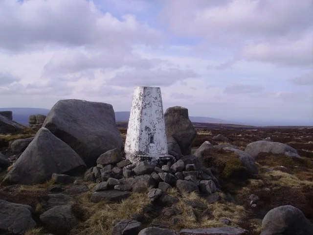
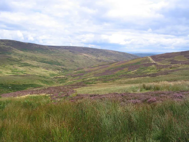
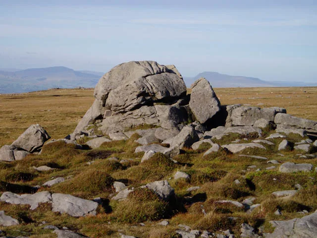
Wolfhole Crag is an isolated and rarely-visited hill in the Forest of Bowland in Lancashire, England. It has an elevation of 527 m (1,729 ft) and a prominence of 38 m (125 ft). Its seclusion is due in part to its low profile and long approach walks. The East crag has a 'Wolf hole' at the base of the south-facing side, presumably how it gained the name. Wolfhole Crag marks the northwesternmost boundary of the civil parish of Bowland Forest High, the historic Forest of Bowland, and the Lordship of Bowland. A long path approaches from Ward's Stone in the west which is fraught with bogs. Another tarmac path from Tarnbrook meets this halfway. A final path comes from the northeast from the Hornby Road in the direction to White Hill. The summit consists of two large (10m high) buttresses of gritstone, some oddly shaped waist-high rocks, and the usual trig point. The buttresses contain a number of recorded rock climbs, including the two furthest "hard grit" routes (E7 & E6) from the road in the entire UK. Both climbs were ascended in 2001 by Neil Kershaw and Greg Chapman.
Excerpt from Wikipedia under CC BY-SA 4.0. See the source article linked in Sources below.
- Coordinates
- 54.0154, -2.5587
- Address
- Forest of Bowland, England
Sources
- osm: n31376759 (ODbL)
- wikipedia: Wolfhole Crag (CC BY-SA 4.0)
- commons: Trig Pillar, Wolfhole Crag - geograph.org.uk - 770706.jpg (CC BY-SA 4.0)
Other places nearby
Loading nearby places…
Nearby
 📷 3
📷 3Natural landmarks · North West England
Wolfhole Crag
Wolfhole Crag — mountain in the United Kingdom.
 📷 3
📷 3Memorials & monuments · North West England
Anthony Mason Hornby
Anthony Mason Hornby — a memorial in england-north-west, United Kingdom.
 📷 3
📷 3Natural landmarks · North West England
White Hill
White Hill — hill in the Forest of Bowland, Lancashire, England, UK.
 📷 3
📷 3Mountains & hills · North West England
White Hill
White Hill — Named summit at 544 m.
 📷 3
📷 3Natural landmarks · North West England
Ward's Stone
Ward's Stone — mountain in the United Kingdom.
 📷 3
📷 3Mountains & hills · North West England
Ward's Stone
Ward's Stone — Named summit at 563 m.
More mountains in this region
 📷 3
📷 3Mountains & hills · North West England
Allen Crags
Allen Crags — Named summit at 785 m.
 📷 3
📷 3Mountains & hills · North West England
Alum Pot
Alum Pot — Open shaft pothole in North Yorkshire.
 📷 3
📷 3Mountains & hills · North West England
Arnside Knott
Arnside Knott — Named summit at 159 m.
 📷 3
📷 3Mountains & hills · North West England
Aye Gill Pike
Aye Gill Pike — Named summit at 556.3 m.
Frequently asked questions
- Where is Wolfhole Crag?
- Wolfhole Crag is in North-West England, United Kingdom.
- Is Wolfhole Crag a protected site?
- Yes — Wolfhole Crag is part of the Bowland Fells SSSI Site of Special Scientific Interest and the Forest Of Bowland National Landscape (AONB).
- Is Wolfhole Crag free to visit?
- Yes, Wolfhole Crag is free to enter.