Mountains & hills · North West England
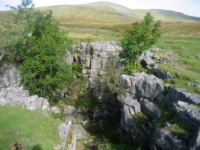
Aye Gill Pike
Aye Gill Pike — Named summit at 556.3 m.

Wikimedia Commons contributors — see linked file page for photographer and licence licence
Plan your visit
- Typical visit
- 3 h–8 h
- Best time of year
- Late spring – early autumn (May–Oct)
- Nearest railway station
- Dent · 4.5 km
- Free entry
- Dog-friendly
About
Aye Gill Pike is a named summit in the United Kingdom. Wikidata describes it as: "Named summit at 556.3 m.". Coordinates: 54.2924°, -2.4306°.
Photo gallery
From the Wikipedia article
Aye Gill Pike is a Marilyn in the Yorkshire Dales, the highest point of the ridge of Rise Hill between Dentdale and Garsdale in Cumbria, England.
Excerpt from Wikipedia under CC BY-SA 4.0. See the source article linked in Sources below.
- Coordinates
- 54.2924, -2.4306
- District
- Westmorland and Furness
- Parish
- Dent
- Postcode
- LA10 5TE
- Parliamentary constituency
- Morecambe and Lunesdale
- Nearest railway station
- Dent — 4.5 km
Sources
- osm: n434373260 (ODbL)
- wikipedia: Aye Gill Pike (CC BY-SA 4.0)
- commons: Aye Gill Pike - geograph.org.uk - 30299.jpg (CC BY-SA 4.0)
Other places nearby
Loading nearby places…
Nearby
 📷 3
📷 3Historic houses · North West England
Haggonthwaite Lathe
Haggonthwaite Lathe — a historic house in england-north-west, United Kingdom.
 📷 3
📷 3Historic bridges · North West England
Low House Bridge
Low House Bridge — Grade II listed building-listed bridge in england-north-west, United Kingdom.
 📷 5
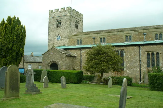
📷 5Historic churches · North West England
St Andrew's Church, Dent
St Andrew's Church, Dent — church in South Lakeland, UK.
 📷 3
📷 3Memorials & monuments · North West England
Dent War Memorial
Dent War Memorial — Grade II listed building-listed memorial in england-north-west, United Kingdom.
Campsites · North West England
Dent Camping and Caravanning Club
Dent Camping and Caravanning Club — a campsite in england north west.
Campsites · North West England
Conder Farm Camp Site
Conder Farm Camp Site — a campsite in england north west.
More mountains in this region
 📷 3
📷 3Mountains & hills · North West England
Allen Crags
Allen Crags — Named summit at 785 m.
 📷 3
📷 3Mountains & hills · North West England
Alum Pot
Alum Pot — Open shaft pothole in North Yorkshire.
 📷 3
📷 3Mountains & hills · North West England
Arnside Knott
Arnside Knott — Named summit at 159 m.
 📷 3
📷 3Mountains & hills · North West England
Bar Pot
Bar Pot is a mountain or hill in the United Kingdom.
Frequently asked questions
- Where is Aye Gill Pike?
- Aye Gill Pike is in North-West England, United Kingdom (postcode LA10 5TE), in the parish of Dent.
- Is Aye Gill Pike free to visit?
- Yes, Aye Gill Pike is free to enter.
- How do I get to Aye Gill Pike?
- The nearest railway station is Dent, about 4.5 km away. Drivers can navigate to postcode LA10 5TE.