Towns & cities · Yorkshire & the Humber
Whenby
Whenby — village and civil parish in North Yorkshire, United Kingdom.

Wikimedia Commons contributors — see linked file page for photographer and licence licence
Plan your visit
- Typical visit
- 3 h–6 h
- Free entry
- Family-friendly
- Dog-friendly
About
Whenby is a town, city, village or settlement in the United Kingdom. It covers approximately 1,966 km². Recent population estimates put it at around 69 people. Address: YO60. Wikidata describes it as: "village and civil parish in North Yorkshire, United Kingdom". Coordinates: 54.1203°, -1.0368°.
Photo gallery
Protected designations
- Area of Outstanding Natural Beauty: Howardian Hills
Designations sourced from Natural England open data under OGL v3.
From the Wikipedia article
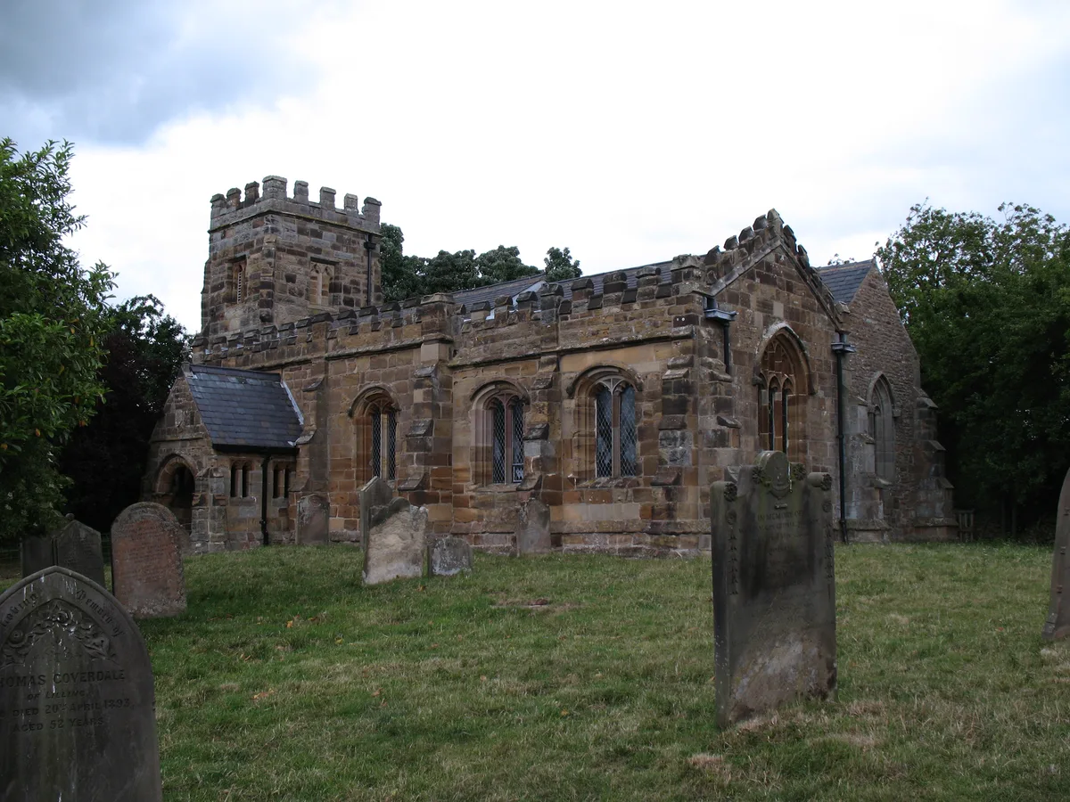
Whenby is a civil parish and village in North Yorkshire, England, 12 miles (19 km) north of York and 8 miles (13 km) east of Easingwold. The village and parish lies between Sheriff Hutton and Brandsby, just south of the Howardian Hills. According to the 2011 census, the parish has an area of 4,860 acres (1,966 ha),. The 15th century parish church was declared redundant in 1983. It is now maintained by the Churches Conservation Trust.
Excerpt from Wikipedia under CC BY-SA 4.0. See the source article linked in Sources below.
Background
History
Although Whenby was recorded in the Domesday Book of 1086, no particular details are shown about the settlement. The first part of the name derives from Old Norse Kona (a woman) and the suffix by, which is Old English for steadings or farm, so literally Woman's Farm. The area was in the possession of the de Nevil family in the 13th century, and passed through several noble families (Moryn, Barton, Thomas etc) until it passed through marriage to the Radclyffe family of Derwentwater. However, the lands around Whenby were forfeited to the crown in 1715 after James Radclyffe, 3rd Earl of Derwentwater was found guilty of treason. Radclyffe took part in the Jacobite Uprising, was tried, found…
Sourced from Wikipedia under CC BY-SA 4.0.
- Coordinates
- 54.1203, -1.0368
- District
- North Yorkshire
- Parish
- Whenby
- Postcode
- YO60
- Parliamentary constituency
- Wetherby and Easingwold
- Population
- 69
Sources
- wikidata: Q596401 (CC0)
- wikipedia: Whenby (CC BY-SA 4.0)
- commons: Whenby Village.jpg (CC BY-SA 4.0)
Other places nearby
Loading nearby places…
Nearby
 📷 3
📷 3Historic churches · Yorkshire & the Humber
St Martin's Church, Whenby
St Martin's Church, Whenby — church in Whenby, North Yorkshire, England, UK.
 📷 3
📷 3Natural landmarks · Yorkshire & the Humber
City of Troy Turf Maze
City of Troy Turf Maze — a other in england-yorkshire, United Kingdom.
 📷 3
📷 3Natural landmarks · Yorkshire & the Humber
Sam's View
Sam's View — a other in england-yorkshire, United Kingdom.
 📷 3
📷 3Natural landmarks · Yorkshire & the Humber
Amphitheatre Picnic Site
Amphitheatre Picnic Site — a other in england-yorkshire, United Kingdom.
 📷 3
📷 3Memorials & monuments · Yorkshire & the Humber
Lynne Goodwill Memorial
Lynne Goodwill Memorial — a memorial in england-yorkshire, United Kingdom.
 📷 3
📷 3Natural landmarks · Yorkshire & the Humber
Snakes and Ladders
Snakes and Ladders — a other in england-yorkshire, United Kingdom.
More towns in this region
 Flagship📷 4
Towns & cities · Yorkshire & the Humber
Bradford
Bradford — city and largest settlement in the City of Bradford district, Yorkshire, England.
 Flagship📷 5
Towns & cities · Yorkshire & the Humber
Coxwold
Coxwold — village and civil parish in North Yorkshire, England.
 Flagship📷 5
Towns & cities · Yorkshire & the Humber
Great Ayton
Great Ayton — village in North Yorkshire, England, UK.
May2005.jpg?width=1200) Flagship📷 5
Flagship📷 5Towns & cities · Yorkshire & the Humber
Great Langton
Great Langton — village in North Yorkshire, England, UK.
Frequently asked questions
- Where is Whenby?
- Whenby is in Yorkshire, United Kingdom (postcode YO60), in the parish of Whenby.
- Is Whenby a protected site?
- Yes — Whenby is part of the Howardian Hills National Landscape (AONB).
- Is Whenby free to visit?
- Yes, Whenby is free to enter.
- How do I get to Whenby?
- Drivers can navigate to postcode YO60. It sits within the Wetherby and Easingwold parliamentary constituency.