Archaeological sites · North East England
Waterhead
Waterhead in England North East, United Kingdom.

Mike Quinn — CC BY-SA 2.0 via Wikimedia Commons licence
_-_geograph.org.uk_-_1357791.jpg)
Plan your visit
- Typical visit
- 45 min–1.5 h
- Free entry
- Dog-friendly
About
Waterhead is a place of interest in England North East, United Kingdom — drawn from open-data sources for visitor reference. See the linked Wikipedia article for the full description.
Photo gallery
From the Wikipedia article
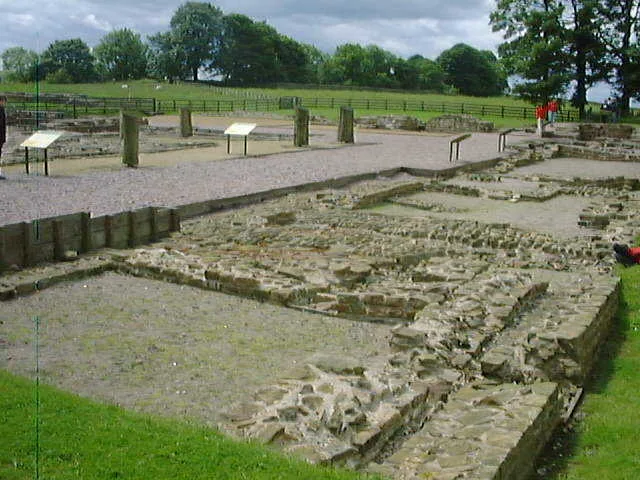
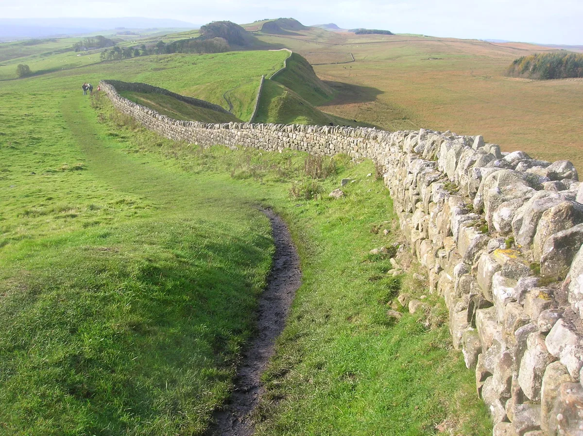
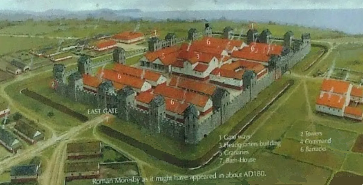
Waterhead is a civil parish in the Cumberland district, Cumbria, England. At the 2021 census it had a population of 110. The east and south boundaries of the parish are largely formed by the River Irthing. The area of the parish is 1,838.88 hectares (7.1000 sq mi). Part of the village of Gilsland lies in the parish, while some of the village is in Northumberland. A section of Hadrian's Wall, with Birdoswald Roman fort, and the related Hadrian's Wall Path both lie within the parish, near its southern border. There is a parish council, the lowest tier of local government. The B6318 road from Langholm to Gilsland passes through the parish.
Excerpt from Wikipedia under CC BY-SA 4.0. See the source article linked in Sources below.
- Coordinates
- 54.9890, -2.6070
- District
- Cumberland
- Parish
- Waterhead
- Postcode
- CA8 7DD
- Parliamentary constituency
- Carlisle
- Official site
- citypopulation.de
Sources
- wikidata: Q2048186 (CC0)
- wikipedia: Waterhead, Cumberland (CC BY-SA 4.0)
Other places nearby
Loading nearby places…
Nearby
 📷 3
📷 3Archaeological sites · Scottish Lowlands
Birdoswald Roman fort and the section of Hadrian's Wall and vallum between the River Irthing and the field boundaries east of milecastle 50
Birdoswald Roman fort and the section of Hadrian's Wall and vallum between the River Irthing and the field boundaries east of milecastle 50 — archaeological site in Waterhead, Carlisle, England, UK.
📷 3Archaeological sites · Scottish Lowlands
Turret 49B
Turret 49B — a archaeological in scotland-lowlands, United Kingdom.
 📷 4
📷 4Archaeological sites · North East England
Birdoswald
Birdoswald in England North East, United Kingdom.
 📷 5
📷 5Hill forts · Scottish Lowlands
Banna
Banna — Roman fort in Cumbria, England.
 📷 3
📷 3Museums · Scottish Lowlands
Birdoswald Roman Fort and Study Centre
Birdoswald Roman Fort and Study Centre — a museum in scotland-lowlands, United Kingdom.
 📷 5
📷 5Forts · Scottish Lowlands
Birdoswald Roman Fort
Birdoswald Roman Fort is a fort in the United Kingdom.
More archaeological sites in this region
 ★ Iconic📷 4
Archaeological sites · North East England
Hadrian's Wall
73-mile UNESCO World Heritage Roman frontier wall — Britain's most extensive Roman monument.
 📷 3
📷 3Archaeological sites · North East England
Force Crag mines and barytes mill and a prehistoric cairnfield
Force Crag mines and barytes mill and a prehistoric cairnfield — archaeological site in Above Derwent, Allerdale, England, UK.
 📷 3
📷 3Archaeological sites · North East England
Gabrosentum Roman Fort
Gabrosentum Roman Fort — Roman fort in Parton, Copeland, England, UK.
 📷 3
📷 3Archaeological sites · North East England
Gisborough Priory Augustinian monastery: late Saxon settlement, cemetery, monastic precinct and dovecote
Gisborough Priory Augustinian monastery: late Saxon settlement, cemetery, monastic precinct and dovecote — archaeological site in Guisborough, Redcar and Cleveland, England, UK.
Frequently asked questions
- Where is Waterhead?
- Waterhead is in North East England, in the United Kingdom — coordinates 54.9890°, -2.6070°.
- Is Waterhead free to visit?
- Yes — admission to Waterhead is free.