Reservoirs & lochs · North West England
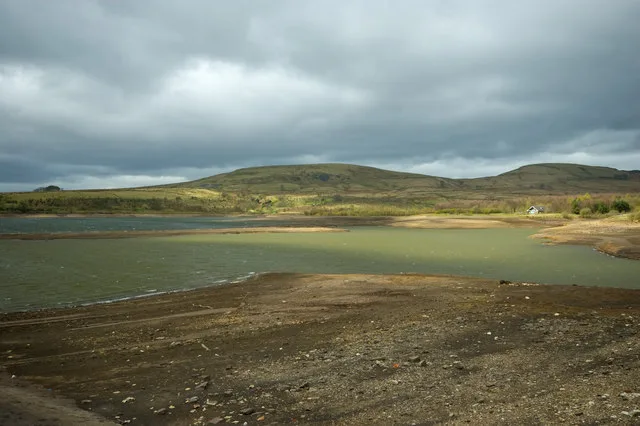
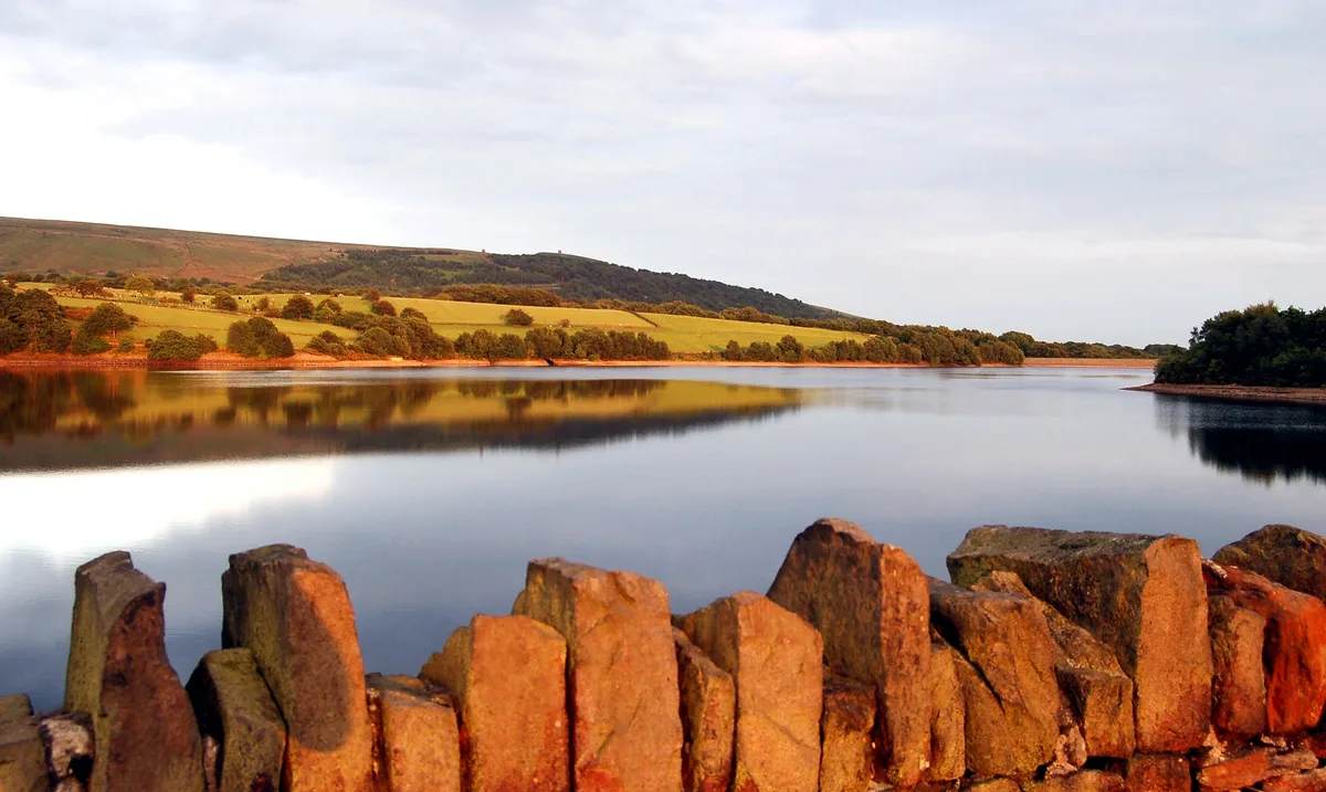
Watergrove Reservoir
Watergrove Reservoir — lake in the United Kingdom.

Wikimedia Commons contributors — see linked file page for photographer and licence licence
Plan your visit
- Typical visit
- 1 h–2.5 h
- Nearest railway station
- Smithy Bridge · 3.1 km
- Free entry
- Dog-friendly
About
Watergrove Reservoir is a reservoir in the United Kingdom. Wikidata describes it as: "lake in the United Kingdom". Coordinates: 53.6572°, -2.1381°.
Photo gallery
Protected designations
- Site of Special Scientific Interest: South Pennine Moors SSSI
Designations sourced from Natural England open data under OGL v3.
From the Wikipedia article
Watergrove Reservoir is a reservoir close to Wardle in the Metropolitan Borough of Rochdale, within Greater Manchester, England. Rochdale Corporation chose Watergrove as a suitable site to build a large reservoir largely to a prolonged drought in the 1930s, resulting in water regularly being bought from Oldham. The ruins of the old village of Watergrove submerged under the large expanse of water in 1938, and dotted around the landscape above the reservoir there are several ruins originally belonging to the village. The book Watergrove: A History of the Valley and its Drowned Village by Allen Holt gives a personal view of the transition as the author grew up in Wardle, a mile to the south of Watergrove. Several photographs in the book show people walking along roads that have resurfaced during times of extreme drought. In July 2008, a 13-year-old boy, Joseph Thomas, was found dead in the reservoir after he had gone swimming with friends. A free, weekly, 5 km Parkrun takes place every Saturday morning. The event is hosted by local volunteers and was first held on Saturday 7 June 2014.
Excerpt from Wikipedia under CC BY-SA 4.0. See the source article linked in Sources below.
- Coordinates
- 53.6572, -2.1381
- District
- Rochdale
- Parish
- Rochdale, unparished area
- Postcode
- OL12 9NJ
- Parliamentary constituency
- Rochdale
- Nearest railway station
- Smithy Bridge — 3.1 km
Sources
- wikidata: Q7349264 (CC0)
- wikipedia: Watergrove Reservoir (CC BY-SA 4.0)
- commons: Watergrove Reservoir.JPG (CC BY-SA 4.0)
Other places nearby
Loading nearby places…
Nearby
 📷 3
📷 3Memorials & monuments · North West England
Wardle History Wall
Wardle History Wall — a memorial in england-north-west, United Kingdom.
 📷 3
📷 3Historic houses · North West England
Little Town
Little Town — a historic house in england-north-west, United Kingdom.
 📷 5
📷 5Towns & cities · North West England
Wardle
Wardle — village in Greater Manchester, UK.
 📷 3
📷 3Natural landmarks · North West England
Brown Wardle Hill
Brown Wardle Hill — mountain in United Kingdom.
 📷 3
📷 3Historic houses · North West England
Shore Hall
Shore Hall — house in Rochdale, Greater Manchester, England, UK.
 📷 3
📷 3Memorials & monuments · North West England
Shore Mill War Memorial
Shore Mill War Memorial — Grade II listed building-listed memorial in england-north-west, United Kingdom.
More places in this region
 Flagship📷 5
Reservoirs & lochs · North West England
Yarrow Reservoir
Yarrow Reservoir — reservoir in Lancashire, England, UK.
.jpg?width=1200) 📷 3
📷 3Reservoirs & lochs · North West England
Abbey Village Reservoir
Abbey Village Reservoir — reservoir in Lancashire, England, UK.
 📷 3
📷 3Reservoirs & lochs · North West England
Anglezarke Reservoir
Anglezarke Reservoir — reservoir in Lancashire, England, UK.
 📷 3
📷 3Reservoirs & lochs · North West England
Ashworth Moor Reservoir
Ashworth Moor Reservoir — reservoir in Greater Manchester, England, UK.
Frequently asked questions
- Where is Watergrove Reservoir?
- Watergrove Reservoir is in North-West England, United Kingdom (postcode OL12 9NJ), in the parish of Rochdale, unparished area.
- Is Watergrove Reservoir a protected site?
- Yes — Watergrove Reservoir is part of the South Pennine Moors SSSI Site of Special Scientific Interest.
- How do I get to Watergrove Reservoir?
- The nearest railway station is Smithy Bridge, about 3.1 km away. Drivers can navigate to postcode OL12 9NJ.