Forests & woodlands · South East England
View Island
View Island is a forest or woodland in the United Kingdom.

Wikimedia Commons contributors — see linked file page for photographer and licence licence
Plan your visit
- Typical visit
- 1 h–3 h
- Nearest railway station
- Reading · 0.7 km
- Free entry
- Family-friendly
- Dog-friendly
About
View Island is a named forest, woodland or nature reserve in the United Kingdom. Coordinates: 51.4619°, -0.9634°. This entry is part of The Great Britain Guide, a free, ad-free, open-data tourist directory.
Photo gallery
From the Wikipedia article
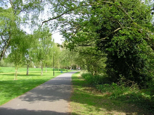
View Island is a small island near Caversham Lock, on the River Thames at Reading, Berkshire in England. View Island forms part of a series of riverside open spaces, managed by Reading Borough Council, that stretch along one or other side of the River Thames throughout its passage through Reading. From west to east these are Thameside Promenade, Caversham Court, Christchurch Meadows, Hills Meadow, View Island and King's Meadow. The island was a derelict boatyard when Reading Borough Council took it over in 1998 and restored it. It is a quiet, relaxing island with grassy paths and seating. It is set out as a small park containing several wooden chain-saw carved sculptures, although all but one having rotted away. It connects to Caversham via Heron Island, which has private riverside housing and is connected by road to Lower Caversham. A body was found on View Island in February 2011. In 2021, the new Reading Hydro community owned hydro-electric power plant opened at the upstream end of the island. At the same time a new and more natural fish pass stream was constructed, snaking through View Island.
Excerpt from Wikipedia under CC BY-SA 4.0. See the source article linked in Sources below.
- Coordinates
- 51.4619, -0.9634
- District
- Reading
- Parish
- Reading, unparished area
- Postcode
- RG4 8DQ
- Parliamentary constituency
- Reading Central
- Nearest railway station
- Reading — 0.7 km
- Opening
- | map = United Kingdom Reading
- Official site
- www.reading.gov.uk
Sources
- osm: w169875221 (ODbL)
- wikipedia: View Island (CC BY-SA 4.0)
- commons: View Island - geograph.org.uk - 14343.jpg (CC BY-SA 4.0)
Other places nearby
Loading nearby places…
Nearby
 📷 5
📷 5Public art & sculpture · South East England
View Island Archway
View Island Archway — a public art in england-south-east, United Kingdom.
 📷 5
📷 5Public art & sculpture · South East England
Face carved out of fallen tree
Face carved out of fallen tree — a public art in england-south-east, United Kingdom.
.jpg?width=1200) 📷 5
📷 5Canal locks · South East England
Caversham Lock and Weir
Caversham Lock and Weir — lock and weir on the River Thames in Berkshire, England.
 📷 5
📷 5Memorials & monuments · South East England
Salmon Ladder
Salmon Ladder — a memorial in england-south-east, United Kingdom.
 📷 5
📷 5Country parks · South East England
Hills Meadow
Hills Meadow — riverside park in Reading, England.
 📷 5
📷 5Other places · South East England
Thames Lido
Thames Lido — Outdoor swimming pool / lido.
More forests in this region
 📷 5
📷 5Forests & woodlands · South East England
Alice Holt Forest
Alice Holt Forest is a forest or woodland in the United Kingdom.
.jpg?width=1200) 📷 5
📷 5Forests & woodlands · South East England
Alverstone Mead Nature Reserve
Alverstone Mead Nature Reserve is a forest or woodland in the United Kingdom.
 📷 5
📷 5Forests & woodlands · South East England
Ambarrow Court
Ambarrow Court is a forest or woodland in the United Kingdom.
 📷 5
📷 5Forests & woodlands · South East England
Ancells Farm Nature Reserve
Ancells Farm Nature Reserve is a forest or woodland in the United Kingdom.
Frequently asked questions
- Where is View Island?
- View Island is in South-East England, United Kingdom (postcode RG4 8DQ), in the parish of Reading, unparished area.
- Who owns View Island?
- View Island is owned by | visitation_num =.
- Is View Island free to visit?
- Yes, View Island is free to enter.
- How do I get to View Island?
- The nearest railway station is Reading, about 0.7 km away. Drivers can navigate to postcode RG4 8DQ.