Country parks · South East England
King's Meadow
King's Meadow — riverside park in Reading, England.

Wikimedia Commons contributors — see linked file page for photographer and licence licence
Plan your visit
- Typical visit
- 1.5 h–3 h
- Nearest railway station
- Reading · 0.8 km
- Free entry
- Family-friendly
- Dog-friendly
About
King's Meadow is a country park in the United Kingdom. Wikidata describes it as: "riverside park in Reading, England". Coordinates: 51.4600°, -0.9610°.
Photo gallery
From the Wikipedia article
King's Meadow is a park in Reading, Berkshire, England, located next to the River Thames. It stretches from the Coal Woodland (so-called because it used to be the site of a coal heap ) to King's Meadow Road near Reading Bridge. The Thames Path long distance footpath runs through the length of King's Meadow, which is visible from the railway when entering or leaving Reading railway station from the eastern side. King's Meadow forms part of a series of riverside open spaces, managed by Reading Borough Council, that stretch along one or other side of the River Thames throughout its passage through Reading. From west to east these are Thameside Promenade, Caversham Court, Christchurch Meadows, Hills Meadow, View Island and King's Meadow.
Excerpt from Wikipedia under CC BY-SA 4.0. See the source article linked in Sources below.
Background
History
King's Meadow was a possession of Reading Abbey and became owned by the King after the dissolution of the monasteries. This area has long been used as the site of a variety of public events such as Reading market, a race course, Reading shows and fairs. In 1869 the town of Reading purchased 12 acres of the meadow as a recreation ground, hence the Reading Recreation Ground name. This ground was home to Reading F.C. from its foundation in 1871 until 1878, when they moved to Coley Recreation Ground. King's Meadow is also the location of the once disused King's Meadow swimming pool, which was built there in 1903. The future of the building was a subject of local controversy until 2015 when…
Description
The park's landscape is open fields of short grass right up to the river bank, with some perimeter trees and an avenue from Napier Road. It is a popular picnic site with groups of mature trees. The park is prone to flooding, but there are playing fields used by the public and football clubs throughout the year. There is a pleasant walk along the towpath up to Reading Bridge and Caversham Lock is at the eastern end. It is also a popular spot for mooring and fishing. To the east of the park is a large Tesco supermarket.
Sourced from Wikipedia under CC BY-SA 4.0.
- Coordinates
- 51.4600, -0.9610
- District
- Reading
- Parish
- Reading, unparished area
- Postcode
- RG1 8AB
- Parliamentary constituency
- Reading Central
- Nearest railway station
- Reading — 0.8 km
- Opening
- | map = United Kingdom Reading
- Official site
- www.reading.gov.uk
Sources
- wikidata: Q6411010 (CC0)
- wikipedia: King's Meadow, Reading (CC BY-SA 4.0)
- commons: King's Meadow, Reading.jpg (CC BY-SA 4.0)
Other places nearby
Loading nearby places…
Nearby
.jpg?width=1200) 📷 5
📷 5Canal locks · South East England
Caversham Lock and Weir
Caversham Lock and Weir — lock and weir on the River Thames in Berkshire, England.
 📷 5
📷 5Memorials & monuments · South East England
Salmon Ladder
Salmon Ladder — a memorial in england-south-east, United Kingdom.
 📷 5
📷 5Public art & sculpture · South East England
View Island Archway
View Island Archway — a public art in england-south-east, United Kingdom.
 📷 5
📷 5Forests & woodlands · South East England
View Island
View Island is a forest or woodland in the United Kingdom.
 📷 5
📷 5Public art & sculpture · South East England
Face carved out of fallen tree
Face carved out of fallen tree — a public art in england-south-east, United Kingdom.
 📷 5
📷 5Other places · South East England
Thames Lido
Thames Lido — Outdoor swimming pool / lido.
More places in this region
 Flagship📷 10
Country parks · South East England
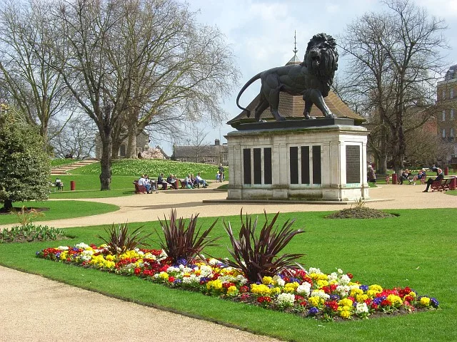
Forbury Gardens
Forbury Gardens — park in Reading, Berkshire, England, UK.
 📷 5
📷 5Country parks · South East England
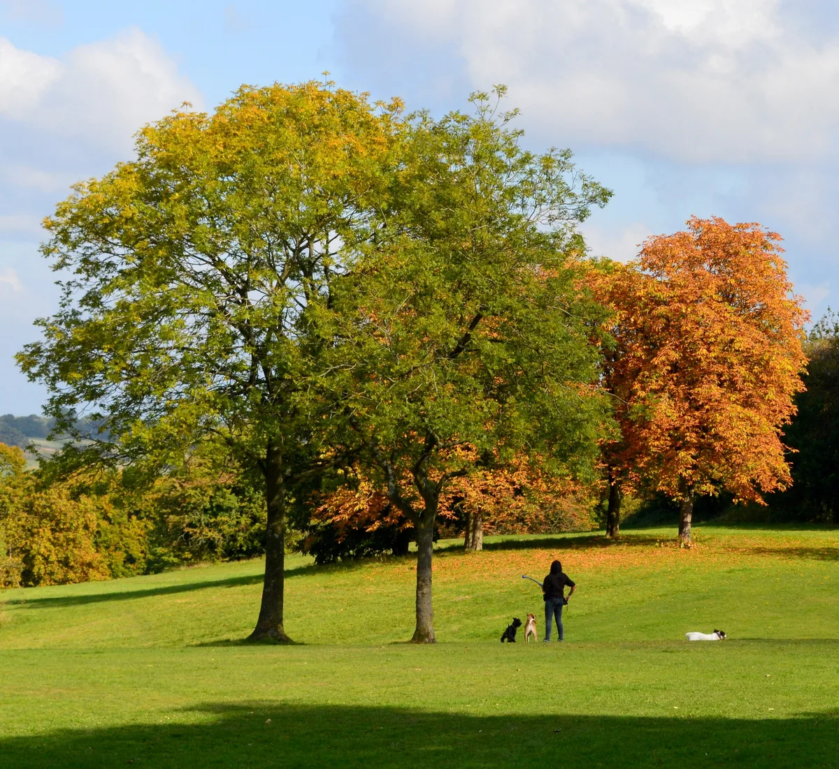
Arthur Newbery Park
Arthur Newbery Park — public park in Tilehurst, Reading, UK.
 📷 5
📷 5Country parks · South East England
Baiter Park
Baiter Park — waterfront area of Poole, Dorset.
 📷 5
📷 5Country parks · South East England
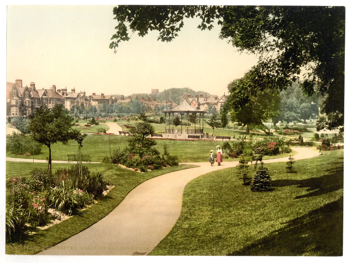
Borough Gardens
Borough Gardens — park in Dorchester, Dorset, England, UK.
Frequently asked questions
- Where is King's Meadow?
- King's Meadow is in South-East England, United Kingdom (postcode RG1 8AB), in the parish of Reading, unparished area.
- Who owns King's Meadow?
- King's Meadow is owned by | visitation_num =.
- Is King's Meadow free to visit?
- Yes, King's Meadow is free to enter.
- How do I get to King's Meadow?
- The nearest railway station is Reading, about 0.8 km away. Drivers can navigate to postcode RG1 8AB.