Natural landmarks · North Wales
Tyrrau Mawr
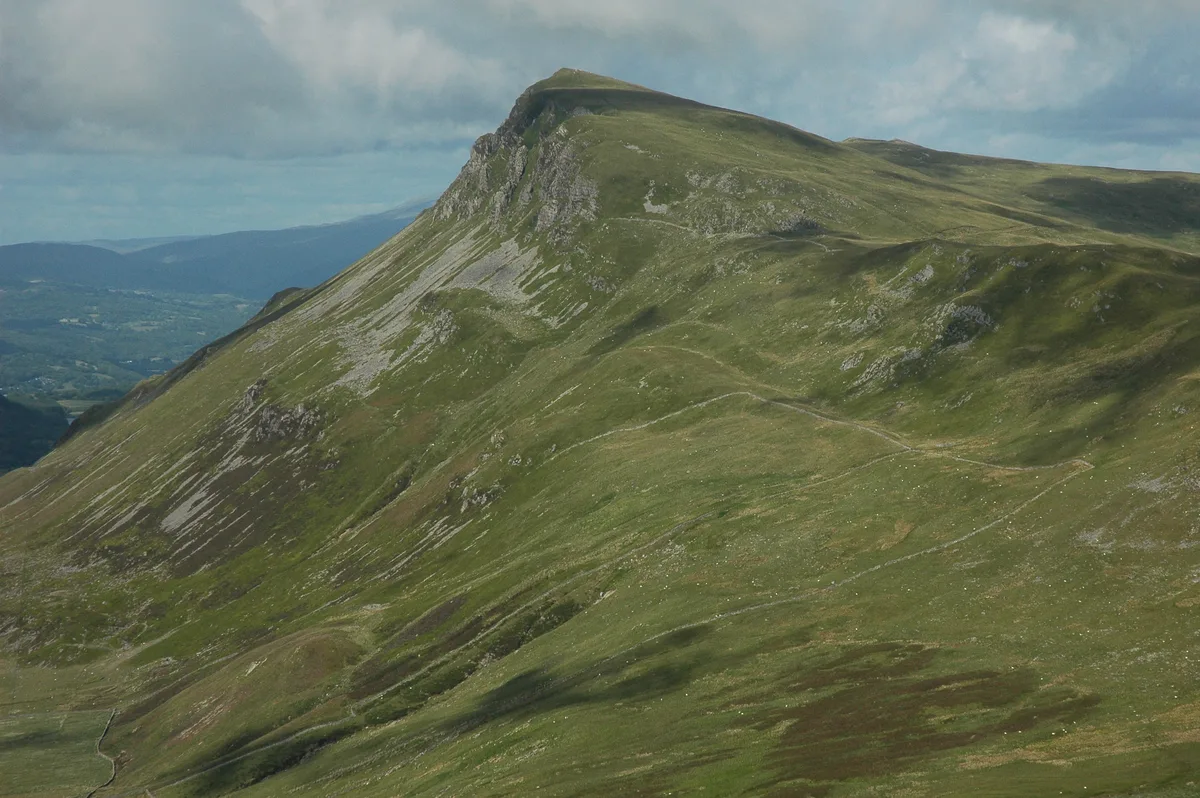
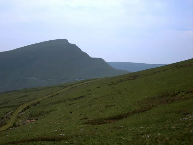
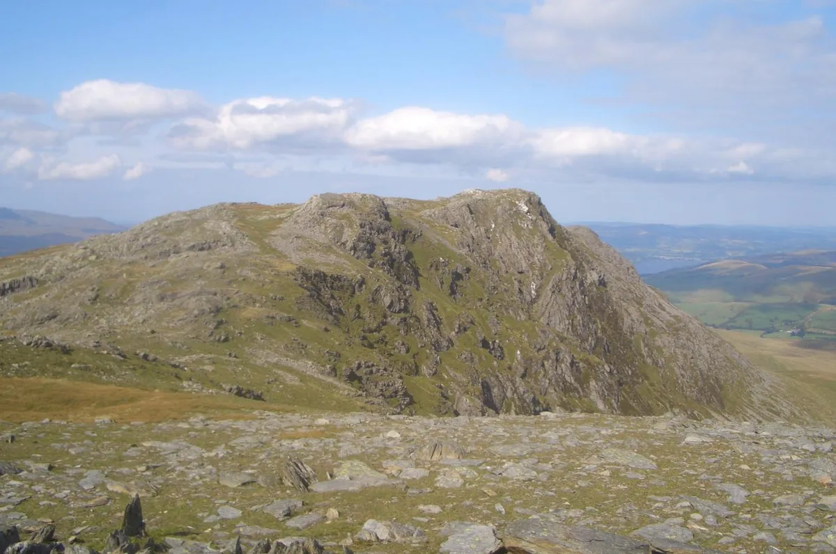
Tyrrau Mawr — mountain (661m) in Gwynedd.

Wikimedia Commons contributors — see linked file page for photographer and licence licence
Plan your visit
- Typical visit
- 1 h–2 h
- Nearest railway station
- Morfa Mawddach · 4.9 km
- Free entry
- Dog-friendly
About
Tyrrau Mawr is a named natural landmark in the United Kingdom. Part of Cadair Idris. Wikidata describes it as: "mountain (661m) in Gwynedd". Coordinates: 52.7035°, -3.9594°.
Photo gallery
From the Wikipedia article
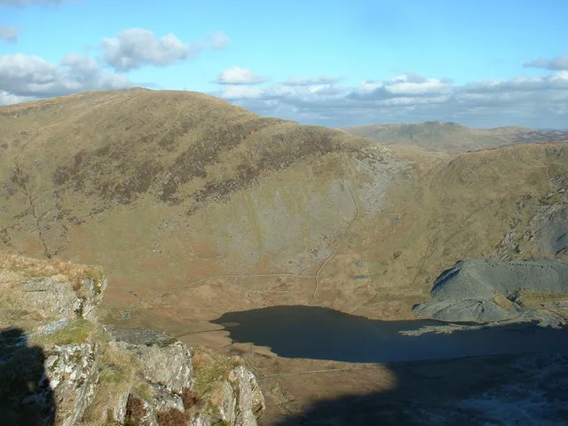
Tyrrau Mawr or Craig-las is a subsidiary summit of Cadair Idris in the Snowdonia National Park, in Gwynedd, northwest Wales. It lies to the west of Cyfrwy, and can be climbed by taking a west bearing from the Pony Path at Rhiw Gwredydd. Its north face is a crag, known as Craig-las. Below the crags lies Llyn Cregennen with its small island. The reflection of Craig-las from this lake is one of the famous images associated with Snowdonia. The summit is grassy and marked by a few stones. To the east of the summit lies the large ancient cairn, Carnedd Lwyd. It is often climbed in combination with Craig-y-llyn.
Excerpt from Wikipedia under CC BY-SA 4.0. See the source article linked in Sources below.
- Coordinates
- 52.7035, -3.9594
- District
- Gwynedd
- Parish
- Arthog
- Postcode
- LL40 1TW
- Parliamentary constituency
- Dwyfor Meirionnydd
- Nearest railway station
- Morfa Mawddach — 4.9 km
Sources
- wikidata: Q7861697 (CC0)
- wikipedia: Tyrrau Mawr (CC BY-SA 4.0)
- commons: Tyrrau Mawr viewed from the west - geograph.org.uk - 1971950.jpg (CC BY-SA 4.0)
Other places nearby
Loading nearby places…
Nearby
 📷 3
📷 3Mountains & hills · North Wales
Tyrrau Mawr
Tyrrau Mawr — Named summit at 661 m.
 📷 3
📷 3Mountains & hills · North Wales
Cefn yr Owen
Cefn yr Owen — a mountain in wales-north, United Kingdom, 312 m.
 📷 3
📷 3Mountains & hills · North Wales
Pen Llynnau Cregennen
Pen Llynnau Cregennen — a mountain in wales-north, United Kingdom, 279 m.
 📷 3
📷 3Mountains & hills · Mid Wales
Craig-y-llyn
Craig-y-llyn — Named summit at 622 m.
 📷 3
📷 3Natural landmarks · Mid Wales
Craig-y-llyn
Craig-y-llyn — mountain (622m) in Gwynedd, Wales.
Vineyards · North Wales
Pared y Cefn hir (hillfort)
Pared y Cefn hir (hillfort) — a UK vineyard in wales north, producing English or Welsh wine from cool-climate grape varieties.
More natural landmarks in this region
 Flagship📷 5
Natural landmarks · North Wales
Llyn Llydaw
Llyn Llydaw is a natural landmark in the United Kingdom.
 📷 5
📷 5Natural landmarks · North Wales
Llyn Tegid
Llyn Tegid is a natural landmark in the United Kingdom.
 📷 3
📷 3Natural landmarks · North Wales
Allt-fawr
Allt-fawr — mountain (698m) in Gwynedd, Wales.
 📷 3
📷 3Natural landmarks · North Wales
Aran Benllyn
Aran Benllyn — mountain (885m) in Gwynedd.
Frequently asked questions
- Where is Tyrrau Mawr?
- Tyrrau Mawr is in North Wales, United Kingdom (postcode LL40 1TW), in the parish of Arthog.
- Is Tyrrau Mawr free to visit?
- Yes, Tyrrau Mawr is free to enter.
- How do I get to Tyrrau Mawr?
- The nearest railway station is Morfa Mawddach, about 4.9 km away. Drivers can navigate to postcode LL40 1TW.