Natural landmarks · North Wales
Cribin Fawr
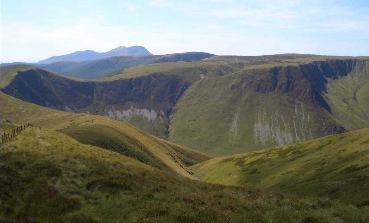
Cribin Fawr — mountain (658.8m) in Gwynedd.

Wikimedia Commons contributors — see linked file page for photographer and licence licence
Plan your visit
- Typical visit
- 1 h–2 h
- Nearest railway station
- Corris · 8.5 km
- Free entry
- Dog-friendly
About
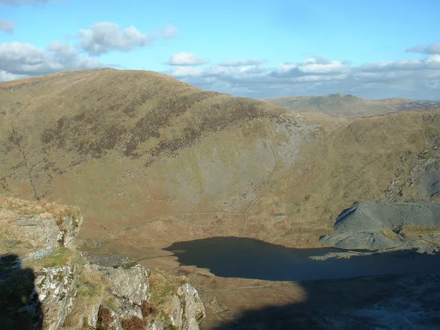
Cribin Fawr is a named natural landmark in the United Kingdom. Part of Cadair Idris. Wikidata describes it as: "mountain (658.8m) in Gwynedd". Coordinates: 52.7218°, -3.7863°.
Photo gallery
From the Wikipedia article
Cribin Fawr is a mountain in Snowdonia, North Wales, situated approximately four miles to the south-west of Aran Fawddwy. It is one of the peaks in the Dyfi hills, a subgroup of the Cadair Idris group. It is a top of Maesglase, connected to its parent peak by the Craig Portas ridge. The top of Cribin Fawr is a large open plateau of peat bog. To the west is Waun-oer, to the north Cadair Idris, to the south Maesglase and Glasgwm to the east.
Excerpt from Wikipedia under CC BY-SA 4.0. See the source article linked in Sources below.
- Coordinates
- 52.7218, -3.7863
- Address
- Snowdonia, Wales
- Nearest railway station
- Corris — 8.5 km
Sources
- wikidata: Q5184891 (CC0)
- wikipedia: Cribin Fawr (CC BY-SA 4.0)
- commons: Cribinfawr.JPG (CC BY-SA 4.0)
Other places nearby
Loading nearby places…
Nearby
 📷 3
📷 3Mountains & hills · North Wales
Cribin Fawr
Cribin Fawr — Named summit at 659 m.
 📷 3
📷 3Natural landmarks · North Wales
Waun-oer
Waun-oer — mountain (670m) in Gwynedd.
 📷 3
📷 3Mountains & hills · North Wales
Waun-oer
Waun-oer — Named summit at 670 m.
 📷 3
📷 3Mountains & hills · North Wales
Craig Portas
Craig Portas — a mountain in wales-north, United Kingdom, 604 m.
 📷 3
📷 3Viewpoints · North Wales
Bwlch (Top Ledge / Middle Ledge)
Bwlch (Top Ledge / Middle Ledge) is a viewpoint in the United Kingdom.
 📷 4
📷 4Mountains & hills · North Wales
Craig Portas East Top
Craig Portas East Top — a mountain in wales-north, United Kingdom, 587 m.
More natural landmarks in this region
 Flagship📷 5
Natural landmarks · North Wales
Llyn Llydaw
Llyn Llydaw is a natural landmark in the United Kingdom.
 📷 5
📷 5Natural landmarks · North Wales
Llyn Tegid
Llyn Tegid is a natural landmark in the United Kingdom.
 📷 3
📷 3Natural landmarks · North Wales
Allt-fawr
Allt-fawr — mountain (698m) in Gwynedd, Wales.
 📷 3
📷 3Natural landmarks · North Wales
Aran Benllyn
Aran Benllyn — mountain (885m) in Gwynedd.
Frequently asked questions
- Where is Cribin Fawr?
- Cribin Fawr is in North Wales, in the United Kingdom — coordinates 52.7218°, -3.7863°. The nearest railway station is Corris, around 8.5 km away.
- Is Cribin Fawr free to visit?
- Yes — admission to Cribin Fawr is free.