Natural landmarks · Scottish Lowlands
Sweethope Loughs
Sweethope Loughs — freshwater lakes in Northumberland, England, UK, on the River Wansbeck.

Wikimedia Commons contributors — see linked file page for photographer and licence licence
Plan your visit
- Typical visit
- 1 h–2 h
- Free entry
- Dog-friendly
About
Sweethope Loughs is a named natural landmark in the United Kingdom. Wikidata describes it as: "freshwater lakes in Northumberland, England, UK, on the River Wansbeck". Coordinates: 55.1370°, -2.0920°.
Photo gallery
From the Wikipedia article
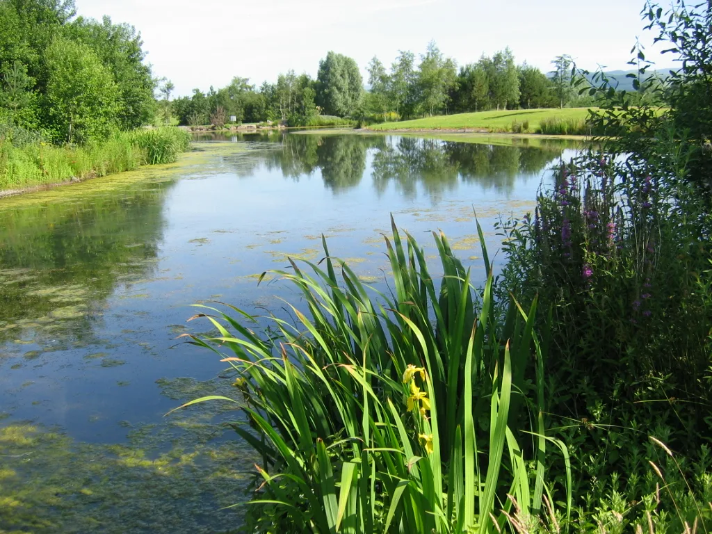
Sweethope Loughs are two freshwater lakes almost 1 mile (1.6 km) in length, the smaller one just east of the larger, in the southern part of Northumberland, England and lying between the A68 road, and the A696 road. They lie about 18 miles (29 km) west of Morpeth; 4 miles (6 km) west of Kirkwhelpington; and 6 miles (10 km) east of Bellingham. There is a crossing between the two lakes, which are lined with trees and surrounded by hills. To the north west are Great Wanney Crag and Little Wanney Crag. The larger lough has a surface area of 46.293 ha and a mean depth of 2.043 m, a catchment area of 618 ha, and is situated at 238 m altitude.
Excerpt from Wikipedia under CC BY-SA 4.0. See the source article linked in Sources below.
- Coordinates
- 55.1370, -2.0920
- District
- Northumberland
- Parish
- Bavington
- Postcode
- NE19 2PN
- Parliamentary constituency
- Hexham
Sources
- wikidata: Q4280759 (CC0)
- wikipedia: Sweethope Loughs (CC BY-SA 4.0)
- commons: East end of Sweethope Lough - geograph.org.uk - 131488.jpg (CC BY-SA 4.0)
Other places nearby
Loading nearby places…
Nearby
Vineyards · Scottish Lowlands
Great Wanney
Great Wanney — a UK vineyard in scotland lowlands, producing English or Welsh wine from cool-climate grape varieties.
 📷 5
📷 5Forests & woodlands · North East England
River Wansbeck
River Wansbeck in England North East, United Kingdom.
 📷 4
📷 4Other places · North East England
Carrycoats
Carrycoats in England North East, United Kingdom.
 📷 3
📷 3Archaeological sites · Scottish Lowlands
Roman milestone N of Waterfalls Farm
Roman milestone N of Waterfalls Farm — archaeological site in Birtley, Northumberland, England, UK.
 📷 4
📷 4Other places · North East England
Thockrington
Thockrington in England North East, United Kingdom.
 📷 3
📷 3Wildlife reserves · North East England
Bavington Crags
Bavington Crags in England North East, United Kingdom.
More natural landmarks in this region
 Flagship📷 3
Natural landmarks · Scottish Lowlands
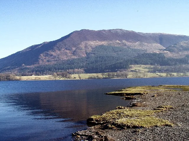
Bassenthwaite Lake
Bassenthwaite Lake — lake in Cumbria, England, UK.
 Flagship📷 3
Natural landmarks · Scottish Lowlands
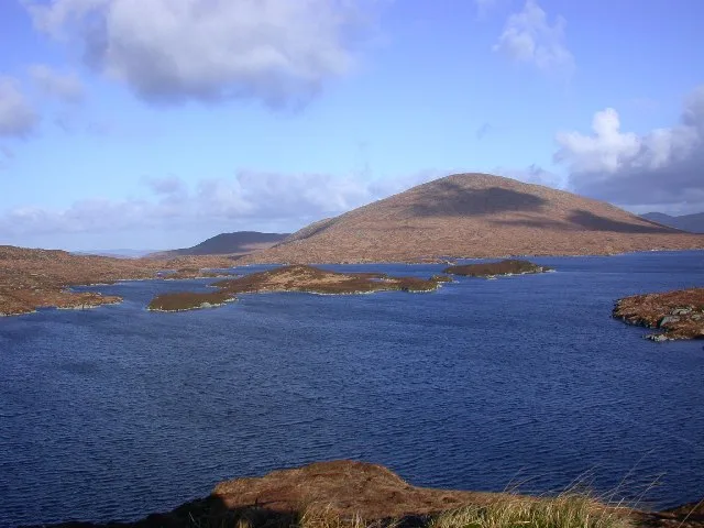
Loch Enoch
Loch Enoch — lake in Dumfries and Galloway, Scotland, UK.
 📷 5
📷 5Natural landmarks · Scottish Lowlands
Annandale Water
Annandale Water — lake in Dumfries and Galloway, Scotland, UK.
 📷 3
📷 3Natural landmarks · Scottish Lowlands
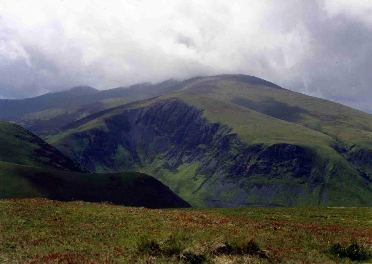
Bakestall
Bakestall — mountain in United Kingdom.
Frequently asked questions
- Where is Sweethope Loughs?
- Sweethope Loughs is in the Scottish Lowlands, United Kingdom (postcode NE19 2PN), in the parish of Bavington.
- Is Sweethope Loughs free to visit?
- Yes, Sweethope Loughs is free to enter.
- How do I get to Sweethope Loughs?
- Drivers can navigate to postcode NE19 2PN. It sits within the Hexham parliamentary constituency.