Towns & cities · West Midlands
Sutton Bassett
Sutton Bassett — village in Northamptonshire, United Kingdom.

Wikimedia Commons contributors — see linked file page for photographer and licence licence
Plan your visit
- Typical visit
- 3 h–6 h
- Nearest railway station
- Market Harborough · 4.1 km
- Free entry
- Family-friendly
- Dog-friendly
About
Sutton Bassett is a town, city, village or settlement in the United Kingdom. Recent population estimates put it at around 96 people. Address: LE16. Wikidata describes it as: "village in Northamptonshire, United Kingdom". Coordinates: 52.5053°, -0.8657°.
Photo gallery
From the Wikipedia article
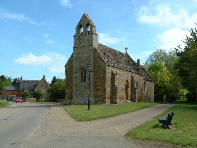
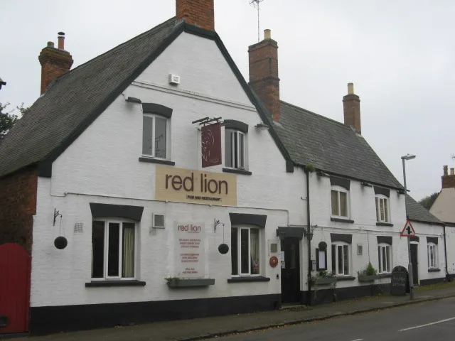
Sutton Bassett is a village and civil parish in Northamptonshire, England, in the Welland valley. It was formerly in the Corby Hundred but has been part of the Stoke Hundred (named after Stoke Albany village). The village's name means 'Southern farm/settlement'. The village was held by Richard Basset in the 12th century. Sutton Bassett's church, The Church of All Saints (which partly dates back to the Norman period) was built as an annexe to St. Mary's Church in the nearby village of Weston by Welland. Unlike the majority of typical English countryside village churches, it has no graveyard. The local pub was the Queen's Head Inn, which closed in January 2015. Sutton Bassett is currently administered by North Northamptonshire council but was administered as part of the Borough of Kettering until changes in 2021, and is roughly 14 miles north-west of Kettering, 12 miles west of Corby, 7 miles north-east of Desborough and roughly 4 miles from Market Harborough.
Excerpt from Wikipedia under CC BY-SA 4.0. See the source article linked in Sources below.
- Coordinates
- 52.5053, -0.8657
- District
- North Northamptonshire
- Parish
- Sutton Bassett
- Postcode
- LE16
- Parliamentary constituency
- Kettering
- Population
- 96
- Nearest railway station
- Market Harborough — 4.1 km
Sources
- wikidata: Q517510 (CC0)
- wikipedia: Sutton Bassett (CC BY-SA 4.0)
- commons: Sutton Basset Church - geograph.org.uk - 116182.jpg (CC BY-SA 4.0)
Other places nearby
Loading nearby places…
Nearby
 📷 3
📷 3Historic churches · West Midlands
All Saints Church, Sutton Bassett
All Saints Church, Sutton Bassett — grade II listed church in Sutton Bassett, North Northamptonshire, England, UK.
 📷 4
📷 4Historic churches · West Midlands
Church of St Mary
Church of St Mary — historic church in Ashley, Kettering, Northamptonshire, England, United Kingdom.
 📷 3
📷 3Memorials & monuments · West Midlands
Flats 1, 2, 3, Porch House, Bell Tower, Cloisters, South Wing, Pediment, Corner House And Tower House At Dingley Hall
Flats 1, 2, 3, Porch House, Bell Tower, Cloisters, South Wing, Pediment, Corner House And Tower House At Dingley Hall — Grade I listed building-listed memorial in england-west-midlands, United Kingdom
 📷 3
📷 3Historic bridges · West Midlands
Bridge Over River Welland
Bridge Over River Welland — Grade II listed building-listed bridge in england-west-midlands, United Kingdom.
 Flagship📷 5
Towns & cities · West Midlands
Great Bowden
Great Bowden — village and civil parish in Leicestershire, United Kingdom.
 📷 3
📷 3Historic churches · West Midlands
St. Mary the Virgin, Brampton Ash
St. Mary the Virgin, Brampton Ash — Grade I listed church in Brampton Ash, North Northamptonshire, England, UK.
More towns in this region
 Flagship📷 3
Towns & cities · West Midlands
Adderbury
Adderbury — village and civil parish in Cherwell district, Oxfordshire, England.
 Flagship📷 3
Towns & cities · West Midlands
Admington
Admington — village in Warwickshire, England, UK.
 Flagship📷 3
Towns & cities · West Midlands
Aldington
Aldington — village in Worcestershire, United Kingdom.
 Flagship📷 5
Towns & cities · West Midlands
Anstey
Anstey — large village in Leicestershire, England.
Frequently asked questions
- Where is Sutton Bassett?
- Sutton Bassett is in the West Midlands, United Kingdom (postcode LE16), in the parish of Sutton Bassett.
- Is Sutton Bassett free to visit?
- Yes, Sutton Bassett is free to enter.
- How do I get to Sutton Bassett?
- The nearest railway station is Market Harborough, about 4.1 km away. Drivers can navigate to postcode LE16.